5:28 PM Tuesday, February 28, 2023
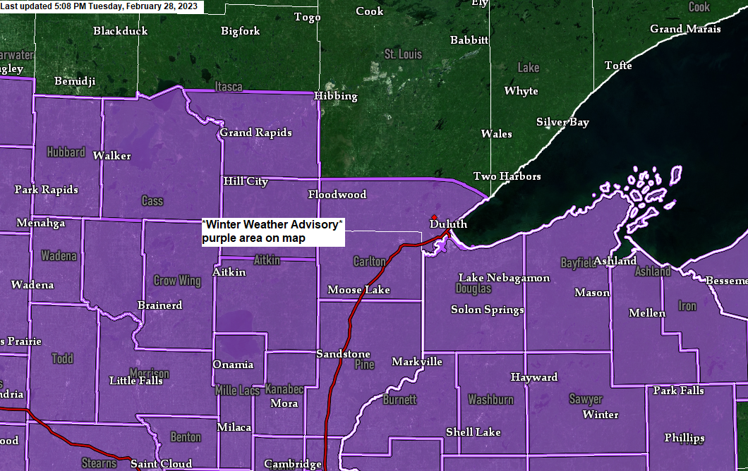
- A swath of about 2 to 6 inches of snow is expected in much of the Northland by late Wednesday afternoon with little to no snow expected near the Borderland including the International Falls area.
- Higher snowfall totals exceeding 6 inches are possible as this system has a chance to overachieve in terms of the amount of snow it drops, this is especially true along and south of Highway 2 in northeast Minnesota including the Twin Ports, east-central Minnesota and parts of northwest Wisconsin.
- Snow should be relatively fluffy on Wednesday with temps in the mid 20s to around 30.
- Potential for some lake enhanced snow near Lake Superior including in the Twin Ports on Wednesday with ENE winds in place along with 850mb temperatures of around -10C.
- Gusty NE winds 25 to 35 mph in the Twin Ports and South Shore will lead to some blowing snow on Wednesday.
Here’s my updated snowfall forecast ending 6 PM Wednesday.
*Increased snow amounts in the Twin Ports compared to my forecast from 24 hours ago, this is due to a farther north track of the low on Wednesday, and also due to the potential for some lake enhanced snowfall. 3 to 6 inches of snow is possible by early Wednesday evening.

Low pressure near Rapid City, South Dakota this afternoon will move off to the east as it nears the west shores of Lake Michigan by around 6 PM on Wednesday. As this low moves east it will actually weaken a bit with pressures rising from 996mb this afternoon to around 1006mb by late Wednesday afternoon, but even with the surface low weakening there is still plenty of dynamics associated with this system to bring accumulating snow to much of the Northland late tonight into Wednesday.
A nice temperature contrast in place for this next system with 850mb temperatures as cold as -20C over Ontario to +2C in northeast Iowa.

-Snow gradually develops late tonight mainly over western/southern portions of the Northland.
-Bulk of the snow falls during the day Wednesday for east-central Minnesota, Twin Ports and northwest Wisconsin.
-Snow tapers off from west to east late Wednesday afternoon/Wednesday evening.
-Little to no snow is expected out of this system across far northern Minnesota into the Arrowhead including for International Falls, Crane Lake, Ely and Grand Marais.
For Duluth: Tonight, should be mostly dry but a little light snow can’t be ruled out early Wednesday morning after 2 AM, but the bulk of the snow falls during the day Wednesday (beginning around 5-8 AM) with bursts of moderate to heavy snow possible. Northeast winds gusting 20 to 35 mph on Wednesday with areas of blowing snow. Temperatures in the mid to upper 20s on Wednesday. Snow tapers off Wednesday night.
18z NAM 3km model radar forecast through 6 AM Thursday.

GUSTY NORTHEAST WINDS WEDNESDAY
Northeast winds will increase near Lake Superior with wind gusts to 20 to 35 mph expected Wednesday. It’ll also be breezy for inland locations with wind gusts of 15 to 25 mph on Wednesday. Winds will decrease Wednesday night.
Note: Patchy blowing snow is possible in parts of the Northland on Wednesday due to the gusty winds.
HRRR model wind gust forecast valid 2 AM Wednesday to Midnight Thursday.

Strong lift represented by the greens, yellows, oranges and reds on the animation below will move across parts of the Northland late tonight but more so on Wednesday, and as this stronger lift moves over us, we should see bands of heavier snowfall develop.
RAP model 700mb forecast through 6 PM Wednesday.

70-degree temperatures as far north as southern Kansas and south-central Missouri this afternoon, with a few 40s in southern/eastern Wisconsin and in the Twin Cities metro.

Thanks for reading!
Tim
Leave a Reply