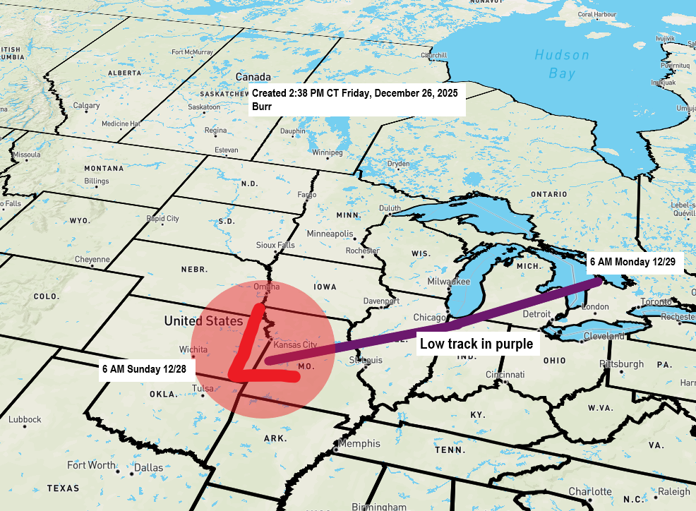
There’s a big disagreement brewing in the computer models this morning for Sunday’s system. The Canadian, ICON and UK models, along with the Euro AI model to some extent, are showing a sharp cutoff in snowfall developing in parts of the Northland. Meanwhile, other models like the Euro, NAM, RAP, HRRR, and GFS are predicting more widespread snow affecting much of the region.
I see some red flags with this system bringing heavy snow to Duluth, which I mentioned in my Friday evening post. Because of that, I’m leaning toward the less snowy Canadian, ICON and UK models in my forecast, as I think they might have a better grasp on this setup.
Duluth and Superior area: 1 to 3 inches of snow is possible from Sunday afternoon into early Monday morning, with blowing and drifting snow likely as gusty north to northwest winds pick up late Sunday into Monday. Temperatures will start in the 30s Sunday morning but drop into the single digits and teens by late afternoon or early evening.
I released this snowfall forecast Friday evening, covering the period from noon Sunday to noon Monday, with a few tweaks likely to be made later today.

A winter storm watch is in effect from Sunday through Monday morning for central and eastern Minnesota, northern Wisconsin, and most of upper Michigan.


Dense fog will persist in parts of northeast Minnesota and northwest Wisconsin through early Sunday morning, with visibility reduced to a quarter mile or less.
A dense fog advisory remains in effect until 6 PM today for the North Shore of Lake Superior in northeastern Minnesota.
In Duluth, dense fog is mostly expected along the hillside ridgeline and into the inland areas of the Twin Ports, while the shorelines will likely see little to no fog.
Note: The dense fog advisory could be extended past 6 PM this evening, with a chance it may also be expanded to other parts of the Northland tonight.

…High Wind Potential…
Strong north to northwest winds are set to move into the Arrowhead and North Shore of Lake Superior Sunday evening, sticking around through Monday. Gusts could reach 50 to 60 mph, with the most intense winds in areas under the high wind warning. These conditions may knock down tree limbs and cause a few power outages.
Note: Strong north to northwest winds are also likely in the Twin Ports of Duluth and Superior beginning mid to late afternoon Sunday and lingering into Monday. Wind gusts of 25 to 45 mph are expected.
A storm watch is in place for the central and eastern parts of Lake Superior, covering a section of the North Shore from Grand Marais to Grand Portage, starting Sunday evening and lasting through Monday evening. Waves in the central-eastern parts of Lake Superior could reach heights of 15 to 20 feet during this period.
Gale watch for the western portion of Lake Superior from Sunday evening to Monday evening.

Leave a Reply