February kicks off on Sunday with a light snowfall across the Northland, dropping about 0.5 to 2 inches of snow, with the heaviest accumulation expected in the western areas and the Arrowhead.
Note: Duluth is likely to see about an inch of snow on Sunday morning.
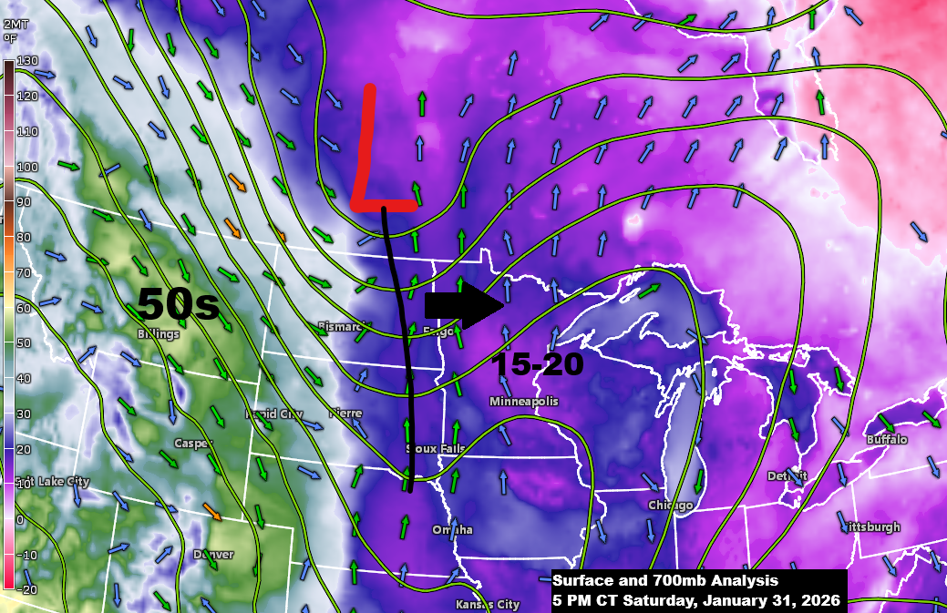
This snow will be driven by a clipper low that passes north of Minnesota on Sunday while a shot of warm air advection occurs ahead of this system, which will be the main culprit in producing our snow later tonight and on Sunday.
We’re seeing temperatures in the 50s behind this system this afternoon over parts of the northern Rockies, but those temperatures won’t be making it this far east just yet.
Tonight in the Northland, temperatures will range from about 5 below to 10 above, with the coldest readings expected before midnight, then slowly warming through the night. Sunday’s highs will be in the teens to 20s.
Here’s the NWS Blend of Models forecast for total snowfall through midnight on Monday.

For Duluth: Snow will start early Sunday morning between 2 and 4 AM, with snow showers likely sticking around on and off for most of the day.
NAM 3km model simulated radar forecast through 7 PM Sunday.

Here’s a look back at February snowfall totals in Duluth, Minnesota, spanning from 2012 to 2025.
In Duluth, the average snowfall for February is 15.1 inches.
- 2012: 19.7 inches
- 2013: 19.1 inches
- 2014: 29.5 inches
- 2015: 8.2 inches
- 2016: 12.2 inches
- 2017: 14.1 inches
- 2018: 24.2 inches
- 2019: 36.4 inches
- 2020: 5.4 inches
- 2021: 8.6 inches
- 2022: 18.8 inches
- 2023: 13.2 inches
- 2024: 1.6 inches
- 2025: 16.2 inches
Since 2012, Duluth has seen seven Februarys with above-average snowfall and seven with below-average snowfall.
Note: In 2019, Duluth had its snowiest February ever, piling up a total of 36.4 inches of snow.
Duluth saw another subzero low on Saturday morning, dipping to -12 degrees, making it the 15th straight day with low temperatures below zero. However, this chilly streak is expected to finally end Sunday morning, with temperatures forecast to remain a few degrees above zero tonight.
In Duluth today, Saturday, January 31, the high hit 21 degrees, marking the warmest day since January 16, when it reached 28 degrees.
Note: This month, Duluth had 19 subzero nights, topping the average of 15. The record stands at 27 subzero nights, set back in 1982 and 1929.
Here’s a look at the daily low temperatures in Duluth, Minnesota, for January 2026.

Leave a Reply