4:51 PM Saturday, July 20, 2024
Today, a cold front moving southward from Ontario and Lake Superior has been triggering scattered showers and thunderstorms across northeast Minnesota and northwest Wisconsin.
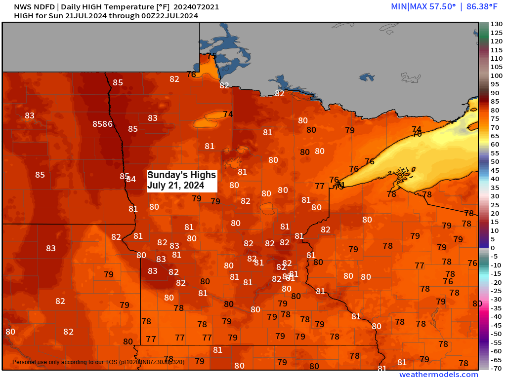
Scattered showers and thunderstorms are expected to continue into this evening, with areas of fog developing overnight and into early Sunday morning. Sunday is forecasted to be less humid, particularly near Lake Superior, with cooler temperatures ranging in the upper 60s to 70s and a northeast wind of about 15 to 25 mph.
The forecast for the Northland indicates a possibility of scattered showers and some thunderstorms on the upcoming Monday and Tuesday.
-Duluth reached a high of 84 degrees today (Saturday, July 20th), marking the 11th day this month with temperatures at least 80 degrees. The average for July is 11 days with temperatures of 80 or higher.
-The Duluth Airport last recorded a quarter inch or more of rainfall on July 2nd.
-As of 4 PM on the 20th, Duluth’s rainfall for July 2024 is nearly 2 inches below the normal, with a precise deficit of 1.91 inches.
Radar loop ends 4:38 PM CT Saturday, July 20, 2024.
Goes-16 sandwich satellite loop ending 4:01 PM CT, Saturday, July 20, 2024.

Torrential downpours have been observed in areas experiencing thunderstorms today, with radar rainfall estimates indicating accumulations ranging from 0.50 inches to more than 2 inches in localized regions.

This afternoon, an area to the west/south of Duluth experienced torrential downpours, whereas the majority of Duluth received little to no rain up until 4 PM today. It really demonstrates the sporadic nature of today’s rainfall.

It was a humid Saturday across the area with dew points in the 60s, but drier air will be pushing south/west out of the Arrowhead and Lake Superior which will cause dew points to drop into the 40s and 50s on Sunday.

For Sunday, the majority of scattered showers and thunderstorms are expected to develop further south than today’s pattern. Consequently, regions from western to central and southern Minnesota, extending into west-central Wisconsin, are more likely to experience rain, while northeast Minnesota and the far northwest of Wisconsin are anticipated to remain dry.
HRRR model simulated radar forecast valid 1 PM to 10 PM Sunday.

Thanks for reading!
Tim
Leave a Reply