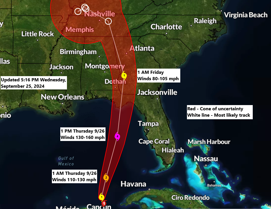
5:59 PM Wednesday, September 25, 2024
Hurricane Helene is predicted to cross the Florida Big Bend coast and make landfall near Apalachicola, or between Port Saint Joe and Carrabelle, FL, on Thursday evening.
Helene is predicted to become a major hurricane, potentially reaching category 4, with wind gusts ranging from 130 to 155 mph as it approaches the Florida Big Bend coast on Thursday evening.
Helene is currently classified as a Category 1 hurricane, with wind speeds reaching 85 mph.
The 4 PM advisory reports that Helene is approximately 460 miles southwest of Tampa, Florida, or about 505 miles south-southwest of Apalachicola, Florida. The storm is advancing northward at a speed of 12 mph and has a minimum central pressure of 978 mb (28.88 inches).

Infrared satellite loop of Helene ending 5:50 PM CT Wednesday, September 25, 2024.
A significant concern with Helene is the storm surge.
The peak storm surge is expected to reach 10 to 15 feet and could rise as high as 20 feet north of Tampa. The most significant surge is anticipated from around Carrabelle, FL, to Suwannee River, FL.
Tampa Bay may experience a storm surge of 5 to 8 feet.

Rainfall forecast through 7 PM Saturday, September 27, 2024.

Warnings map


NAM 3km model simulated radar forecast valid from 7 AM Thursday to Midnight Friday.

Leave a Reply