6:12 PM Thursday, February 6, 2025
Updated Snowfall Stats for Duluth, Minnesota as of 4 PM February 6, 2025
Month to date total: 8.6 inches
Departure: +5.7 inches above normal
Percent of normal snowfall: 297% of normal
2024-2025 Seasonal total: 33.1 inches
Departure: -22.2 inches below normal
Percent of normal snowfall: 60% of normal
Note: Duluth has received about 16 inches more snow this winter than last winter through February 6th.
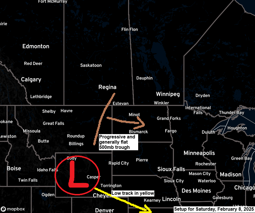
Another snow event is expected Friday night into Saturday. A winter storm watch is in effect for northern South Dakota, central and eastern Minnesota, and central Wisconsin, where there is a risk of significant snow accumulation (4-7″+).


Here’s my preliminary snowfall forecast for Friday night through early Saturday evening.
Expect a sharp cutoff to snowfall amounts on the north side of this system; thus, a slight shift in the track of this system, either north or south, will also shift the snowfall gradients.
- Greatest snow accumulations of 2 to 4 inches are expected over far southern portions of the Northland, with lesser amounts of snow expected farther north.
- Duluth metro area: 1 to 2 inches of snow is possible by Saturday afternoon.
Note: There’s a 10% chance of getting 2 inches of snow in Duluth on Saturday, based on the Euro ensemble model.

European model simulated radar forecast valid 6 PM Friday to 6 PM Saturday.

Strong winds and colder temperatures today.
Peak Wind Gusts from Thursday, February 6, 2025, as of 4 PM
Duluth, MN: 46 mph
Brainerd, MN: 45 mph
Ashland, WI: 44 mph
Hibbing, MN: 38 mph
International Falls, MN: 37 mph
Colder air returned to the Northland today after last night’s snowfall, with temperatures at 850mb dropping to about -20C.

Note: Overall, a cold pattern is expected, with low temperatures possibly dropping to the teens and 20s below zero in much of the Northland early next week.
Temperatures were only in the single digits above zero in the Northland this afternoon.

The strong winds in the Northland today were caused by the difference in pressure between the low pressure north of Lake Superior and the high pressure over the northern Rockies.

Strong cold air advection that was over the Northland today has already moved eastward in this progressive weather pattern and has been replaced by warm air advection this evening.

Thanks for reading!
Leave a Reply