6:05 PM Monday, February 17, 2025
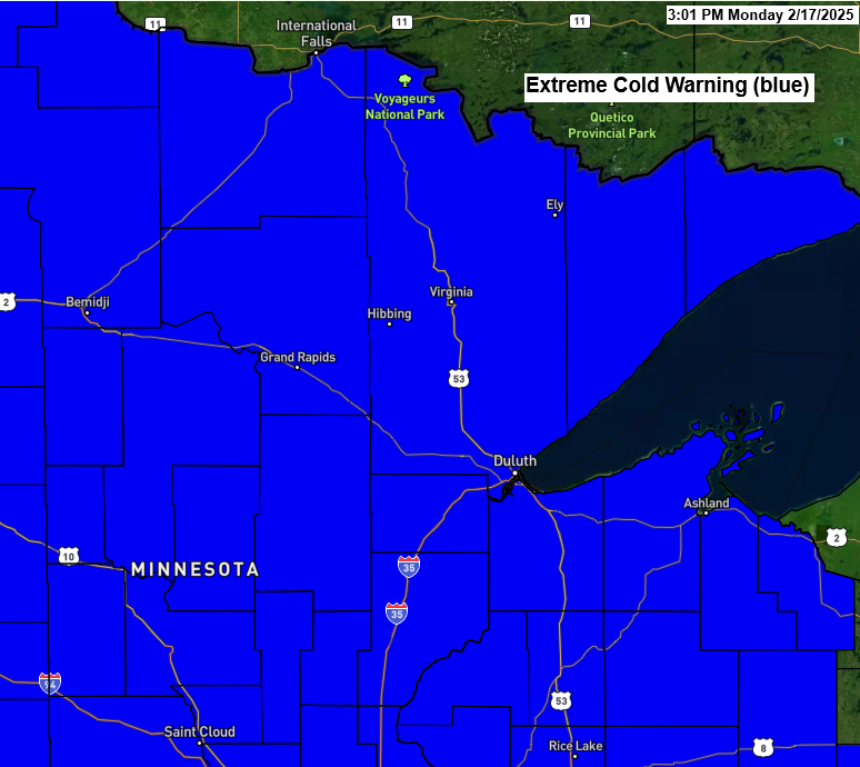
An Extreme Cold Warning is in effect for all of northeast Minnesota and northwest Wisconsin until 10 AM Tuesday. Wind chill temperatures of 45 below to 50 below zero are expected late tonight through Tuesday morning.
Temperatures early Tuesday morning are expected to be between 15 and 30 degrees below zero in the Northland, with some areas in northern Minnesota possibly reaching lows of 35 to 40 degrees below zero.
Record Lows for February 18th
- International Falls: -44 set in 1966
- Hibbing: -33 set in 1989
- Ashland: -32 set in 1979
- Brainerd: -27 set in 1945, 1958 and 1979
- Duluth: -25 set in 1966

Highs on Tuesday will be between 2 and 10 degrees in our area.

Core of the arctic air is over the northern Plains, upper Midwest into central Canada today with 850mb temperatures near -30°C. Meanwhile, a somewhat milder air mass covers northeastern portions of Canada today, and that milder air will advect southwest into our area on Wednesday as we will see 850mb temperatures climb to around -15 to -20°C.

Arctic air is affecting the region today, with afternoon temperatures in northeast Minnesota and northwest Wisconsin ranging from just below zero to just above zero. However, it is even colder to the west, where temperatures are in the teens to around 20 degrees below zero.

Temperatures this afternoon were 25 to 45 degrees below normal in the northern Plains and 20 to 25 degrees below normal in northeast Minnesota and northwest Wisconsin.

Widespread winter weather alerts cover the Pacific northwest, northern Rockies, central Plains to Midwest, and parts of the eastern U.S. as another storm affects these areas in the coming days.

The significant snows this week will stretch from parts of the central Plains to Virginia, where up to 6 inches or more of snow are possible.

We may see a bit of snow in parts of the Northland on Wednesday as some energy moves down from Ontario, but the cold, dry air means it won’t be significant.

Snow accumulations of an inch or less are possible in parts of northeast Minnesota and northwest Wisconsin on Wednesday.

We are expecting a warmup in the Northland this weekend into next week, but don’t get too excited about the milder temperatures lasting, as an active clipper pattern may develop. These clipper lows could bring colder air south into our area at times next week, but there should be brief warmer temperatures (highs in the 30s) likely occurring between February 23-28.

Thanks for reading!
Leave a Reply