A mid and upper-level low, along with a trough, will move southeast across the upper Midwest tonight and Saturday, before heading east by Saturday evening.
This system will bring a little snow at times to parts of northeast Minnesota and northwest Wisconsin tonight and Saturday, but it won’t be a major snow event by any means.
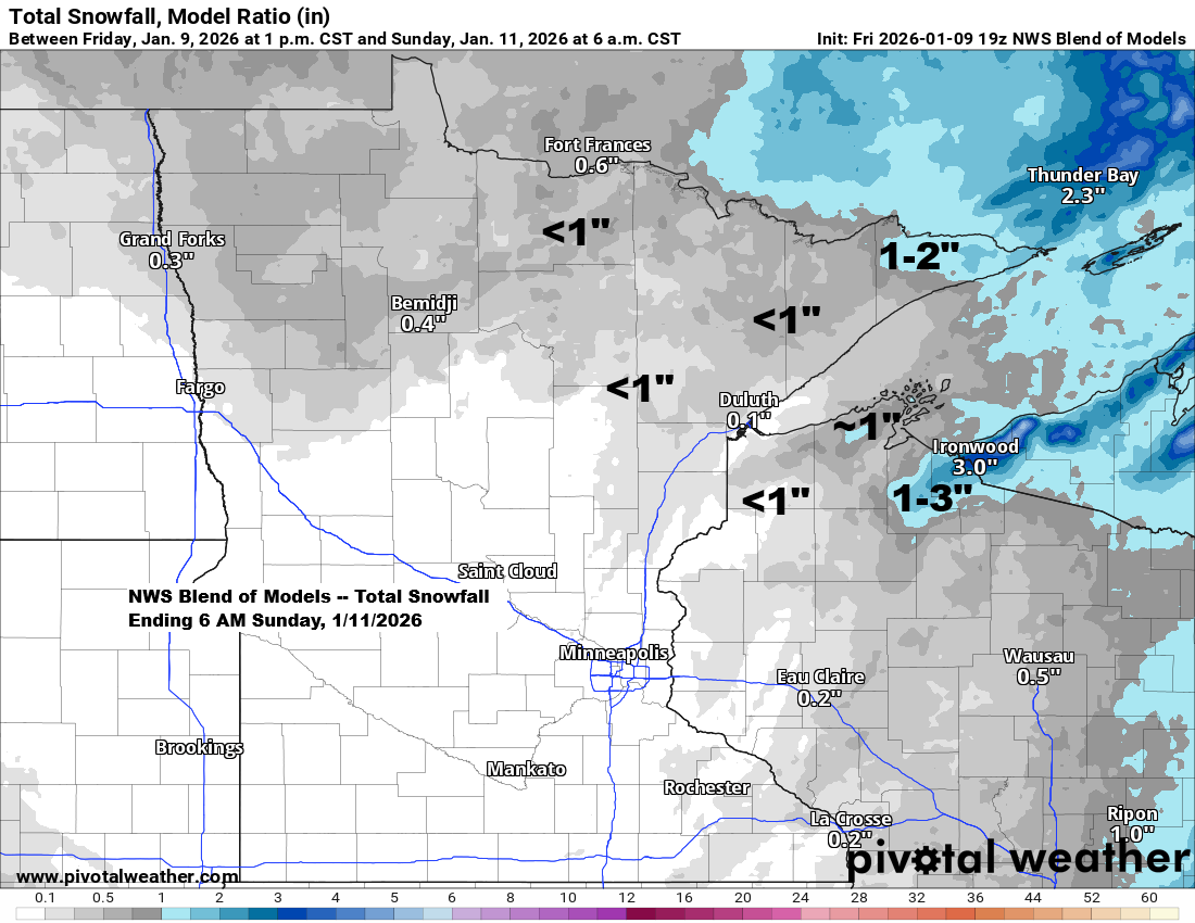
Most of the Northland will likely see less than an inch of snow through Saturday, except for the Arrowhead of Minnesota, where 1 to 2 inches could fall. In the snowbelt areas of northwest Wisconsin, east of Ashland, snowfall totals may reach 1 to 3 inches.

NAM 3km model simulated radar forecast ending 12 AM Sunday.

…Temperatures and long range trends…
Duluth enjoyed its second day above freezing today, hitting a high of 34 degrees. January usually sees around four days above freezing, with the record being 22 days set back in January 1880. Cooler weather is on the way this weekend, with temperatures staying below freezing, but we might hit or pass the freezing mark again next Monday and Tuesday.
Computer models indicate an active clipper pattern will return next week, bringing a few chances for snow in the Northland, including Duluth. For now, it doesn’t appear a major winter storm is on the horizon, with mostly light snow amounts expected.
…Heavy Snow in Kansas today…
Parts of southwest Kansas were hit by a hefty winter storm today, with several reports of snowfall totals exceeding 6 inches.

…First tornados of 2026…
There were five tornado reports in central Oklahoma on Thursday, and so far today, another five have been reported farther east in central and southern Mississippi.


Leave a Reply