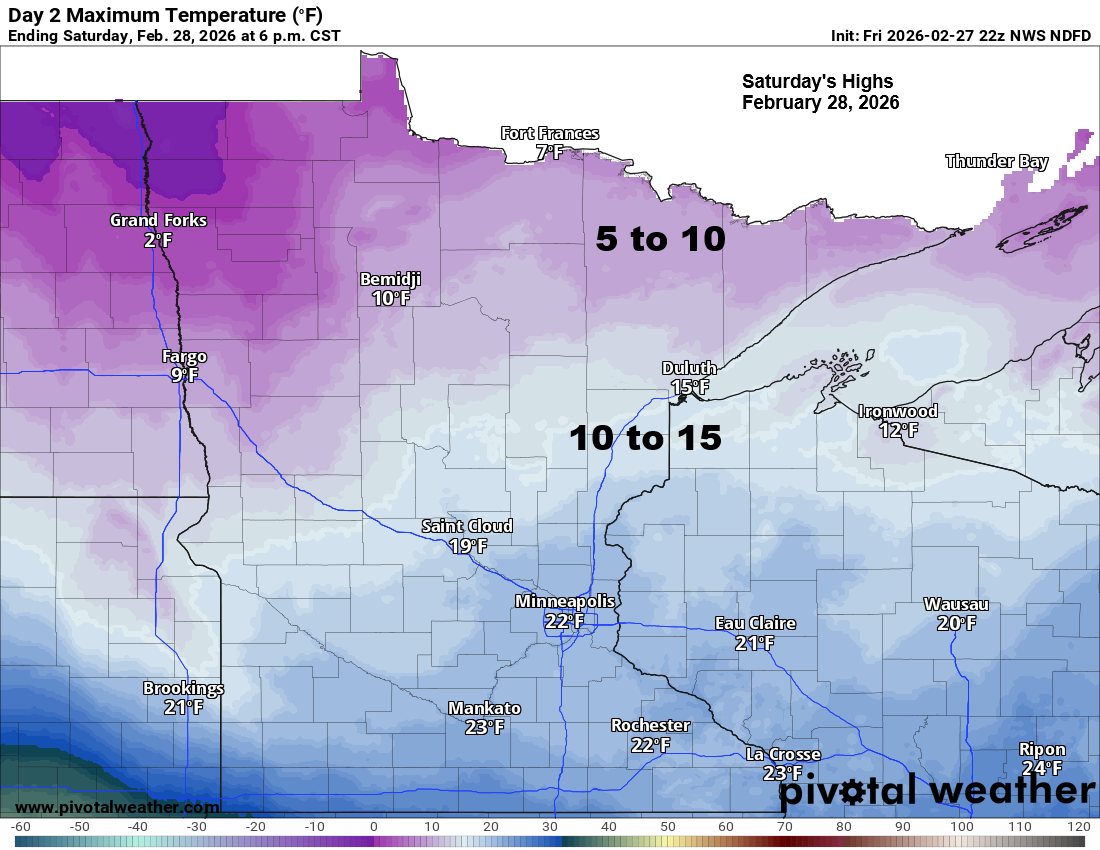
After a mild Friday, a much colder air mass will surge back into the Northland this weekend as a fresh batch of late‑season Arctic air drops south. Temperatures will tumble quickly tonight, with lows ranging from around 15 below zero to 5 above zero. Saturday will be sharply colder, with highs only in the single digits and teens, followed by an even colder night as readings fall to around 0 to 25 below zero by early Sunday.
Temperatures ahead of today’s cold front reached the 40s and lower 50s in northeast and east-central Minnesota and northwest Wisconsin.

As expected we saw very strong wind gusts develop across much of the Northland this afternoon as a potent cold front passed through the region.
A potent cold front blasted through the region today, and it delivered exactly what the setup suggested: widespread very strong west to northwest wind gusts across much of the Northland. Gusts commonly reached 35 to 50 mph, with several sites pushing even higher.
Some of the strongest reported gusts included:
Duluth Sky Harbor — 59 mph (one of the highest readings today)
International Falls — 54 mph
Hibbing — 52 mph
Ashland — 52 mph
Duluth International Airport — 52 mph
Two Harbors — 51 mph
It’ll stay windy tonight with gusts of 25 to 45 mph, and as strong as 60 mph along the North Shore of Lake Superior, but winds will diminish overnight and especially this weekend.

…Power Outages Friday evening…
As of 6:30 PM Friday, 23 outages were affecting about 540 Minnesota Power customers.

…Forecast lows for Sunday morning…

…Saturday Snow…
Snow associated with a system on Saturday will track mostly south of the Northland, with several inches expected across central and southern Minnesota.
Far southern portions of the region—from the Brainerd Lakes east toward Hayward—may catch the northern edge of this band, with up to 1 inch of accumulation possible.
For Duluth and areas north, the system’s track keeps the snow shield too far south, and no accumulation is expected on Saturday.

RRFS-A model simulated radar forecast valid 1 AM Saturday to 6 PM Saturday.

Leave a Reply