The slow snowmelt kept going today, with mild temps in the 40s and a few spots hitting the low 50s, while far northern Minnesota stayed cooler in the mid to upper 30s.
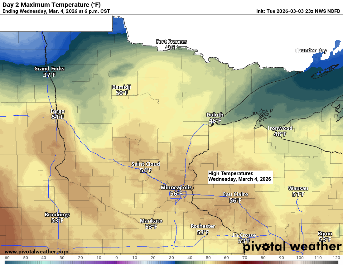
Highs on Wednesday should be similar to today, with temperatures in the 40s and 50s, assuming any low clouds or fog that form later tonight clear out.
Temperatures will cool off on Thursday, especially near Lake Superior, as stronger northeast winds develop, bringing readings back down into the 20s.

Areas of low clouds and fog will likely redevelop across the Northland tonight and linger into Wednesday morning, much like what we experienced earlier today.
In some areas, visibility might drop to less than a mile due to the fog.

…Late week precipitation chances…
Friday’s synoptic setup looks messy, but one thing seems certain: we’re not expecting a major system to impact northeast Minnesota or northwest Wisconsin.
The setup features a southwest flow aloft from the Midwest to the Great Lakes, with a strong trough over the central Rockies. Some of that energy will slide southwest toward Baja, while another part pushes east-northeast. Meanwhile, in the northern stream, another trough and cold front will move eastward out of the Dakotas.
It’s unlikely we’ll see much phasing between the northern and southern streams on Friday, which will probably lead to mostly light precipitation in northeast Minnesota and northwest Wisconsin.
Most of the precipitation will likely be rain, but a mix of rain and snow or some wet snow could appear Friday night. Any snow that does fall should have little to no accumulation.

Leave a Reply