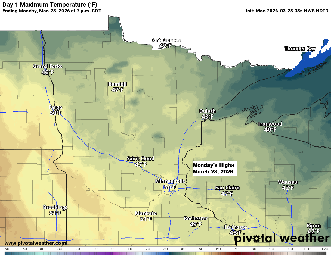
After a chilly Sunday, temperatures will bounce back to more typical levels on Monday, with highs mainly in the 40s across northeast Minnesota and northwest Wisconsin.
A few weak systems will move through the area over the next few days, but any precipitation they might bring doesn’t seem likely to amount to much, whether it comes as rain, snow, or a wintry mix.
Monday and most of Tuesday should stay dry, but from Tuesday night through Thursday, there’s a chance for a bit of precipitation in parts of the Northland.
A powerful cold front swept through the upper Midwest today, leaving temperatures this afternoon a staggering 30 to 50 degrees colder than they were yesterday at the same time.

| A look back at the historic March heatwave over the past few days. Thirteen states just broke their March heat records. CA: 112 degrees (Buttercup and Squaw Lake) AZ: 112 degrees (Fort Yuma and Martinez Lake) NV: 106 degrees (Laughlin) NM: 100 degrees (Carlsbad, Draw Near) KS: 101 degrees (Phillipsburg) NE: 99 degrees (Cambridge, Little Blue River) UT: 97 degrees (St George) SD: 97 degrees (Vermilion) MO: 97 degrees (Harrisonville, St Charles) IA: 97 degrees (Hitchcock) WY: 90 degrees (Torrington, Guernsey, and Wheatland) MN: 88 degrees (Luverne) ID: 86 degrees (Boise River) |
Leave a Reply