No signs of any prolonged or significant warmth in the Northland at least through the middle of next week, as a cooler northwest flow aloft will stick around for a bit longer.
There’s a chance for showers in parts of the area late tonight into early Saturday morning, with another possibility of rain next Tuesday. Both systems are clipper types, so they aren’t expected to bring significant precipitation.
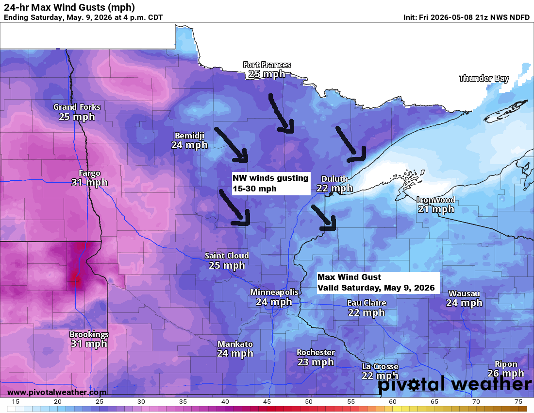
Expect a breezy Saturday with northwest winds gusting between 15 and 30 mph across northeast Minnesota and northwest Wisconsin.
Note: If a few showers move through Duluth late tonight, they should clear out before 7 AM on Saturday.
HRRR model simulated radar forecast through 7 AM Saturday.

Late tonight, rainfall will be light for those who see it, with amounts ranging from just a trace to about 0.10 inches.

It was a cold morning in the Northland, with temperatures again in the upper teens and 20s.
***=New record low temperature for May 8th
International Falls, MN
Low: ***20***
Record Low: 21 set in 2008
Hibbing, MN
Low: ***20***
Record Low: 21 set in 1983
Ashland, WI
Low: 24
Record Low: 20 set in 1948 and 1983
Duluth, MN
Low: 27
Record Low: 22 set in 1966
Brainerd, MN
Low: 27
Record Low: 24 set in 1983

Temperatures warmed up nicely this afternoon, climbing into the upper 50s and low to mid 60s across northeast Minnesota and northwest Wisconsin, which is right around normal for May 8.
Highs on Saturday and Sunday will drop back into the 40s and 50s, with lows remaining in the 20s and 30s. Frost is likely in some areas both Saturday and Sunday nights.

Leave a Reply