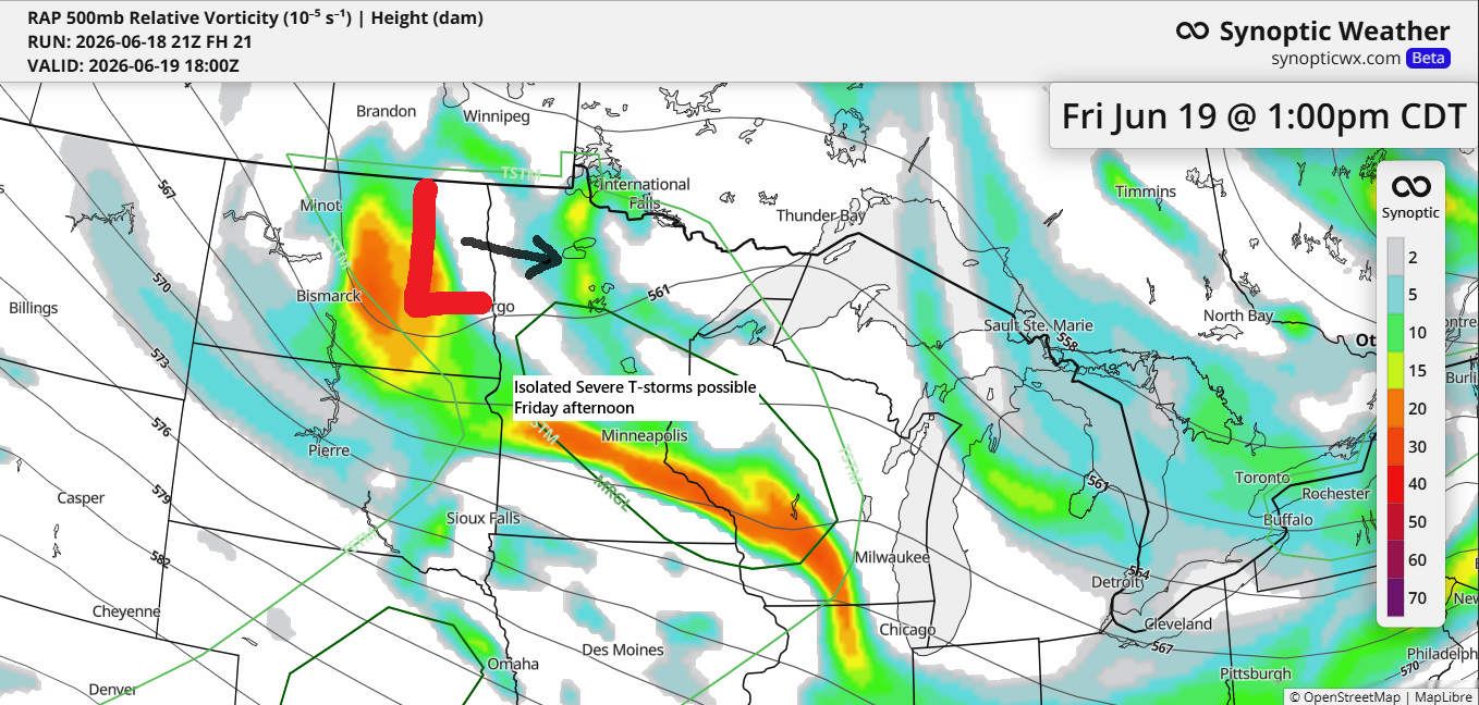
Another system will move east-southeast out of the northern Plains on Friday, bringing a fresh round of scattered showers and a few thunderstorms to northeast Minnesota and northwest Wisconsin from Friday into the evening.
With 500mb temperatures dipping to about -20°C, enough low-level moisture with dew points in the 50s, decent CAPE (instability), and a plume of steep mid-level lapse rates around 7.0°C/km, conditions seem ripe for thunderstorms to develop in parts of the Northland, especially from the afternoon into early evening.
Widespread severe weather isn’t expected on Friday, but a few strong to severe storms could pop up, especially in the darker green zone on the map. The main threats include hail up to 1.5 inches in diameter (about the size of a ping pong ball) and winds between 40 and 60 mph.

Duluth area: Friday morning should be dry, but scattered showers and thunderstorms are likely in the afternoon and early evening.
HRRR model simulated radar forecast valid 7 AM to 10 PM Friday.
A few showers moved quickly southeast across parts of northeast Minnesota and far northern Wisconsin this afternoon, but they should fade away by mid to late evening.
Radar loop ends 5:55 PM Thursday, June 18, 2026.
…Rainy June in Duluth…
Duluth has had some decent rain this month, with four events bringing at least 0.25 inches and three of those topping 0.50 inches.
The heaviest rainfall so far this month occurred on June 10th, with a total of 0.77 inches.
As of 4 PM on June 18th, Duluth has seen 2.49 inches of rain this month, which is 0.05 inches above the normal amount.

Northeast Minnesota and northwest Wisconsin could see between 0.10 and 0.25 inches of rain by Friday evening, with some spots getting up to half an inch.

If you enjoy these posts and want to support the blog, I truly appreciate it.
Make a one-time donation
Make a monthly donation
Make a yearly donation
Choose an amount
Or enter a custom amount
Your contribution is appreciated.
Your contribution is appreciated.
Your contribution is appreciated.
…Saturday’s Forecast (June 20th)…
Saturday morning looks dry, with temperatures at 7 AM ranging from 48 to 53 degrees between Two Harbors and Duluth, MN, warming to around 60 by mid to late morning. Winds will stay under 15 mph out of the northwest.
7 AM Saturday

10 AM Saturday

…Today’s Weather…
The weather improved a bit today, with some sunshine breaking through and temperatures climbing into the 60s, though still about 5 to 10 degrees below the average for June 18th. The wind stayed gusty, coming from the northwest behind yesterday’s system, with gusts hitting up to 30 mph.

Leave a Reply