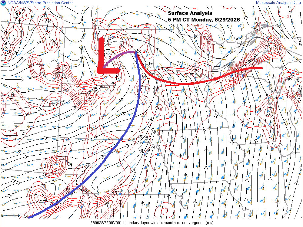
This afternoon, a low-pressure system over central North Dakota has a warm front stretching east-southeast through central Minnesota into northern Wisconsin, while a cold front extends southwest from the low across the eastern Dakotas.
South of the warm front, temperatures climbed into the upper 80s and low 90s today, while cooler 60s and 70s prevailed to the north across the Northland.
The air is thick with moisture today, with dew points west and south of the warm front in the 70s and some spots even hitting the low 80s this afternoon, which is pretty remarkable for this far north.
Despite the earlier storms that swept through much of the Northland, the airmass is still loaded with potential energy, with CAPE values between 2500-5000 J/kg, steep mid-level lapse rates, and strong wind shear. There’s definitely potential for more showers and thunderstorms across the region tonight, with large hail and damaging winds being the main threats, though isolated tornadoes can’t be ruled out if storms become surface-based. If storms remain elevated, the tornado risk would be lower.
Heavy downpours are expected in areas with storms tonight, with PWATs ranging from 1.50 to 2 inches, and there’s a chance of some localized flooding.


Scattered showers and thunderstorms are already redeveloping late this afternoon in northern Minnesota, a clear sign of just how unstable the airmass over the area is today.
Radar loop ends 5:34 PM Monday, June 29, 2026.
Visible satellite imagery shows plenty of breaks in the clouds following the storm cluster, which continues racing east late this afternoon.
Goes-19 visible satellite loop ending 5:21 PM CT Monday, June 29, 2026.

Leave a Reply