7:07 PM Saturday, December 28, 2024
-There is not much precipitation expected in the Northland, and mild temperatures are anticipated to persist for a few more days.
-Areas of fog are once again possible over the next few nights and days, but that will be the extent of the excitement when it comes to the weather in our region.
-Much colder risks are appearing starting mid to late this coming week, and this colder pattern may have some staying power, with a potential visit from the Polar Vortex.
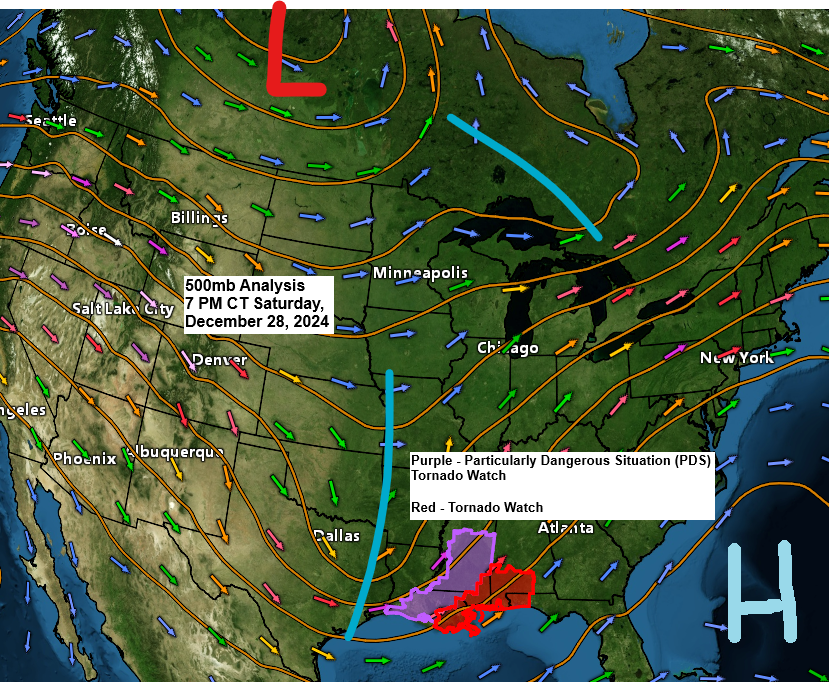
A severe weather outbreak has occurred today over parts of the lower Mississippi Valley, and this severe weather is expected to spread into the Tennessee Valley, parts of Georgia and the central Gulf Coast region tonight.
Goes-16 infrared satellite loop ending 5 PM CT Saturday, December 28, 2024.
Radar loop ends 5:24 PM CT Saturday, December 28, 2024.
So far today (through 5 PM CT), a total of 15 tornadoes have been reported in Texas, Louisiana, Arkansas, and Mississippi.

Arctic Air making a return?
Computer models are converging on a consensus that suggests a significantly colder pattern for the Northland, with multiple incursions of Arctic air expected from early to mid-January.
Temperatures will begin to drop in the Northland from mid to late this coming week, with highs in the single digits and teens, and lows ranging from the teens below zero to single digits above zero. Note: Even colder temperatures are possible starting around or after January 6th.
Below is the GFS model through January 13th, 2025.
The white areas represent upper lows or segments of the Polar Vortex. Notice how these upper lows begin to descend southward from Canada around or after January 6th.


Subscribe to continue reading
Become a paid subscriber to get access to the rest of this post and other exclusive content.