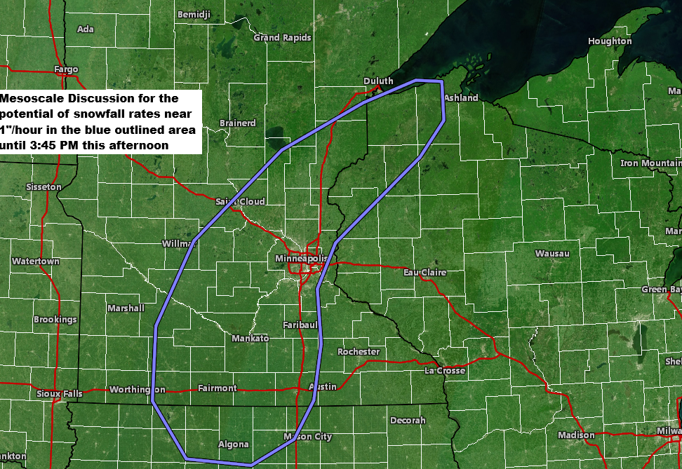
The Storm Prediction Center in Norman, Oklahoma has issued a mesoscale discussion for areas from north-central Iowa, southern and eastern Minnesota, and northwest Wisconsin. Snowfall rates could pick up to about 1 inch per hour in this region through around 3 PM today. Southern Minnesota and northern Iowa may also see occasional blizzard conditions as winds strengthen, with frequent gusts of 30 to 50 mph reducing visibility to a quarter mile or less, causing blowing snow and blizzard conditions.
Radar loop ends 10 AM Sunday, December 28, 2025.
Heavier snowfall shows up in the green colors on the loop.
Road conditions are likely to worsen in parts of Minnesota today as snow and blowing snow persist. By later today and tonight, some areas, especially in west-central and southern Minnesota, could face travel advisories due to expected blizzard conditions.

Leave a Reply