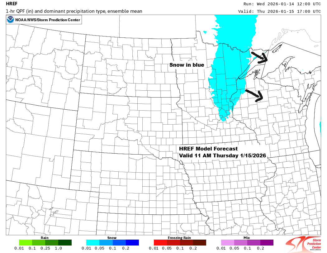
A clipper system will move southeast from eastern Manitoba Thursday afternoon, reaching northern Lower Michigan by Friday afternoon. It will bring occasional snow to northeast Minnesota and northwest Wisconsin from Thursday into Friday, but snowfall amounts should be modest, with most areas seeing just a few inches by Friday morning.
Note: Heading into this event, Duluth’s biggest single-day snowfall this month has been just 1 inch on the 10th. Let’s see if we can beat that on Thursday.
Here’s my snowfall forecast valid through 6 AM Friday.
Northeast Minnesota and northwest Wisconsin, including Duluth and Superior, are looking at 1 to 3 inches of snow. Some spots along the North Shore and in the Arrowhead could see 3 to 6 inches, with a chance for lake-enhanced snow Thursday afternoon and evening as southerly winds pick up.
A little more light snow and flurries are expected on Friday, but any additional accumulation should be around an inch or less.

It looks like snow will start falling in Duluth before noon on Thursday, likely sometime between 7 and 10 AM.
NAM 3km model simulated radar forecast valid Midnight tonight to 6 AM Friday.

Temperatures will start off chilly in the teens during the day Thursday but should warm into the 20s and lower 30s by Thursday night into Friday morning, before colder air moves back in starting Friday afternoon.
Note: There’s a chance of some patchy freezing drizzle forming over parts of the Northland as warmer air moves in Thursday night.
Winds will come from the south on Thursday, shifting to the northwest by Friday. Gusts could range from 15 to 30 mph, with the strongest expected Friday as low pressure moves out and colder air moves in. Patchy blowing snow may occur at times due to the gusty winds.
Euro model temperature forecast valid 6 AM Thursday to 6 PM Friday.

…Clipper track Thursday-Friday…

As of the 13th, Duluth has seen 3.6 inches of snow this month, which is 4.4 inches below the normal amount.
Here’s a look at this month’s snowfall totals so far—it’s been fairly light throughout most of the region.

So far this month, only far northern Minnesota and the Arrowhead have seen above-average snowfall, while the rest of the region is running below average.

Note: Today, January 14th, Duluth saw a below-average temperature for the first time since January 4th.
Average temperatures in northeast Minnesota and northwest Wisconsin have been running well above average through about the first half of this month, with anomalies of about 6 to 10 degrees warmer than average. A colder pattern should start to erase these warm anomalies in the next few weeks.

Leave a Reply