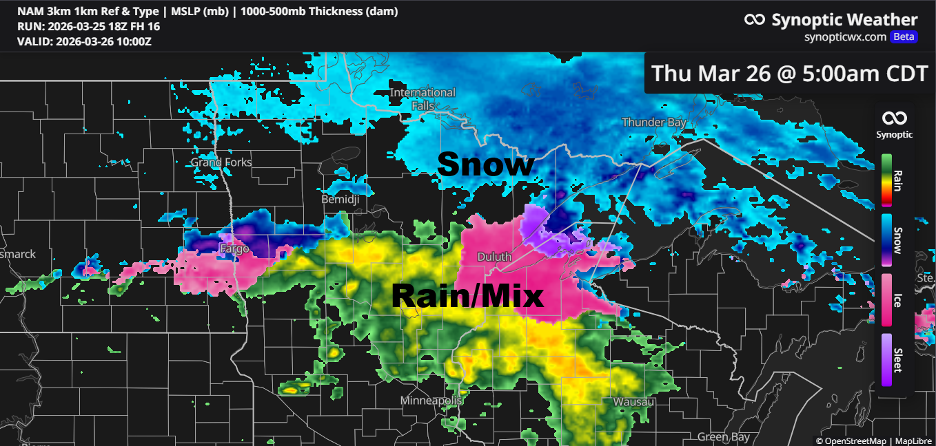
Confidence is fairly low about how things will unfold late tonight into Thursday morning, but there’s a chance we could see some rain and a wintry mix in parts of northeast and east-central Minnesota, stretching into northwest Wisconsin. This would happen as a frontal boundary slowly drifts south, with warm air lingering to the south and cold, arctic air settled to the north.
Early Thursday morning, between about 4 AM and 9 AM, there’s a small window when a band of freezing rain or sleet could move through, potentially leaving a thin glaze of ice in or near the black outlined area on the map.

The NWS Blend of Models does a good job showing the uncertainty, indicating the main band of precipitation forming a bit farther south, though there’s still a chance it could shift slightly north early Thursday morning.
Beneath the main precipitation band, we might get about 0.05 to 0.30 inches of precipitation.

Note: For areas near Lake Superior, be prepared for a stretch of gusty northeast winds from late tonight through Thursday morning, with gusts ranging from 15 to 30 mph.
The next few days will bring cooler temperatures, with highs on Thursday ranging from the upper 20s to around 40 degrees across the Northland, and mostly in the 20s to low 30s on Friday.
NAM 3km model simulated radar forecast valid Midnight tonight to Noon Thursday.

…Snow Chances Friday…
Some snow may pop up across the Northland on Friday as a disturbance in the northwest flow aloft moves through the region.
NAM 3km model simulated radar forecast valid 1 AM to 7 PM Friday.

By 7 PM Friday, northeast Minnesota and northwest Wisconsin could see anywhere from a trace to an inch of snow, with most of it expected to fall on Friday.

…Record warmth today…
Brainerd, Minnesota recorded a high of 68 degrees today, setting a new record for March 25. The old record was 67 degrees, set in 1963 and 1968.
Note: The high of 60 in Duluth today was 4 degrees below the record high of 64 set in 1925.
Aside from areas near Lake Superior and far northern Minnesota, the rest of the Northland enjoyed a pleasant early spring day, with temperatures in the 50s and 60s, and Hinckley hitting a high of 70. Cooler 40s prevailed in far northern Minnesota, while mid 30s to 40s were common closer to Lake Superior.

Another hot day across the central Plains, with temperatures soaring into the 80s and 90s, and near 80-degree warmth stretching into southwest Minnesota.
Up north, it’s still much colder, with temperatures in the single digits and teens, both above and below zero, across much of Canada.

…Active Pattern next week…
The pattern continues to look active next week with a possibility for a few systems to track far enough north to bring precipitation to northeast Minnesota and northwest Wisconsin beginning around the middle of next week. Anything from rain to snow to a wintry mix is possible at this time.
Ensemble models are still predicting some impressive precipitation totals of an inch or more across the Northland through April 9.


Leave a Reply