It’ll be chilly tonight and Friday, but things will start to warm up over the weekend. By Sunday, east winds will bring cooler air back to areas near Lake Superior, while inland spots will see highs in the 40s and 50s, with a few places possibly hitting the 60s.
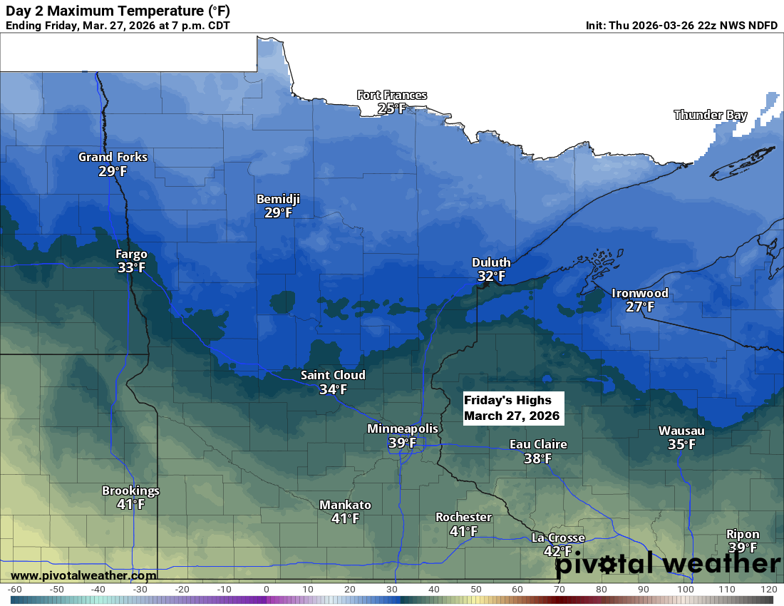
Tonight and Friday night, lows across the Northland will dip into the teens and 20s, with a few spots possibly reaching single digits. Friday’s highs will range from the 20s to lower 30s, much like Thursday afternoon’s temperatures.
A few snow showers and flurries could pop up in northeast Minnesota and northwest Wisconsin on Friday, but they’re not expected to bring much accumulation—maybe just a light dusting in some areas.
HRRR model simulated radar forecast through 7 PM Friday.

Another powerful cold front swept through the region today, sending temperatures plunging by anywhere from 20 to nearly 50 degrees compared to Wednesday afternoon.

A strong thermal gradient persisted today, with arctic air settled over Canada bringing chilly temperatures to the northern tier, while regions near and south of the white line enjoyed warm to hot conditions.

The southern parts of the Northland saw some rain early this morning, with totals ranging from roughly 0.01 inches to about 0.20 inches.

Here’s a look at some of the rainfall totals from Thursday morning.
- Hayward, WI: 0.15″
- Minong, WI: 0.12″
- Hinckley, MN: 0.11″
- Glidden, WI: 0.11″
- Siren, WI: 0.09″
- Clam Lake, WI: 0.09″
- Grantsburg, WI: 0.09″
- Danbury, WI: 0.07″
- Moose Lake, MN: 0.02″
- Brainerd, MN: 0.01″

Leave a Reply