Category: Rainfall Reports
-
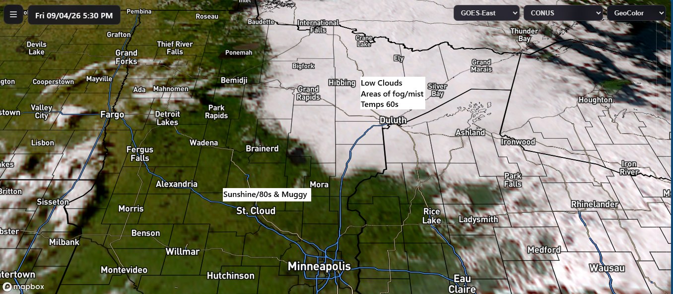
Rainfall Recap + Labor Day Outlook
Weather conditions varied widely across the region today. In northeast Minnesota and northwest Wisconsin, low clouds, fog, and mist dominated, with temperatures mostly in the 60s and cool east breezes coming off Lake Superior. Farther west and south, however, it was warmer and sunnier, with muggy conditions pushing temperatures into…
-
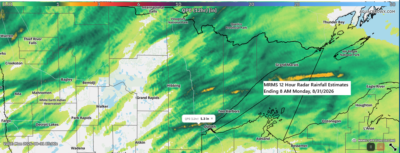
🌧️ Twin Ports Rainfall Ranged from 0.4″ to Over 1″ Overnight
There was a notable rainfall gradient across the Twin Ports last night, with several rounds of showers and thunderstorms producing brief, intense downpours in parts of Duluth. Rainfall varied across the region, with totals ranging from about 0.4 inches to over an inch at the Duluth Airport and Hermantown. Other…
-
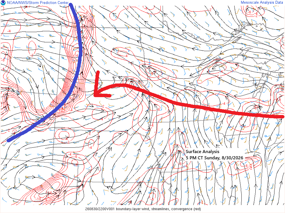
🌫️⚡Fog Settles In Tonight; Northern MN Storms Roll Through Overnight
Tonight, a warm front will advance east-northeast from southern Minnesota, while a cold front from the western Dakotas moves eastward. By Monday afternoon, the entire system is expected to have moved northeast of the Northland. Scattered showers have tracked east across parts of the Northland today, remaining brief and producing…
-

East‑Central Minnesota Gets Drenched — Duluth Barely Scrapes a Tenth
A widespread area of rain moved east-southeast across east-central Minnesota and parts of northwest Wisconsin on Saturday morning, with the heaviest totals in east-central Minnesota, where Hinckley and Aitkin each recorded over 1.50 inches of rain. Rain totals fell sharply to the north, with only 0.11 inches reported at the…
-

Northland Storms: Hail, Funnel Clouds and Heavy Rain – Aug. 25
Today, the Northland saw scattered showers and thunderstorms, featuring hail from quarter- to half-dollar size, isolated funnel clouds, and localized wind damage in Duluth’s Morgan Park area. Local Storm Reports – August 25, 2026 7:32 PM: Funnel Cloud. 6 SW Webb Lake, WI (Burnett County). Funnel over County C and…
-
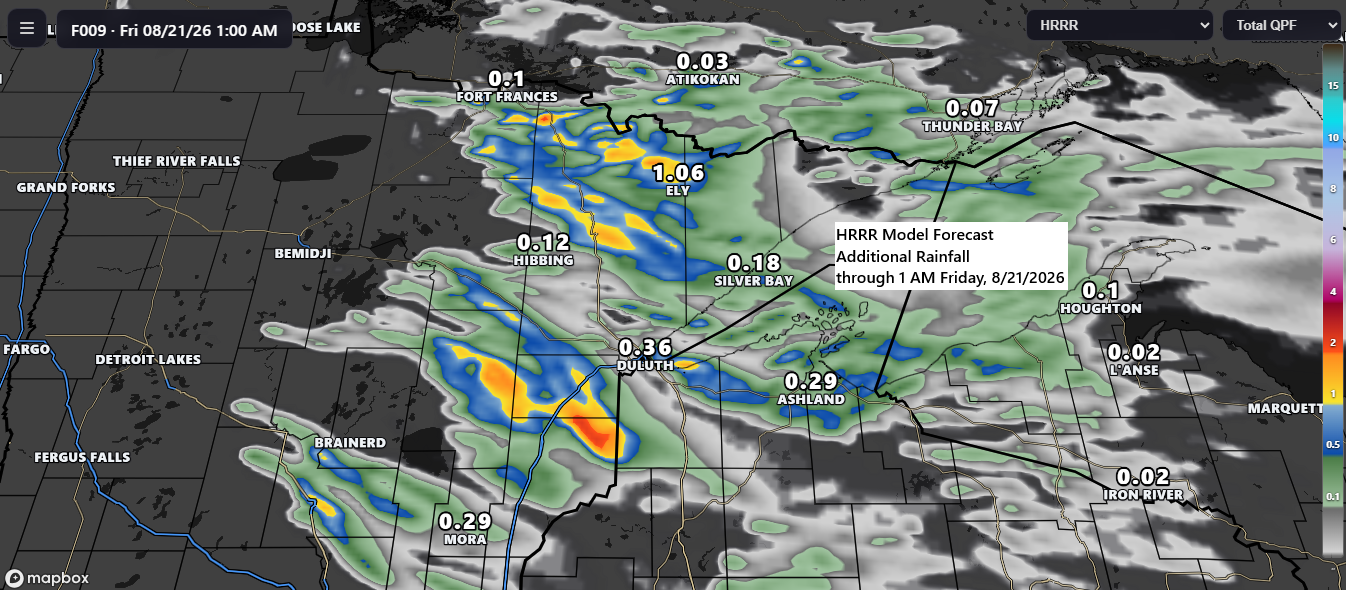
🌧️🌩️ Scattered Storms Continue This Evening; ⚡🧊 Isolated Severe Threats with Quarter-Size Hail and Winds Up to 60 mph
Scattered showers and thunderstorms are forecast to continue across the Northland through this evening, progressing southeastward. These storms may produce brief periods of heavy rainfall, with isolated strong to severe thunderstorms possible. The primary hazards include hail up to half-dollar size (1.25″ in diameter) and wind gusts approaching 60 mph.…
-

🌧️ Heavy Downpours Hit NE Minnesota Monday; Chisholm Tops the Region With 1.99″
On Monday, scattered showers and thunderstorms moved east-southeast across the region, bringing heavy downpours to parts of northeast Minnesota. Areas north of Duluth received half an inch or more of rain, while a separate corridor of heavier rain developed from west-central to central Minnesota. It was a close call for…