Category: rain
-
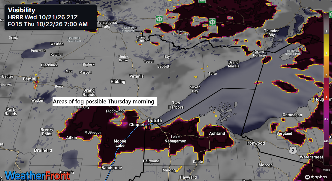
🌫️🌡️Fog Tonight, Cool Shores Tomorrow, Mild Inland Through Saturday
It looks like some fog may develop in parts of northeast Minnesota and northwest Wisconsin later tonight, lingering into Thursday morning. This should clear by Thursday afternoon, though some clouds might stick around, especially near Lake Superior. This afternoon in the Northland, temperatures ranged from the mid-60s to the low…
-

Contrasting Weather: ⛈️🌪️Arizona Braces for Severe Storms as Northland Enjoys Mild Fall Days☀️🍂
A dry cold front will move through the Northland Wednesday morning, shifting winds from northeast to northwest near Lake Superior. Those northwest winds will push temperatures into the 60s near the lake on Wednesday, but east winds will return by late Wednesday afternoon and likely persist through Thursday and Friday,…
-
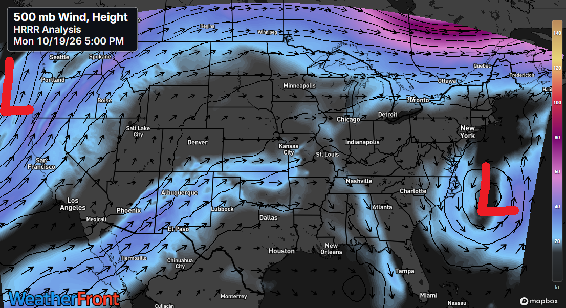
🍂 🌤️ 🍁Quiet Skies, Warm Afternoons, and No Major Storms in Sight
A calm fall pattern will persist over the next few days, with cool nights and mild afternoons. Temperatures will climb into the 60s across much of the Northland from Tuesday through Saturday, with some spots possibly reaching 70 degrees. Occasional east winds will keep temperatures cooler near Lake Superior on…
-
🌬️🌧️🌊Lake Superior Gale Friday, Then a Quick Weekend Warmup
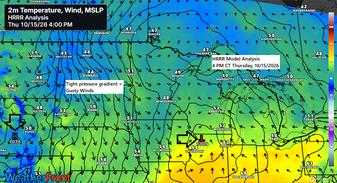
Today has been all about two systems: a strong northern stream trough digging southeast out of the Dakotas, and a southern stream system moving east-northeast from the central Plains. Southwesterly flow aloft carried moisture northeast ahead of these systems, bringing a rainy Thursday to northwest Wisconsin and east-central and northeast…
-
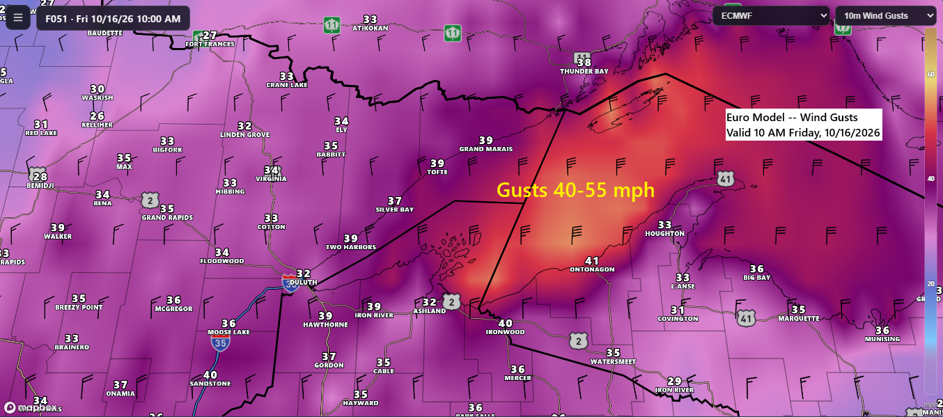
🌧️💨🌊Showers Thursday, then a Windy Friday with Lake Superior Gales
A cold front and a strong upper-level trough will move through the Northland on Thursday, bringing scattered showers and ushering in a period of gusty northwest winds. The strongest winds are expected to develop Thursday night and persist into midday Friday, with gusts of 20 to 35 mph likely across…
-

🌦️🌬️Fast-Moving Cold Front Brings Wind, Limited Rain Chances Late This Week
On Thursday, a low-pressure system will head toward the central Plains, while a strong trough and cold front push southeast toward the upper Midwest. The northern trough will help keep the southern system and its widespread rain away from the Northland, though a few showers might pass through our area…
-

⚡🌧️Rain Tonight, Then 💨Gusty Northwest Winds and Lake Superior Gales 🌊Thursday Night Into Friday
Rain and isolated thunderstorms are expected in the Northland tonight, with showers tapering off overnight. The heaviest rain will be in far northern Minnesota and the Arrowhead region, where half an inch or more is possible, while areas farther south, including Duluth, will see much lighter amounts. Radar loop from…