Category: gale warning
-

⚡🌧️Rain Tonight, Then 💨Gusty Northwest Winds and Lake Superior Gales 🌊Thursday Night Into Friday
Rain and isolated thunderstorms are expected in the Northland tonight, with showers tapering off overnight. The heaviest rain will be in far northern Minnesota and the Arrowhead region, where half an inch or more is possible, while areas farther south, including Duluth, will see much lighter amounts. Radar loop from…
-
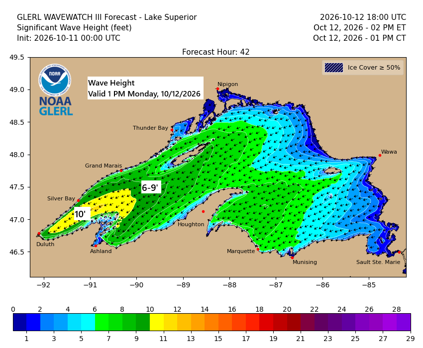
💨🌊🌧️Lake Superior Kicks Up: 45 MPH Gusts and 10-Foot Waves Possible
…Gales on western Lake Superior Monday… East to northeast winds will pick up over western Lake Superior on Monday, with gusts hitting 25 to 45 mph. Waves are expected to build to 5 to 10 feet, with the biggest swells likely from late morning through mid-evening. In Duluth, northeast winds…
-
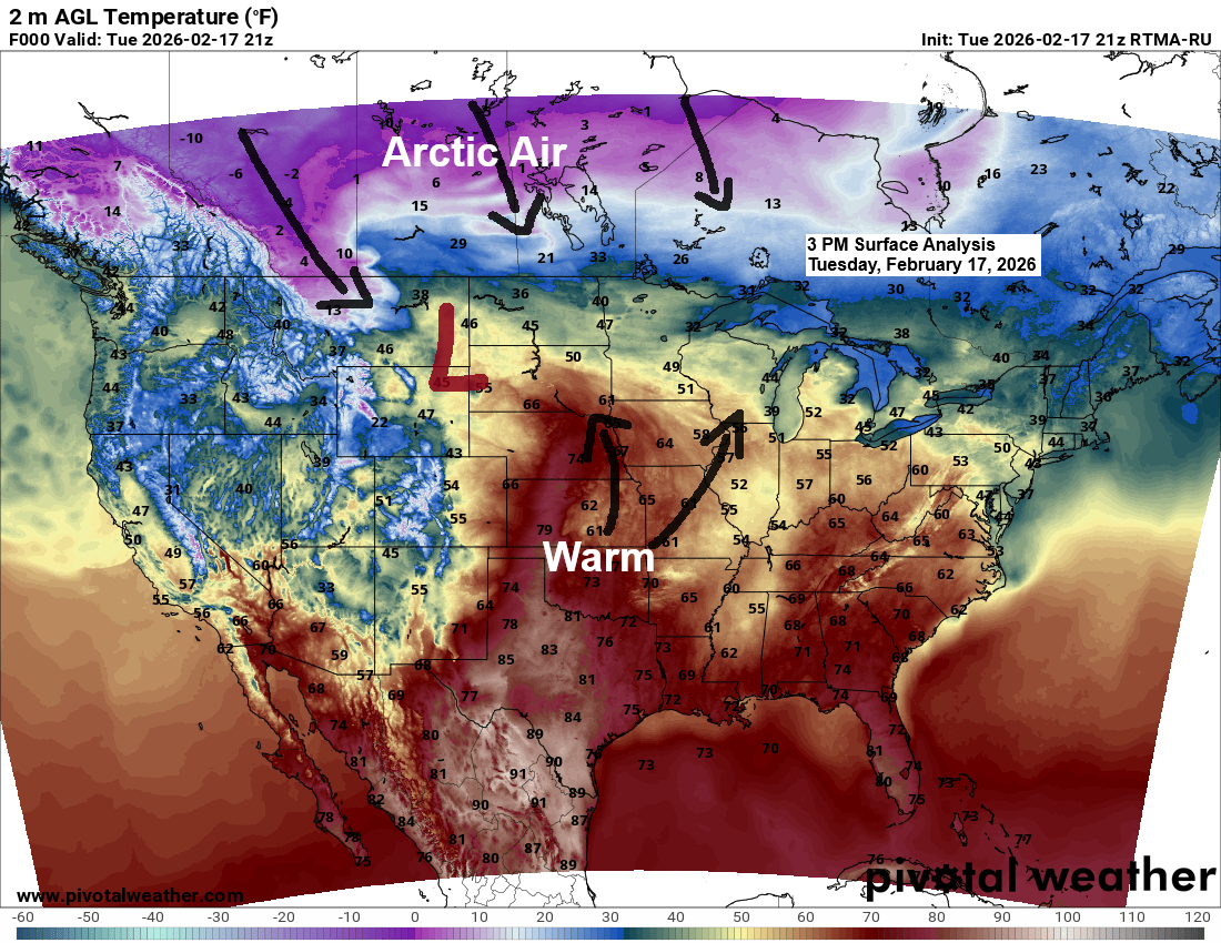
Winter Storm Update – 6:00 PM, Tuesday, February 17, 2026
A major winter storm is set to roll through the Northland from tonight into Thursday morning, with the worst conditions expected along the North Shore of Lake Superior in northeastern Minnesota. I had to use the lime green color on my updated snowfall forecast, and I’m not sure I’ve ever…
-
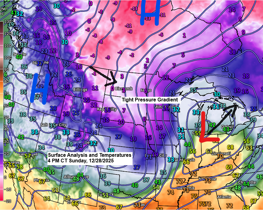
5 p.m. Weather Update – December 28, 2025
Today’s storm has unfolded pretty much as expected, with a noticeable sharp cutoff to the northern edge of the snow this afternoon. So far today, Cloverdale, Minnesota, just east of Hinckley, has seen 4 inches of snow, while Brainerd, Minnesota, has received 3 inches, and 3 inches of snow has…
-
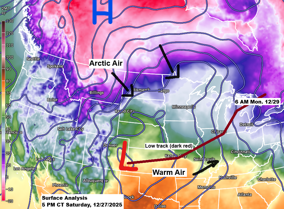
Weather update and snowfall forecast — 6 PM, Saturday, December 27, 2025.
Here’s my updated snowfall forecast as of late Saturday afternoon. I’m leaning more on the UK, ICON, and Canadian models for my forecast, which results in lower snowfall totals for northern Minnesota, including the North Shore and Duluth-Superior areas. I think those models are handling the setup the best on…
-
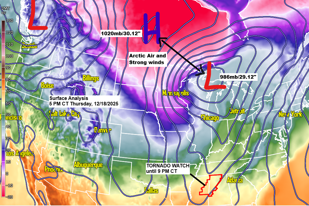
Strong winds and subzero temperatures tonight with lingering snow, followed by more bursts of arctic air and gusty winds over the weekend.
Early this evening, a strong low-pressure system pushed into the eastern side of Lake Superior as high pressure moved in from the northwest. The steep pressure difference between them is kicking up strong northwest winds across the Northland, boosted by a rush of cold air. By 5 PM, 850mb temperatures…
-
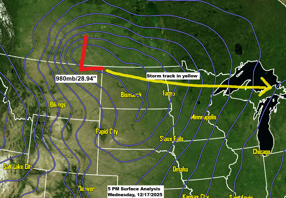
A powerful clipper is set to bring a variety of weather conditions to the Northland in the next 24 hours.
A strong low-pressure system over southern Saskatchewan this afternoon will move east-southeast, passing over far northern Minnesota Thursday morning before reaching eastern Lake Superior by around 6 PM Thursday. Over the next 24 to 36 hours, this system will bring snow, rain, wind, and a burst of arctic air to…