Category: tornado watch
-
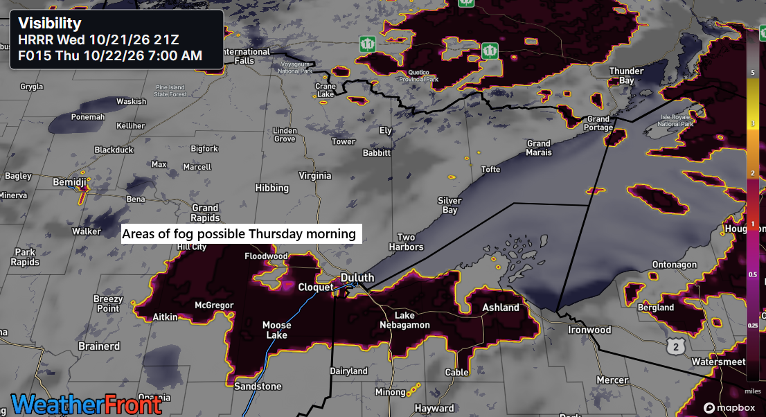
🌫️🌡️Fog Tonight, Cool Shores Tomorrow, Mild Inland Through Saturday
It looks like some fog may develop in parts of northeast Minnesota and northwest Wisconsin later tonight, lingering into Thursday morning. This should clear by Thursday afternoon, though some clouds might stick around, especially near Lake Superior. This afternoon in the Northland, temperatures ranged from the mid-60s to the low…
-
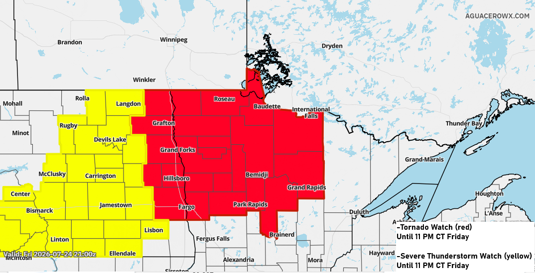
Strong to Severe Storms Tonight in Northern MN; Local 1–2″+ Rainfall Possible
Strong to severe thunderstorms are expected tonight across parts of northwest and north-central Minnesota, extending into areas of North Dakota. Northwest and north central Minnesota could get hit with massive hail, possibly up to the size of baseballs, along with damaging winds reaching 60–80 mph. A few tornadoes might also…
-
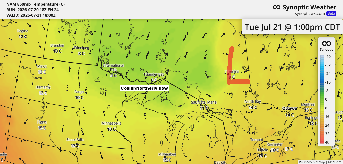
Duluth’s 12‑Day Run of 80° Highs Ends Tuesday as Cooler Air Moves In
After a stretch of very warm to hot weather in the Northland, a wave of cooler air is on its way for Tuesday and Wednesday. On Tuesday, 850mb temperatures are expected to drop to around +5 to +10°C in our area, the lowest in several weeks. This should mean daytime…
-

Thursday Rebound: Partial Sun, 60s, and Northwest Breezes
After a wet and chilly Wednesday, the Northland’s weather will improve a bit on Thursday, with some partial sunshine breaking through during the day. Temperatures will climb into the 60s—still below normal for mid-June, but warmer than Wednesday. Winds will shift to the northwest, with gusts between 15 and 25…
-
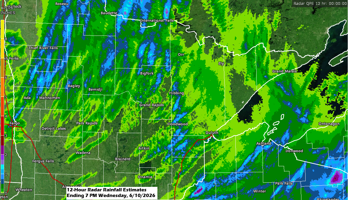
Thunderstorms will wrap up by late this evening, but showers might make a comeback on Thursday.
A round of showers and thunderstorms moved northeast through the Northland early this morning, and scattered storms have redeveloped as expected this afternoon. Fortunately, we haven’t seen much in the way of severe weather with this system today, and it looks like that will remain the case before it moves…
-
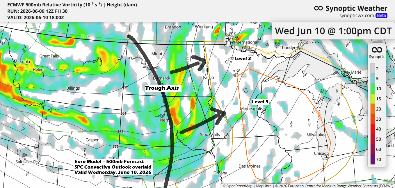
Strong Storms Possible in the Northland late Tonight and Wednesday
One of the most favorable setups for strong and severe thunderstorms in the Northland this spring is expected to arrive on Wednesday. A strong mid- and upper-level trough will quickly move northeast out of the northern Plains, with strong divergence and southwest winds aloft creating plenty of lift in the…
-
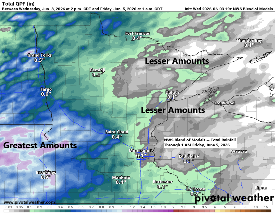
Northland Weather: Rain Chances and Temperature Trends
Two cold fronts will sweep across the Northland by Friday. The first arrives Thursday, moving slowly as it pushes east from western Minnesota in the morning and exits to the east by Friday morning. Hot on its heels, a second cold front will pass through the area later on Friday.…