Category: flash flood risk
-
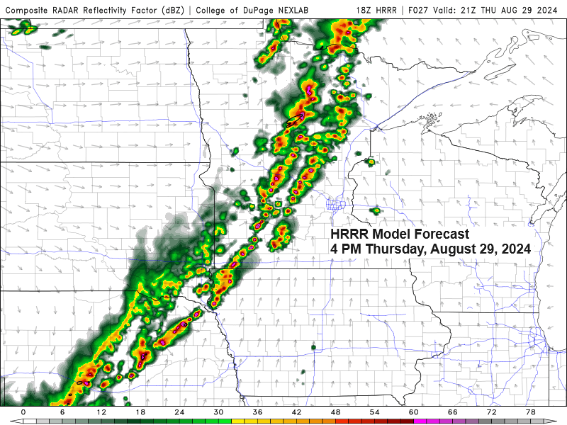
Northeast Minnesota and Northwest Wisconsin Weather Forecast: Rain and Thunderstorms Expected on Thursday
5:20 PM Wednesday, August 28, 2024 Rain is expected to return to northeast Minnesota and northwest Wisconsin on Thursday due to a strong cold front and an upper-level trough moving eastward from the northern Plains.
-
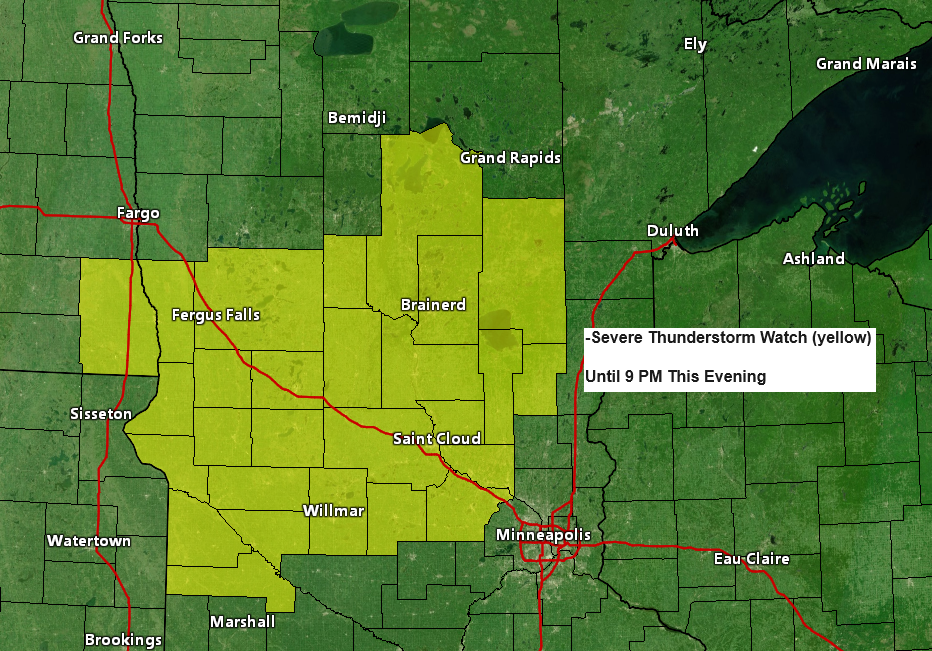
Severe Thunderstorm Watch in Central Minnesota and Southeast North Dakota Until 9 PM
3:21 PM Monday, August 26, 2024 Some cities in the Northland that are included in this severe thunderstorm watch are Walker, Longville, Remer, Backus, Pine River, Leader, Brainerd, Crosby, Nisswa, Garrison, Hill City, McGregor, Aitkin, Malmo and McGrath.
-

High Precipitable Water Values and Severe Thunderstorm Potential
12:20 PM Monday, August 26, 2024 Sunday proved to be fruitful as I gained three new paid subscribers to my blog, increasing the total to six. I hope to see this number grow further. My gratitude goes out to those who have subscribed so far. Considering the strength of the…
-
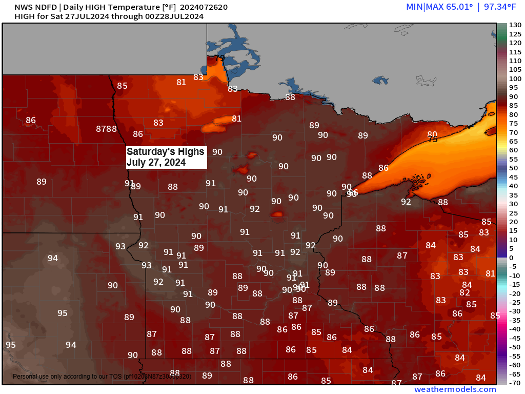
Warm and Humid Weekend Forecast for Northeast Minnesota and Northwest Wisconsin
4:41 PM Friday, July 26, 2024 Northeast Minnesota and northwest Wisconsin are expected to experience a very warm and humid weekend, with temperatures ranging from the 80s to the lower 90s. The highest temperatures are anticipated on Saturday. Late tonight and on Saturday, northern Minnesota is forecasted to experience scattered…
-
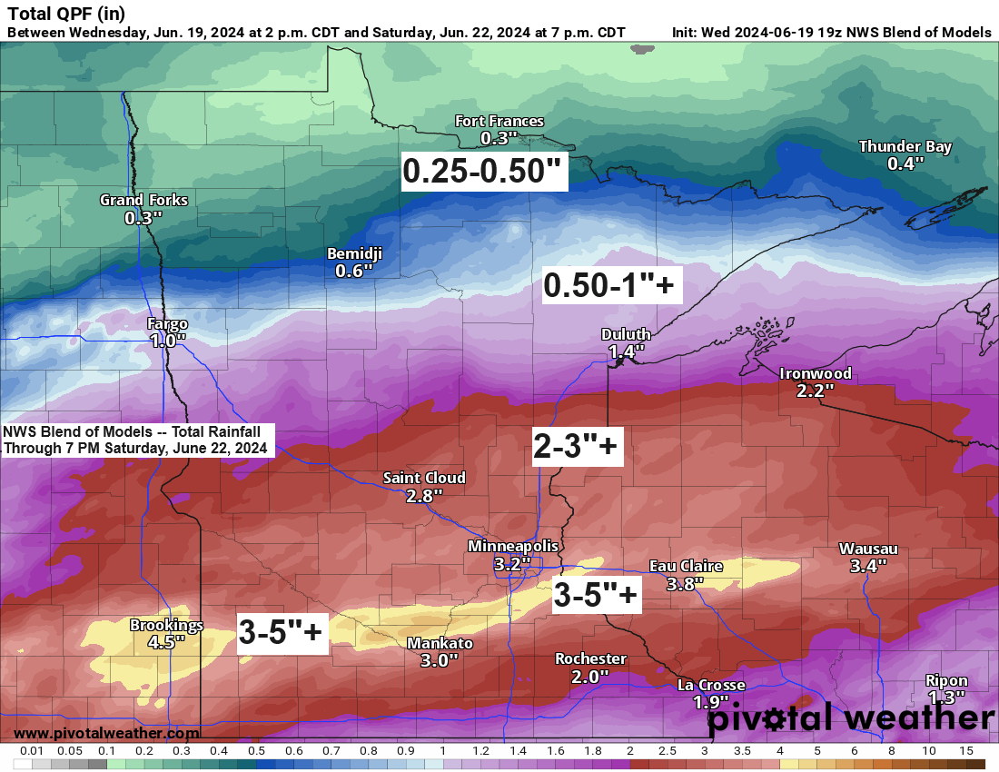
Active pattern continues at times
6:34 PM Wednesday, June 19, 2024 The unfortunate news is that more rain is expected at times in northeast Minnesota and northwest Wisconsin from Friday into this weekend. However, it appears that the heaviest rainfall will occur a bit further south than the areas affected by Tuesday’s system. The current…
-
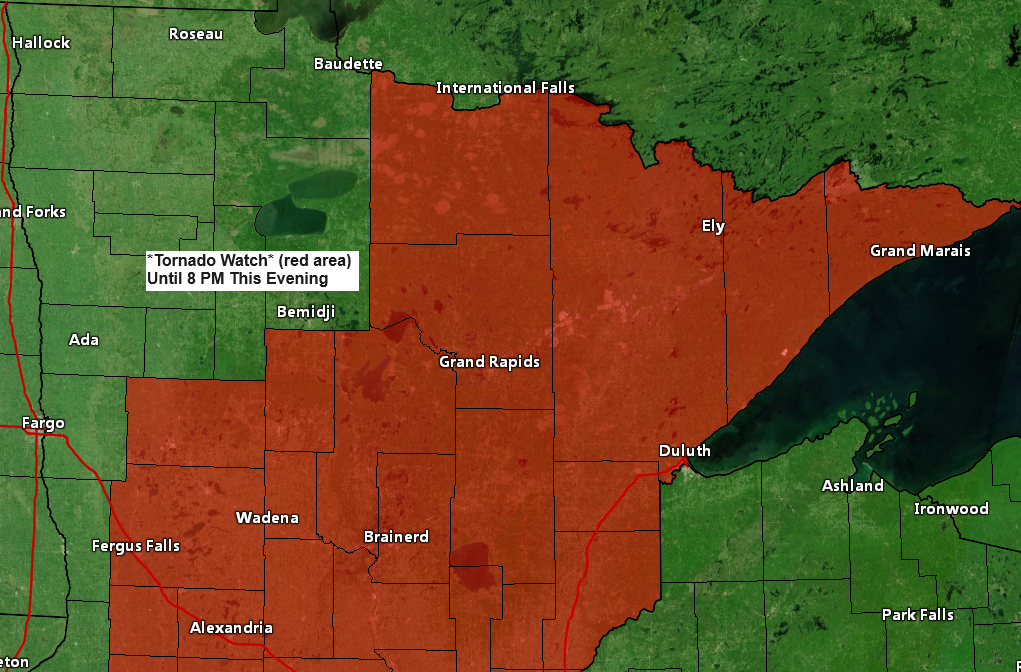
Tornado Watch issued for all of northeast MN
1:56 PM Tuesday, June 18, 2024 The Storm Prediction Center in Norman, Oklahoma, has issued a tornado watch effective until 8 PM tonight. This watch encompasses parts of Minnesota, including International Falls, Hibbing, Grand Rapids, Walker, Brainerd, Aitkin, Pine City, Hinckley, Moose Lake, Cloquet, Duluth, Two Harbors, Isabella, Silver Bay,…
-
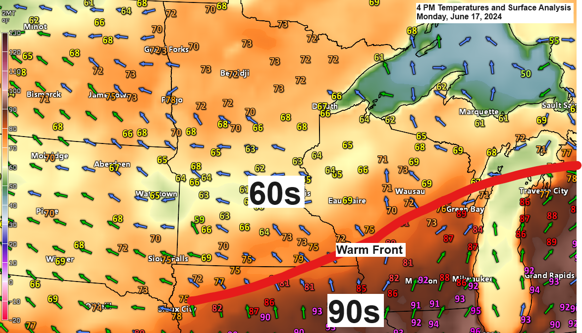
Scattered showers/t-storms tonight and Tuesday; More rain chances ahead late week/weekend
6:26 PM Monday, June 17, 2024 There has been minimal northward movement of the warm front today; it remained near the Iowa-Minnesota border late this afternoon. The warm front is expected to start moving northward tonight and is forecasted to reach northern Minnesota by daybreak on Tuesday, before continuing north…