Category: heat dome
-
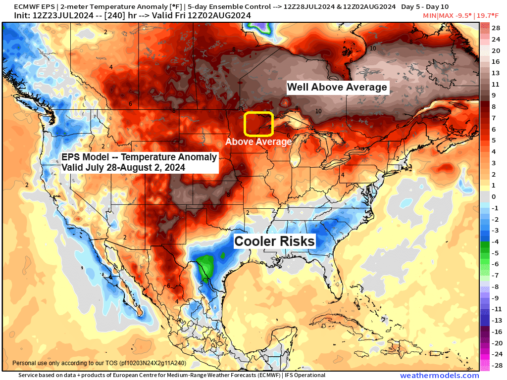
A warming trend is expected later this week, accompanied by rising humidity levels.
6:36 PM Tuesday, July 23, 2024 A warming trend is approaching. Wednesday will be cooler than average, yet temperatures will be slightly warmer than those experienced on Tuesday, with highs around 70 near Lake Superior and into the 70s throughout the rest of the Northland. High temperatures in the 80s…
-
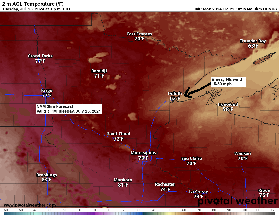
Expect breezy and cooler conditions in the coming days, followed by a warming trend later in the week.
5:23 PM Monday, July 22, 2024 Today, showers and thunderstorms have been prevalent across much of northwest Wisconsin and parts of northeast Minnesota. These storms have produced heavy rainfall, resulting in minor flooding in areas with low-lying terrain and poor drainage in northwest Wisconsin. Today’s storms have been developing south…
-

Rain possible Saturday with a few showers Sunday; Gusty NE winds near Lake Superior Saturday
6:28 PM Friday, June 21, 2024 There are some notable differences in the weather models for the Northland on Saturday. The weather setup involves a nearly stationary frontal boundary along the Minnesota-Iowa border extending into south-central Wisconsin. This front is not expected to move much farther north through Saturday afternoon.…
-
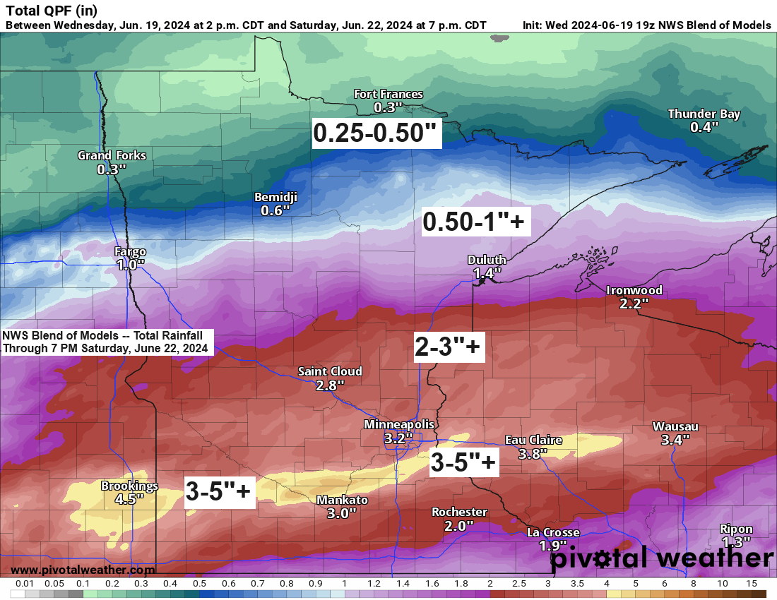
Active pattern continues at times
6:34 PM Wednesday, June 19, 2024 The unfortunate news is that more rain is expected at times in northeast Minnesota and northwest Wisconsin from Friday into this weekend. However, it appears that the heaviest rainfall will occur a bit further south than the areas affected by Tuesday’s system. The current…
-

Active pattern with waves of rain/t-storms through Tuesday; Turning warmer and more humid Sunday
6:46 PM Saturday, June 15, 2024 Rain is expected tonight in northwest Wisconsin and east central to northeast Minnesota. The rainfall is anticipated to taper off late tonight or by early to mid-morning on Sunday. The weather on Sunday afternoon and evening hinges on the strength of the forcing associated…
-

Active pattern this weekend into next week; Additional Storm Reports from Wednesday
5:52 PM Thursday, June 13, 2024 Rain chances are expected to return periodically this weekend and continue into much of next week. The first opportunity for rain is forecasted for Saturday afternoon, continuing into Sunday morning. This rainfall is expected to be associated with a disturbance moving northeast from the…
-
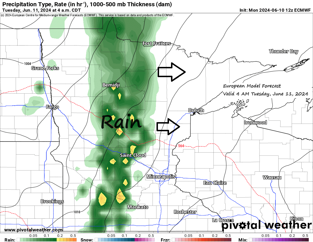
Some rain on the way Tuesday morning; A risk for strong to severe t-storms Wednesday; Active pattern at times this weekend into next week
5:04 PM Monday, June 10, 2024 The upcoming weeks appear to be quite dynamic over the upper Midwest, with numerous opportunities for showers and thunderstorms. Some storms may intensify to strong or severe levels, particularly on Wednesday, and then again later this weekend into the following week. The risk of…