5:23 PM Monday, July 22, 2024
Today, showers and thunderstorms have been prevalent across much of northwest Wisconsin and parts of northeast Minnesota. These storms have produced heavy rainfall, resulting in minor flooding in areas with low-lying terrain and poor drainage in northwest Wisconsin.
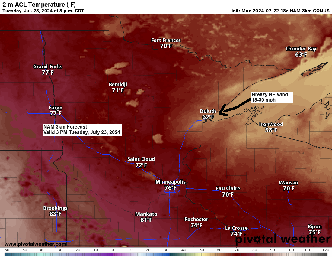
Today’s storms have been developing south of a cold front that lingered over northern Minnesota this afternoon. This front is expected to move south of the Northland by early Tuesday morning, leaving behind a cooler and less humid air mass with rising northeast winds near Lake Superior.
The current cool weather pattern is expected to persist until Wednesday, after which a warming trend could bring several days of high temperatures in the 80s. This warmup is likely to start later in the week and continue into the following week. There’s also a possibility that some areas in the Northland may experience temperatures close to 90 degrees at some point during this weekend or next week. Additionally, humidity levels are set to increase, particularly by this weekend, with dew points returning to the 60s.
Showers and thunderstorms are expected to gradually subside in northwest Wisconsin tonight, while a few isolated showers or thunderstorms may persist in northeast and east-central Minnesota until early evening.
Note: The upcoming days are expected to be predominantly dry throughout the Northland area.
Radar loop ends 5:02 PM Monday, July 22, 2024.
Goes-16 sandwich satellite loop from Monday, July 22, 2024, loop time ends 3:51 PM CT.

Make a one-time donation
Make a monthly donation
Make a yearly donation
Choose an amount
Or enter a custom amount
Your contribution is appreciated.
Your contribution is appreciated.
Your contribution is appreciated.
cash app, $timo590
Today, the upper Midwest remains under a north-northwest flow, situated between an upper trough to the east and an upper ridge to the west.

The western U.S. is experiencing intense heat under a ridge extending into the northern Rockies, with temperatures surpassing 90 degrees reaching as far north as Montana and Alberta today.

The heat is expected to spread into the northern Plains by mid to late week, with temperatures likely reaching the 90s and possibly up to 100 degrees in parts of the Dakotas from Wednesday through this weekend.

Thanks for reading!
Tim
Leave a Reply