5:04 PM Monday, June 10, 2024
The upcoming weeks appear to be quite dynamic over the upper Midwest, with numerous opportunities for showers and thunderstorms. Some storms may intensify to strong or severe levels, particularly on Wednesday, and then again later this weekend into the following week. The risk of severe thunderstorms could reach as far north as the Northland, with the initial possibility occurring on Wednesday.
The forthcoming weather pattern may lead to periods of intense or excessive rainfall, potentially triggering flood risks in the upper Midwest. This is due to storm clusters forming on the northwest side of an upper-level ridge, commonly known as a heat dome. These clusters are expected to move over the ridge next week. Consequently, regions experiencing several storm clusters could face an elevated flood risk during that time.

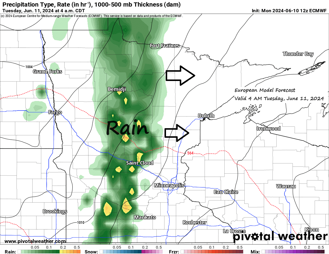
The onset of this active weather pattern is expected Tuesday morning, with an area of rain moving eastward across the Northland. The rain is anticipated to be brief, lasting only a few hours, and should give way to drier conditions by Tuesday afternoon and evening. However, there is a possibility of showers and thunderstorms re-emerging in some areas later on Tuesday as a cold front moves east across the area. However, for thunderstorms to develop, the skies must clear sufficiently early to permit the build-up of instability, the warming of temperatures, and the rise of dew points to levels conducive to storm formation. Currently, the likelihood of all these factors aligning is quite low.
The weather system set to cross the Northland on Tuesday is presently over the northern Plains, delivering rain to the Dakotas and causing severe thunderstorms (indicated by yellow outlines on the radar loop) in parts of South Dakota late this afternoon.
Radar loop from Monday, June 10, 2024, loop time ends 5:40 PM CT.
Note: Rain is expected in Duluth on Tuesday, particularly between 6 AM and 11 AM. There’s also a slight chance of showers and thunderstorms reappearing later in the afternoon.
HRRR model simulated radar forecast valid from 1 AM Tonight to 7 PM Tuesday.

Rainfall predictions for Tuesday’s system suggest modest totals, with expected amounts typically varying from about 0.05 inches to a quarter of an inch across the Northland.

Isolated to scattered strong and severe thunderstorms may occur in the Northland from Wednesday into Wednesday evening, with the highest likelihood in the yellow-marked area on the map.
The main severe weather threats for Wednesday are large hail, possibly exceeding the size of a golf ball (1.75-inch diameter), and damaging winds up to 60 mph.
Note: The risk of golf ball-sized or larger hail is greatest in the yellow -marked area on the map for Wednesday through Wednesday evening.

The rainfall forecast for the next two weeks is significant, with an expected 2 to 3 inches or more across a large portion of the upper Midwest.


Today’s weather is characterized by multiple troughs and upper-level lows, accompanied by a few highs and upper-level ridges. At this time of year, the weather pattern is particularly active.

Goes-16 water vapor loop from Monday, June 10, 2024, loop time ends 5:20 PM CT.

It was a brisk mid-June morning in the Northland.
While no new record lows were established today, both Hibbing and International Falls came close, within one or two degrees of their record low temperatures for June 10th.
Low temperature reports from Monday morning, June 10, 2024
2 S Brimson, MN: 29
2 E Celina, MN: 29
2 S Tower, MN: 31
Hibbing, MN: 32
Bigfork, MN: 32
Orr, MN: 32
Embarrass, MN: 33
International Falls, MN: 33
Floodwood, MN: 33
Hayward, WI: 34
Cook, MN: 34
Crane Lake, MN: 34
Eveleth, MN: 34
Ely, MN: 34
Walker, MN: 36
Superior Airport: 36
Cass Lake, MN: 36
Ashland, WI: 37
Hurley, WI: 37
Grand Marais Airport: 37
Grand Rapids, MN: 37
Siren, WI: 37
Cotton, MN: 38
*Record Lows for June 10th*
Ashland: 28 set in 1972
Hibbing: 30 set in 1972
International Falls: 32 set in 1908 and 1958
Thanks for reading!
Tim
Leave a Reply