5:44 PM Saturday, June 8, 2024
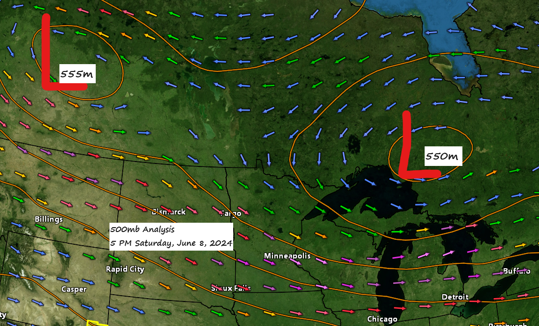
Today, the Northland continued to experience a northwest flow aloft, accompanied by two upper-level lows situated to our north.
Intermittent showers will continue into the evening, but drier conditions are expected overnight and into Sunday, likely extending through Monday. This will bring a welcome respite from the wet weather over the next few days.
The likelihood of rain returns on Tuesday, with another bout of rainfall possible sometime between Wednesday afternoon to early Thursday morning.
Rainfall reports from Friday evening-Saturday, June 7-8, 2024
Source: MesoWest
Saginaw, MN: 0.18″
Hill City, MN: 0.13″
Hermantown, MN: 0.12″
Duluth Airport: 0.10″
Walker, MN: 0.07″
Esko, MN: 0.06″
Poplar, WI: 0.05″
Grand Rapids, MN: 0.05″
Glidden, WI: 0.04″
Washburn, WI: 0.04″
Odanah, WI: 0.03″
Cass Lake, MN: 0.03″
Clam Lake, WI: 0.03″
Hayward, WI: 0.02″
French River, MN: 0.02″
Nashwauk, MN: 0.02″
Winter, WI: 0.02″
Spooner, WI: 0.01″
McGregor, MN: 0.01″
Minong, WI: 0.01″
Ashland, WI: 0.01″
Hibbing, MN: 0.01″
Keewatin, MN: 0.01″
Deer River, MN: 0.01″
Today, the area experienced colder temperatures aloft (500mb temperatures between -20 to -23C) coupled with increasing mid-level lapse rates of approximately 7 C/km. This scenario prompted the emergence of sporadic afternoon showers and occasional thunderstorms across the Northland. The primary hazards from these showers have been transient gusty winds, reaching speeds of 25 to 35 mph, and short-lived heavy downpours.
Radar loop ends 5:20 PM Saturday, June 8, 2024.
Today’s high temperatures in our area were quite comparable to those on Friday, predominantly ranging in the lower to mid-70s.
The weather is expected to cool down on Sunday, with high temperatures primarily in the 60s.
Note: The potential for patchy frost early Monday morning persists in parts of the Northland, primarily in areas well inland from Lake Superior.

The heat persists today across the southern United States, while cooler, more seasonal temperatures prevail further north.
Note: Current computer models show no significant indications of prolonged periods of high heat and humidity affecting the Northland through at least next weekend.

Thanks for reading!
Tim
Leave a Reply