5:56 PM Friday, June 7, 2024
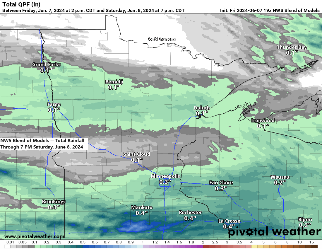
A system moving southeast from North Dakota is expected to bring scattered rain showers to parts of the Northland tonight into early Saturday morning, though it is not anticipated to be a widespread or substantial rain event.
The far northern region of Minnesota, close to the Ontario border, is expected to remain dry tonight.
The warmest day of the weekend is expected to be Saturday, with high temperatures ranging from the low to mid-70s, similar to Friday’s highs. However, a drop in temperatures is forecasted for Sunday, with highs in the 60s up to around 70.
We could see some patchy frost in parts of the Northland (inland from Lake Superior) early Monday morning.
The upcoming week’s forecast includes chances of rain for next Tuesday and again on Thursday.
Radar loop ends 5:48 PM Friday, June 7, 2024.
Note: Showers may occur in Duluth early Saturday morning, approximately between 1 AM and 7 AM.
HRRR model simulated radar forecast through 10 AM Saturday.

Moving into Saturday afternoon, some instability is expected to develop over the Northland, with colder temperatures aloft and milder temperatures near the surface, accompanied by steeper mid-level lapse rates. This could lead to isolated showers and thunderstorms in the afternoon and evening, although the precipitation will be hit-or-miss.
HRRR model simulated radar forecast valid 1 PM to 10 PM Saturday.

The Northland experienced a significant temperature increase today, with afternoon readings approximately 10 to 15 degrees higher than those of Thursday afternoon.

Today’s high temperatures ranged from the low to mid-70s, aligning closely with the typical averages for the 7th of June.

The upper Midwest remains under a northwest flow aloft as the region is positioned beneath a dual upper-level low pressure system with lower 500mb heights to the north.
A robust upper-level ridge with higher 500mb heights, known as a heat dome, persisted over the southern and southwestern US today. This heat dome is expected to remain relatively stationary in the coming days. However, computer models are beginning to indicate a potential expansion of this heat dome further north and east. The extent of this northward shift and its precise timing remain uncertain at present.

Beneath the heat dome, 850mb temperatures are reaching as high as +35C today, whereas in areas near or under the upper low, 850mb temperatures range from -3 to +2C.

A look at temperatures from late Friday afternoon.

Thanks for reading!
Tim
Leave a Reply