Category: Frost Potential
-
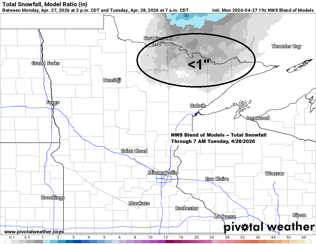
Rain Fades Tonight; Frosty Nights on the Way
Much of the Northland has seen a rainy Monday, thanks to a strong low-pressure system lingering over far southeast Minnesota late this afternoon. The system will move northeast, eventually passing north of Lake Superior by Tuesday. Widespread rain will persist in the Northland northwest of the low tonight, but it’s…
-
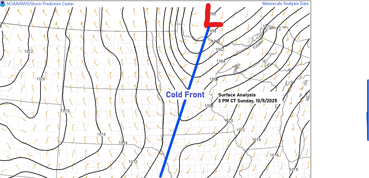
Cold Front Moves Across Northland: Weather Update
A cold front is moving across the Northland from west to east this afternoon and will pass through by this evening. Cold air advection is spreading east into the Northland this afternoon behind this cold front, with 850mb temperatures down to +1°C in northwest Minnesota, while the warmest air, which…
-

Forecast: Heavy Rain and Thunderstorms Possible Late Monday-early Tuesday
Before Monday arrives, we have one more cool night ahead, with patchy frost possible in parts of northeast Minnesota and northwest Wisconsin, especially inland from Lake Superior. Tonight’s lows will be in the 30s and 40s, but record-breaking cold is not expected, unlike the past few nights. Showers and thunderstorms…
-
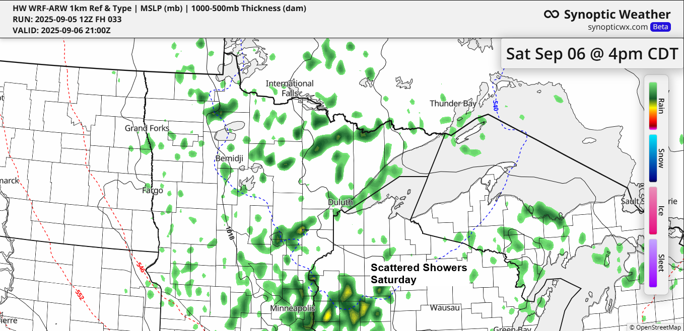
Cool Weekend Weather Forecast for the Northland
A cool pattern persists through the weekend, with a strong trough and upper low settled over Ontario and the Great Lakes, maintaining a northwest flow aloft across the Northland. A few showers are expected to continue this evening and will return on Saturday, but widespread, persistent rain like what occurred…
-
Upcoming Weather: Showers and Cooler Temperatures in Northeast Minnesota and Northwest Wisconsin
A strong cold front is set to move southeast across the Northland on Tuesday, bringing scattered showers and a few thunderstorms to northeast Minnesota and northwest Wisconsin. While severe thunderstorms aren’t expected, some storms may bring heavy downpours, wind gusts up to 40 mph, and small hail less than 1…
-

Northland Weather Update: Cooler Temps and Possible Frost Ahead
A cold front will keep moving south across the Northland tonight. While it has just enough lift to bring scattered showers, a widespread rain event is unlikely. In fact, some of us probably won’t see any rain at all. Radar loop ends 5:48 PM Wednesday, August 27, 2025. Behind this…
-
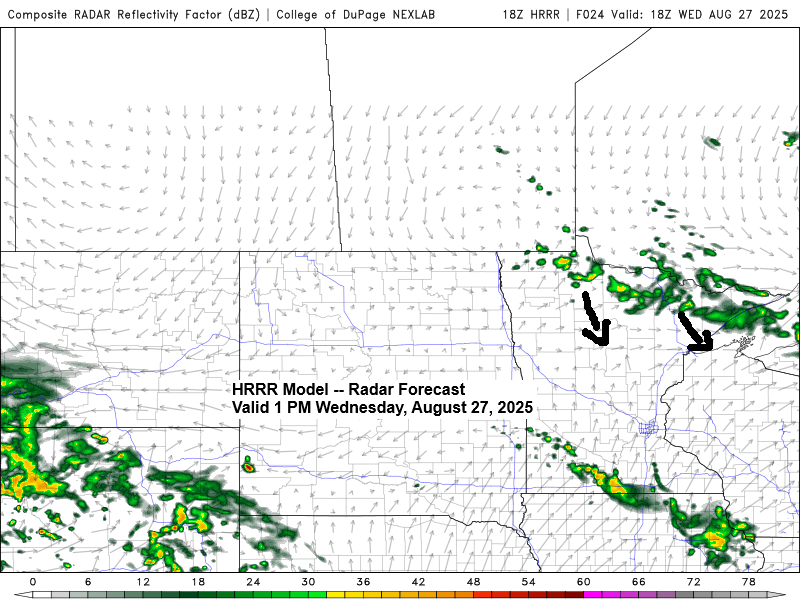
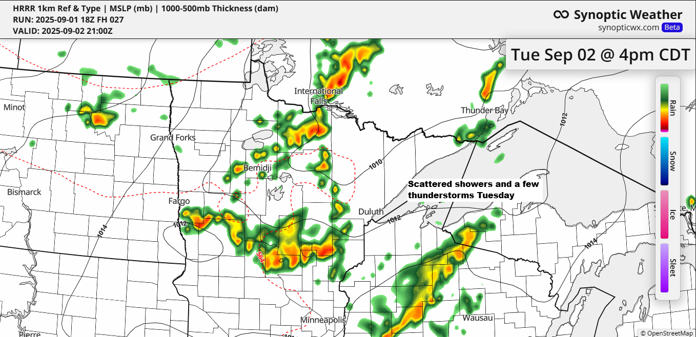
Weather Forecast: Scattered Showers and a few Thunderstorms on Wednesday
Scattered showers and a few thunderstorms are expected in northeast Minnesota and northwest Wisconsin on Wednesday, continuing into the evening as a cold front moves south from Ontario. Widespread rain is unlikely with this upcoming front, but scattered showers are expected, with some areas experiencing brief heavier downpours. According to…