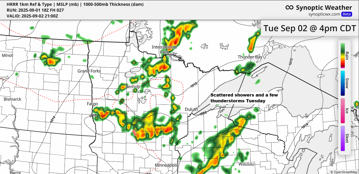
A strong cold front is set to move southeast across the Northland on Tuesday, bringing scattered showers and a few thunderstorms to northeast Minnesota and northwest Wisconsin. While severe thunderstorms aren’t expected, some storms may bring heavy downpours, wind gusts up to 40 mph, and small hail less than 1 inch in diameter.
Up to 0.25 inches of rain is expected across much of the Northland by early Wednesday morning, with some areas potentially seeing higher totals of half an inch or more.
Note: There are additional chances for rain from mid to late week due to a strong upper low over the area and from a possible clipper system that may affect the Northland Thursday to early Friday.
The image below displays the forecasted precipitation totals up to 7 AM on Wednesday.

HRRR model’s simulated radar forecast valid from 7 AM Tuesday until midnight.

After a few days of milder temperatures in the Northland, temperatures will be turning much cooler from mid to late week as we tap into some of that cold air which is lurking well to our north today where temperatures are only in the 30s and 40s.
Daytime highs in northeast Minnesota and northwest Wisconsin are expected to range from the 40s to 50s Wednesday through at least Friday, with nighttime lows in the 30s and 40s. Whether frost develops later this week will depend on wind speeds and cloud cover.
Temperatures at the 850mb level will drop to around 0 to -2°C in northeast Minnesota and northwest Wisconsin from mid to late week, which is cold enough for snow. However, I don’t think surface temperatures will get low enough across most of the Northland for snow to develop. The only potential exception might be the tip of the Minnesota Arrowhead, inland from Lake Superior in the higher elevations, but even there, snow chances appear relatively low at the moment.

Leave a Reply