Category: Uncategorized
-
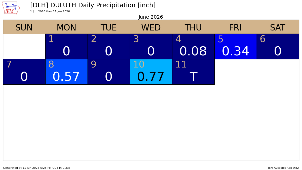
Rainfall Totals and Storm Reports for June 10, 2026
June has kicked off on a soggy note in Duluth, with three rainfall events adding up to over a quarter inch so far, and two of those topping half an inch. Following Wednesday’s thunderstorms in Duluth, here’s an update on the latest rainfall statistics. Month to dateTotal: 1.76″Departure: +0.33″ Year…
-
Stubborn Upper Low Keeps the Northland Locked in the Cold
The Northland will remain in a relatively dry pattern through the weekend, though a few brief snow or rain showers could pop up on Wednesday, and there’s a chance of some light showers early Saturday morning. No widespread or significant precipitation is expected in the area through Sunday. Note: On…
-

Flood Advisory: North Shore & Arrowhead, MN
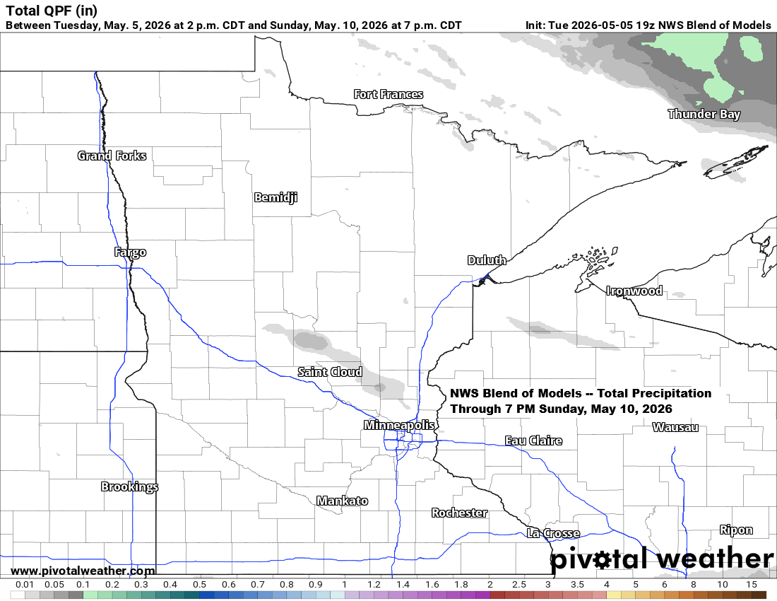
Flood Advisory has been issued for the North Shore and Arrowhead in northeast Minnesota until 6 PM Tuesday. Rainfall in the flood advisory area today has ranged from half an inch to over an inch, with another quarter to half inch or more expected by around midnight tonight.
-

Weekend weather for the Northland: Expect occasional rain with a few thunderstorms in the mix.
Dry weather will stick around in the Northland tonight and through most of Saturday, but the chance for occasional rain will increase later in the day and continue into Sunday night. This rain will be caused by a northward-lifting warm front, which is forecast to be over southern Kansas around…
-
Upcoming Active Weather Pattern in Upper Midwest
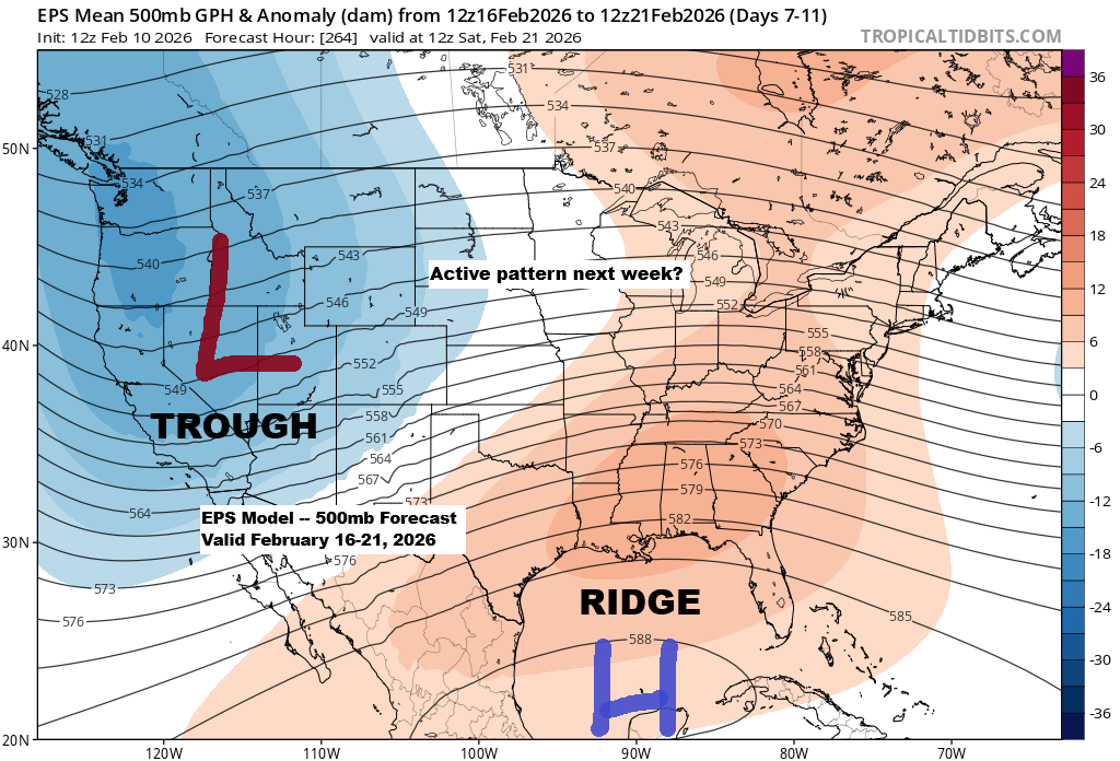
It looks like there’s potential for an active weather pattern to develop across the upper Midwest next week, especially from the middle to the end of the week based on current trends. A general pattern of troughing in the West and a ridge over the Southeast U.S. appears to be…
-

Northland Weather Update: Cooler Temps and Possible Frost Ahead
A cold front will keep moving south across the Northland tonight. While it has just enough lift to bring scattered showers, a widespread rain event is unlikely. In fact, some of us probably won’t see any rain at all. Radar loop ends 5:48 PM Wednesday, August 27, 2025. Behind this…
-

Northland Rainfall Reports: April 22, 2025
7:00 PM Tuesday, April 22, 2025 Scattered rain showers were observed in the Northland today, with some locations receiving between one-tenth and one-quarter of an inch of rainfall, while other locations recorded amounts of less than 0.05 inches. Rainfall Reports for April 22, 2025 Littlefork, MN: 0.22″Siren, WI: 0.19″International Falls,…