Much of the Northland has seen a rainy Monday, thanks to a strong low-pressure system lingering over far southeast Minnesota late this afternoon. The system will move northeast, eventually passing north of Lake Superior by Tuesday.
Widespread rain will persist in the Northland northwest of the low tonight, but it’s expected to taper off from southwest to northeast overnight.
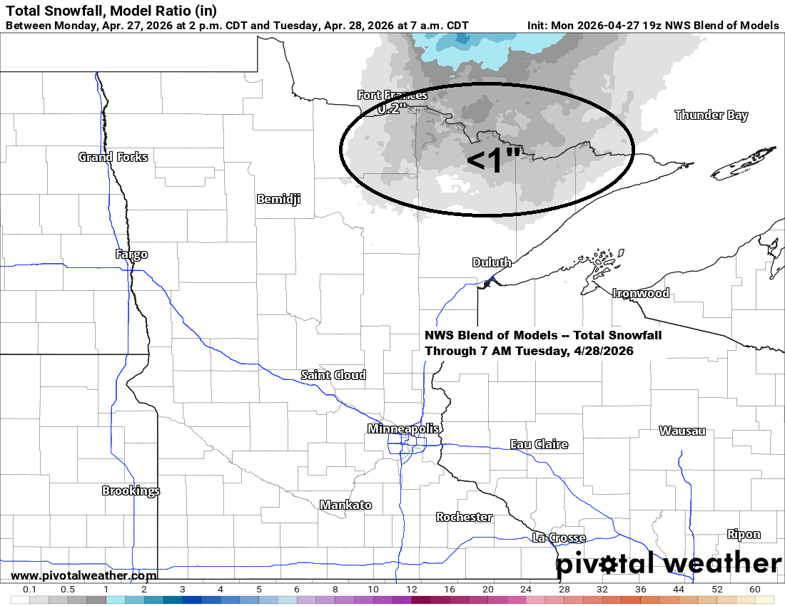
There’s a small chance that rain could mix with or briefly change to snow early Tuesday morning in far northern Minnesota near the Ontario border, in places like Ely, Cook, and Crane Lake. If snow does fall, it’s unlikely to last long and would likely result in slushy accumulations of less than an inch.
As the system shifts farther east tonight, northwest winds will pick up, increasing to 15 to 30 mph, with gusts over 40 mph likely through Tuesday morning.
So far today, 1.22 inches of rain have fallen in Duluth at the airport, and there’s a good chance we might set a new precipitation record for April 27th. The current record is 1.27 inches, set back in 1963.

As the upper trough moves over the Northland, stronger lift and heavier rainfall are developing in northeast Minnesota and northern Wisconsin near the 500mb and 700mb troughs.
The mid and upper-level trough will move east tonight, taking the stronger lift and heavier rain along with it.

Rain in Duluth will taper off late tonight, between midnight and 2 a.m. Tuesday looks much drier, though a few brief pop-up showers might show up in the mid to late afternoon.
HRRR model simulated radar forecast through 10 PM Tuesday.

In the warmer, more unstable part of today’s storm, there’s a risk of severe thunderstorms tonight across parts of the Midwest and the southern U.S., with several tornado and severe thunderstorm watches in place, including one PDS tornado watch.

Radar loop ends 5:32 PM CT Monday, April 27, 2026.
Red polygons: Tornado Warning
Yellow polygons: Severe Thunderstorm Warning
Green polygons: Flash Flood Warning
A look at today’s system wrapping up as it crosses the upper Midwest this evening.
Goes-19 infrared satellite loop ending 5:21 PM CT Monday, April 27, 2026.

…Looking Ahead…
Once tonight’s system moves out, the rest of the week should be much drier, though a few pop-up showers might form Tuesday and Wednesday afternoons, but they likely won’t bring much rain if they happen.
Afternoon temperatures will mostly be in the 40s and 50s through Friday, with plenty of chances for frost or freeze conditions through the end of the week as overnight and early morning temps drop into the 20s and low 30s.
This weekend could bring temperatures around 60 degrees to parts of the Northland.
Leave a Reply