Category: severe thunderstorm watch
-

🌦️🌬️Fast-Moving Cold Front Brings Wind, Limited Rain Chances Late This Week
On Thursday, a low-pressure system will head toward the central Plains, while a strong trough and cold front push southeast toward the upper Midwest. The northern trough will help keep the southern system and its widespread rain away from the Northland, though a few showers might pass through our area…
-
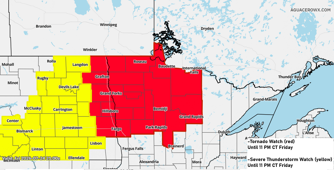
Strong to Severe Storms Tonight in Northern MN; Local 1–2″+ Rainfall Possible
Strong to severe thunderstorms are expected tonight across parts of northwest and north-central Minnesota, extending into areas of North Dakota. Northwest and north central Minnesota could get hit with massive hail, possibly up to the size of baseballs, along with damaging winds reaching 60–80 mph. A few tornadoes might also…
-
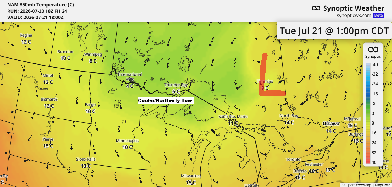
Duluth’s 12‑Day Run of 80° Highs Ends Tuesday as Cooler Air Moves In
After a stretch of very warm to hot weather in the Northland, a wave of cooler air is on its way for Tuesday and Wednesday. On Tuesday, 850mb temperatures are expected to drop to around +5 to +10°C in our area, the lowest in several weeks. This should mean daytime…
-

Northern Minnesota Severe Thunderstorm Watch, More Rain Possible Midweek
A severe thunderstorm watch is in effect until 9 PM tonight for northern Minnesota and eastern North Dakota. The main threats include scattered damaging wind gusts between 60 and 75 mph, large hail measuring 1 to 2 inches in diameter (about the size of a quarter to a hen’s egg),…
-

Severe Thunderstorm Watch for Central & Northern Minnesota Today
This morning, a small but intense supercell and bow echo raced northeast from southern South Dakota into west-central Minnesota. As a result, a severe thunderstorm watch is in effect downstream of the storm until 4 PM today, covering northern and central Minnesota (highlighted in yellow on the map). The main…
-

Thursday Rebound: Partial Sun, 60s, and Northwest Breezes
After a wet and chilly Wednesday, the Northland’s weather will improve a bit on Thursday, with some partial sunshine breaking through during the day. Temperatures will climb into the 60s—still below normal for mid-June, but warmer than Wednesday. Winds will shift to the northwest, with gusts between 15 and 25…
-
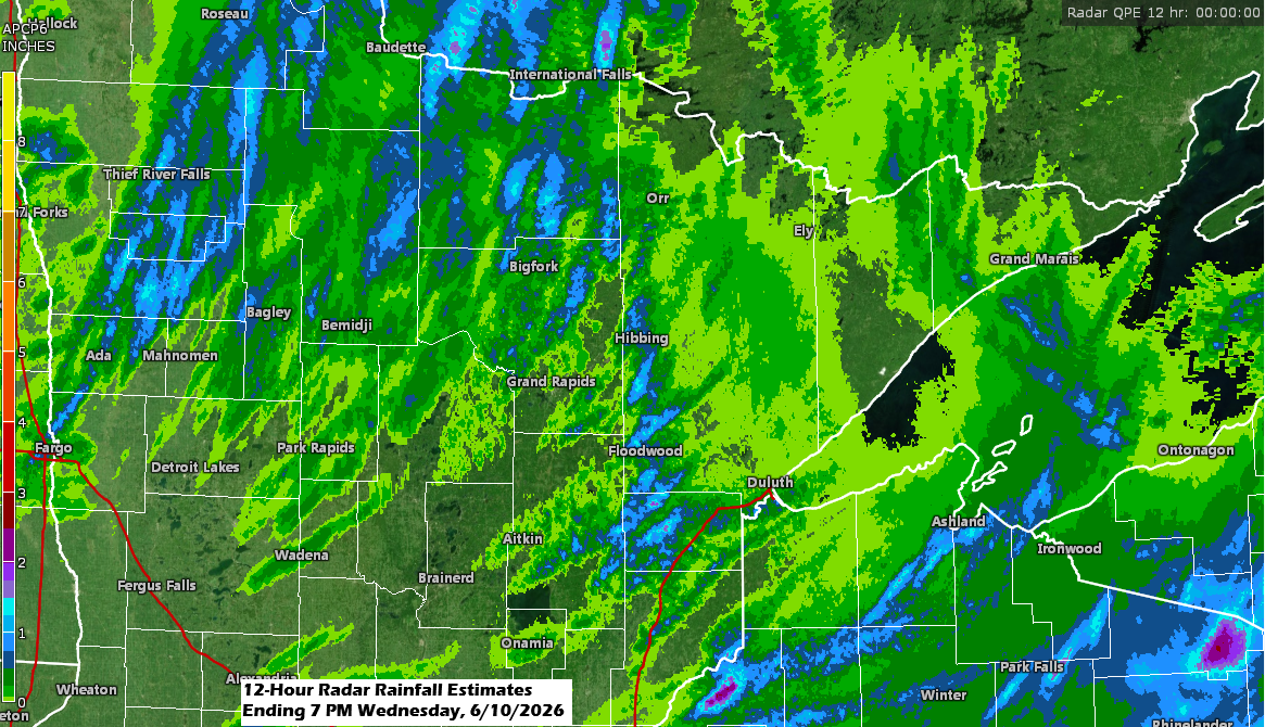
Thunderstorms will wrap up by late this evening, but showers might make a comeback on Thursday.
A round of showers and thunderstorms moved northeast through the Northland early this morning, and scattered storms have redeveloped as expected this afternoon. Fortunately, we haven’t seen much in the way of severe weather with this system today, and it looks like that will remain the case before it moves…