Category: 90 degree temps
-
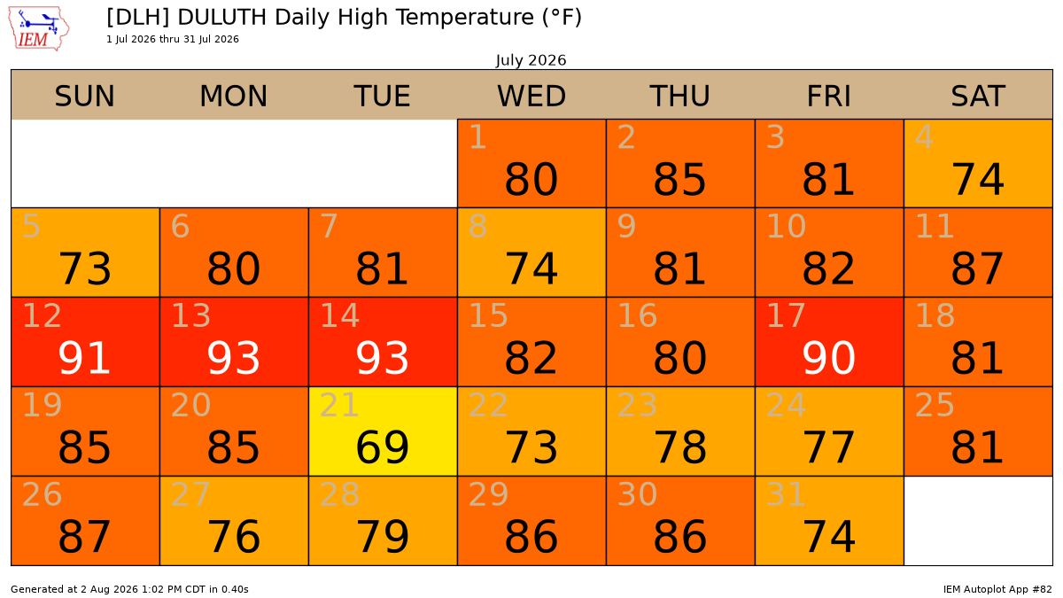
🏆 July 2026 ranks among the top three warmest Julys ever recorded in Duluth, MN.
July 2026 was definitely a warm month in Duluth, Minnesota, with plenty of days hitting the 80s and 90s. There were 21 days with temperatures hitting 80 degrees, well above the average of 11. The record is 25 days, set in 2012. There were 4 days with temperatures reaching 90…
-

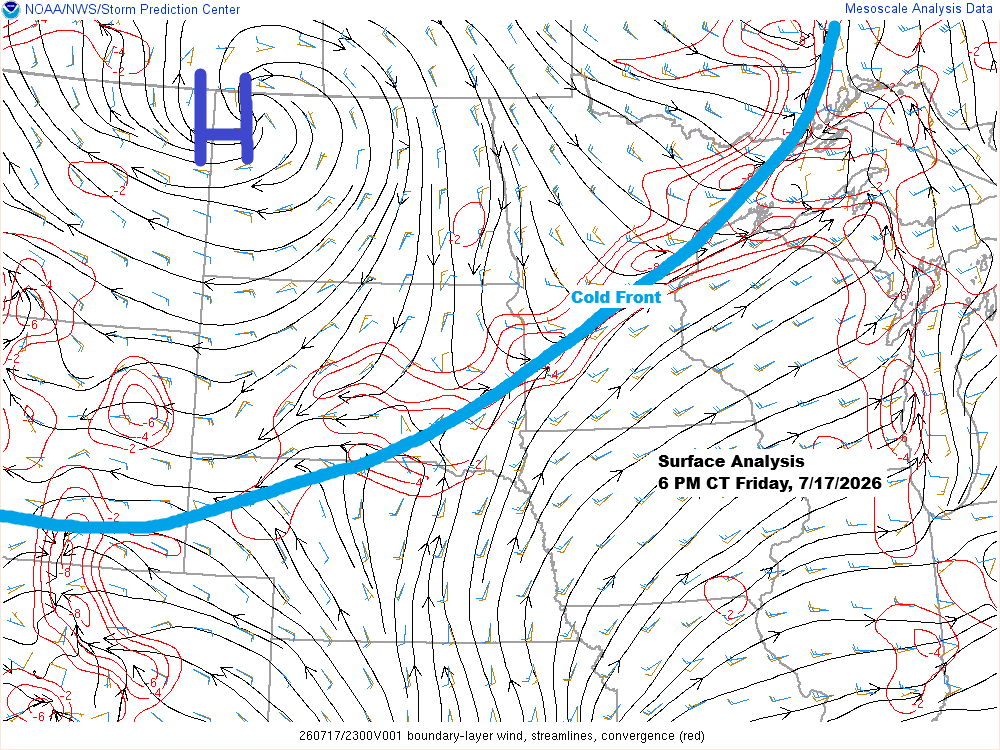
⛈️ Chaotic Rainfall Pattern as Cold Front Slides Through the Northland
A cold front will move slowly southeast from eastern North Dakota and northwest Minnesota between Thursday and Friday, while low pressure over the western High Plains shifts east-southeast, staying well south of the Northland. Rainfall patterns with this system seem pretty chaotic, with showers and thunderstorms likely along the cold…
-
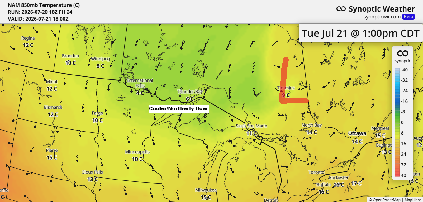
Duluth’s 12‑Day Run of 80° Highs Ends Tuesday as Cooler Air Moves In
After a stretch of very warm to hot weather in the Northland, a wave of cooler air is on its way for Tuesday and Wednesday. On Tuesday, 850mb temperatures are expected to drop to around +5 to +10°C in our area, the lowest in several weeks. This should mean daytime…
-
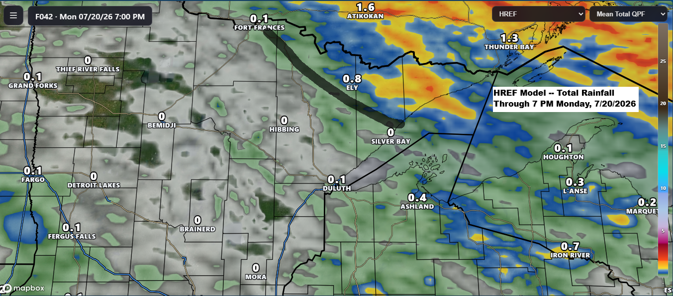
A warm Sunday is in store across the Northland before scattered showers arrive tonight and continue into Monday.
Scattered rain is on the way for the Northland as a strong low-pressure system moves east today from Saskatchewan and into Ontario by Monday. A warm front and cold front tied to this system will sweep through the Northland on Monday. Ahead of this system, south winds will draw moisture…
-
Warm, Mostly Dry Weekend Ahead, but Northland Smoke Forecast Remains Uncertain After Friday’s Rain
Expect mostly dry weather across northeast Minnesota and northwest Wisconsin this weekend, with highs in the 70s and 80s on Saturday and mainly in the 80s to near 90 on Sunday. Breezy northwest to north winds on Saturday will shift to the southwest by Sunday. There’s a lot of uncertainty…
-
Wildfire Smoke Engulfs Northland: Air Quality Alert Through Friday
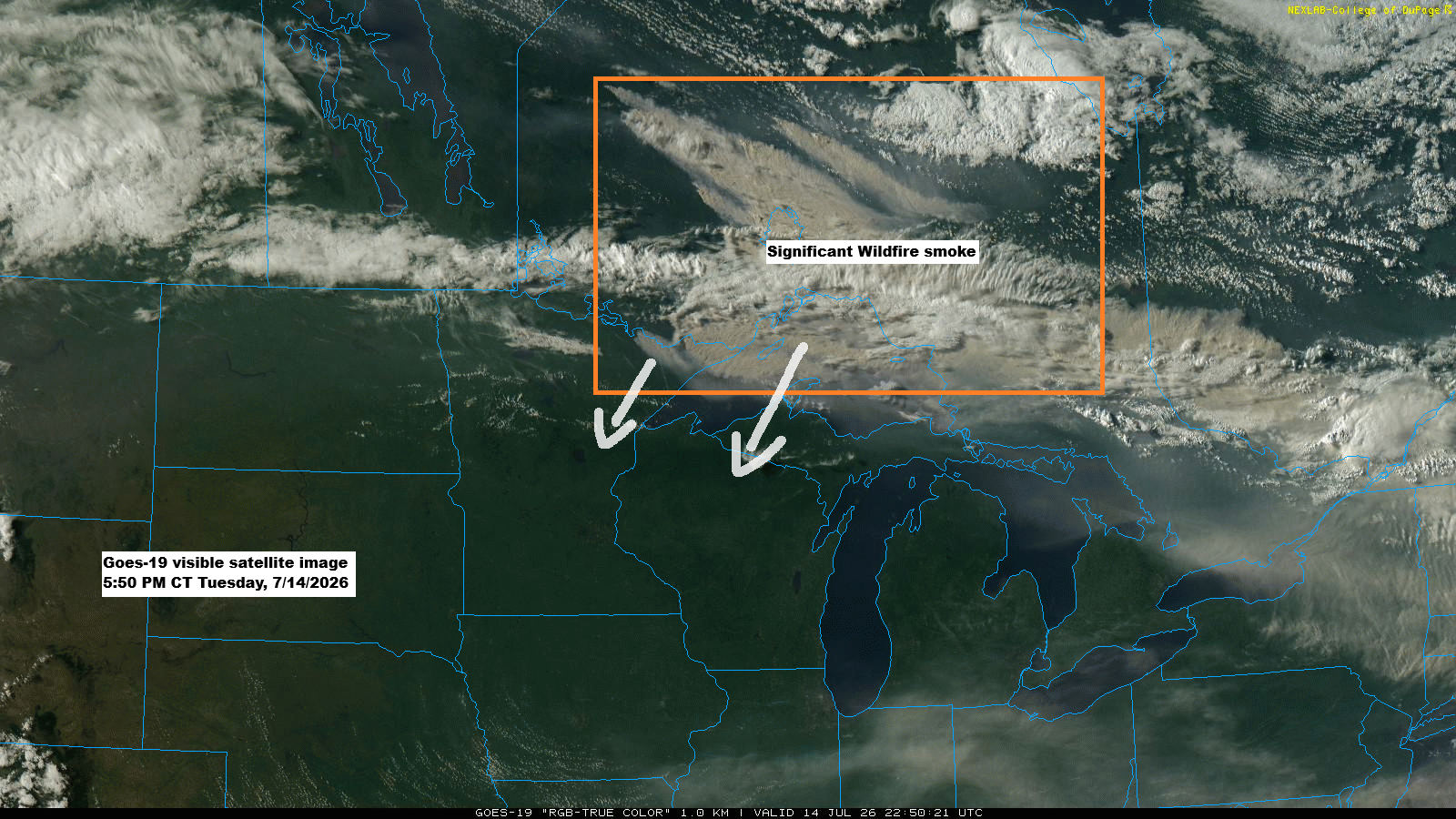
GOES-19 satellite images show thick plumes of wildfire smoke drifting from parts of Ontario into far northeast Minnesota and over Lake Superior this afternoon, mixing with some clouds. The smoke is expected to move southwest across the Northland, with air quality likely to worsen overnight into Friday morning. The smoke…
-
Northland Heat Wave, BWCA Fire Growth and Smoke Risk This Week
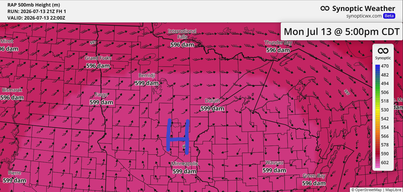
Today’s blog will take a bit longer to read, about five minutes, as there’s plenty of weather to cover, including fires and heat across the Northland. As expected, the ridge over the upper Midwest has reached near-historic levels for this far north, with the RAP model indicating 500mb heights hitting…