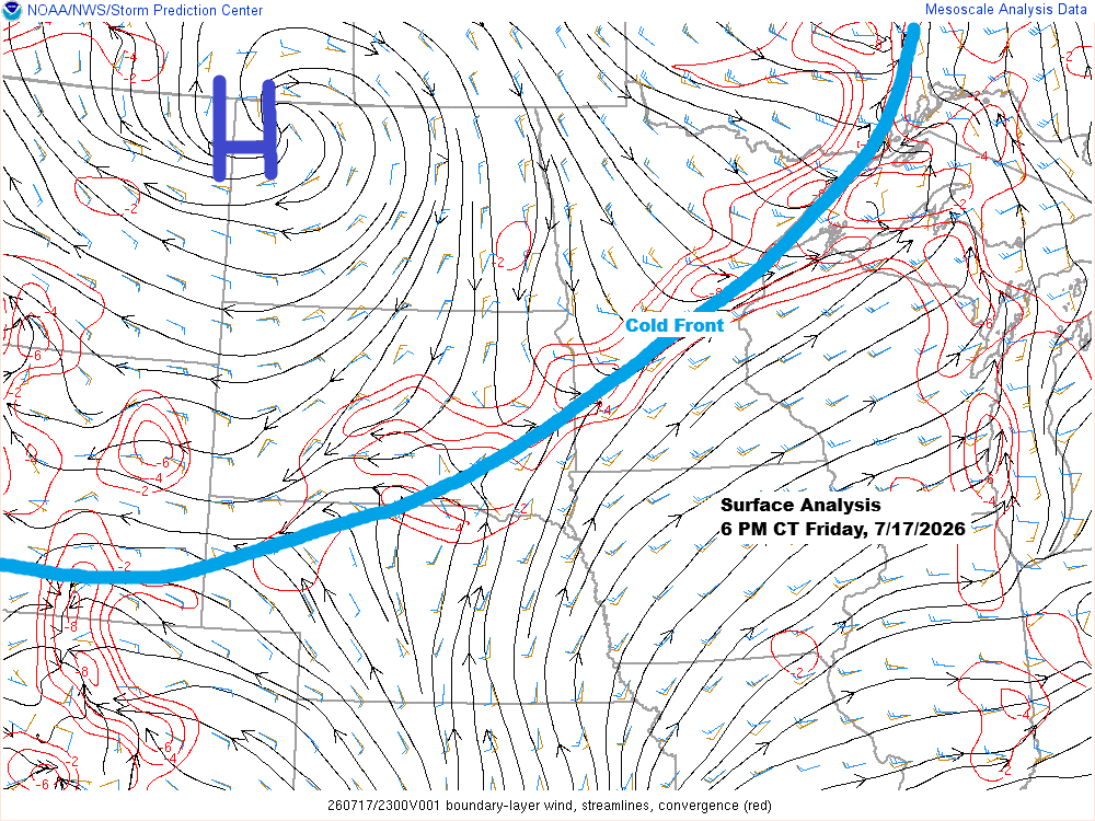
Expect mostly dry weather across northeast Minnesota and northwest Wisconsin this weekend, with highs in the 70s and 80s on Saturday and mainly in the 80s to near 90 on Sunday. Breezy northwest to north winds on Saturday will shift to the southwest by Sunday.
There’s a lot of uncertainty about how much wildfire smoke the Northland might see in the next few days, thanks to rain that fell over fires in far northern Minnesota early Friday morning, as well as in parts of Ontario where fires are also burning.
Late Friday afternoon, air quality across much of northeast Minnesota and northwest Wisconsin ranged from unhealthy to very unhealthy, with some of the worst conditions near Lake Superior. A small pocket of hazardous air quality persisted in the Twin Ports area.
Late Friday afternoon, Duluth’s AQI ranged from 354 to 256, still in the hazardous to very unhealthy range, though much improved from Thursday when levels at times soared above 1000.

…Near Surface Smoke Density Forecast…
Here’s a look at the HRRR model forecast for near surface wildfire smoke.
Overnight, most of the smoke is expected to settle over Ontario and across Lake Superior into northeast Wisconsin, with much of the Northland seeing improved air quality.

Another wave of wildfire smoke could move into northeast Minnesota and northwest Wisconsin on Saturday, with the thickest haze appearing in deep shades of orange, red, and purple on the map. There’s still some uncertainty about how far west or south this smoke will travel.

On Sunday, the thickest wildfire smoke could drift farther east, stretching from southern Minnesota into most of Wisconsin, except the far northwest. At the same time, northeastern Minnesota might enjoy better air quality, though there’s still plenty of uncertainty.

…Friday afternoon rain totals…
A brief downpour brought between 0.1 and 0.31 inches of rain to the Twin Ports area late Friday afternoon.
Hermantown, MN: 0.31″
Duluth Airport: 0.28″
Duluth Sky Harbor Airport: 0.28″
Superior Airport: 0.17″
About half an inch of rain fell farther west, from Burnett to Saginaw, Minnesota, on Friday afternoon.

Radar loop from Friday, July 17, 2026, 3:19 PM to 6:18 PM
Storm Reports from Friday, July 17, 2026
6:02 PM: Hail 0.70″. 5 WNW Washburn, WI (Bayfield County)
5:40 PM: Hail 1.00″ (quarter size). 4 SSW Cornucopia, WI (Bayfield County)
5:35 PM: Thunderstorm Wind Gust 52 mph. 4 NE Herbster, WI (Bayfield County)
5:07 PM: Thunderstorm Wind Damage. 2 NE Munger, MN (St. Louis County). Three trees downed.
5:02 PM: Thunderstorm Wind Gust 58 mph. 2 SW Twig, MN (St. Louis County). Measured on eastern shore of Grand Lake.
3:05 PM: Hail 0.70″. 6 ENE Makinen, MN (St. Louis County)
…Temperatures…
The heat made a comeback in parts of the Northland today, with highs in the low to mid-90s across the southern half of the region and temperatures in the 80s farther north.
The combination of thick wildfire smoke and an onshore wind kept temps near 70 in Canal Park in Duluth today to the lower 80s in Superior.
Record highs for July 17
Brainerd, MN: 96 set in 2005
Ashland, WI: 95 set in 1964
Duluth, MN: 94 set in 1964
Hibbing, MN: 94 set in 1964
International Falls, MN: 94 set in 1991
Note: Today’s high of 90 degrees at the Duluth Airport marked the fourth time this month that temperatures have reached at least 90. On average, Duluth only sees one day in July when temperatures hit 90 degrees or above.
-The last time Duluth saw at least four days in the 90s during July was back in 1983.

Showers and thunderstorms rolled through the far northern parts of Minnesota early this morning, and by the afternoon, scattered storms popped up again in northeast Minnesota, impacting the North Shore and Twin Ports areas.
Goes-19 infrared satellite loop ending 5:21 PM CT Friday, July 17, 2026.

It looks like our next chance for rain will be from Sunday night into Monday, with scattered showers and a few thunderstorms possible in the Northland. Early estimates from the NWS Blend of Models suggest we could see around 0.1 to 0.25 inches of rainfall in our area.

Leave a Reply