Category: wildfires
-
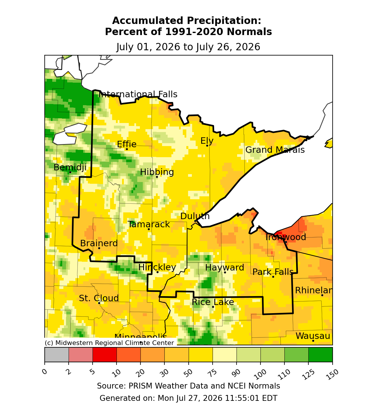
Hit‑or‑Miss Summer Rain: July Drier for Most, Wetter Near Northern MN Fires
Rainfall this summer has been a bit of a mixed bag, but that’s not too unusual since summer rain tends to be hit or miss. We usually don’t get the large-scale weather systems that bring widespread precipitation like we see in fall, winter, and early spring. Compared to June, much…
-
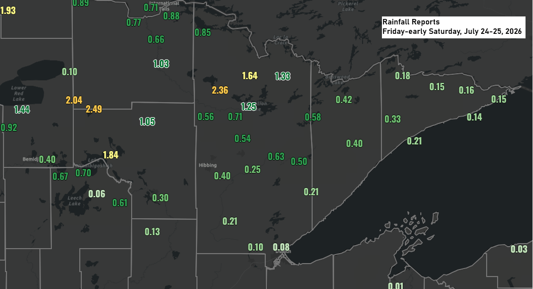
Northern Minnesota Soakers: Northome Leads Friday Night Rainfall
Parts of northern Minnesota saw plenty of rain from Friday night’s storms, with Northome leading the way at 2.49 inches, followed by Orr with 2.36 inches. Rain totals dropped farther south, with about 0.6 inches in Ely, 0.4 inches in Hibbing, and just 0.08 inches at the Duluth Airport. Rainfall…
-
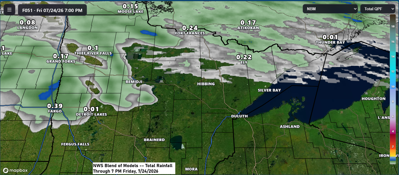
Aside from a Few Northern Showers, Most of the Northland Stays Dry Through Friday
Aside from a few scattered showers and the possibility of an isolated thunderstorm in far northern Minnesota Thursday night into Friday, most of the Northland is expected to stay dry through Friday. A few more showers or thunderstorms are possible this weekend, but they should be pretty scattered, with no…
-
Warm, Mostly Dry Weekend Ahead, but Northland Smoke Forecast Remains Uncertain After Friday’s Rain
Expect mostly dry weather across northeast Minnesota and northwest Wisconsin this weekend, with highs in the 70s and 80s on Saturday and mainly in the 80s to near 90 on Sunday. Breezy northwest to north winds on Saturday will shift to the southwest by Sunday. There’s a lot of uncertainty…
-
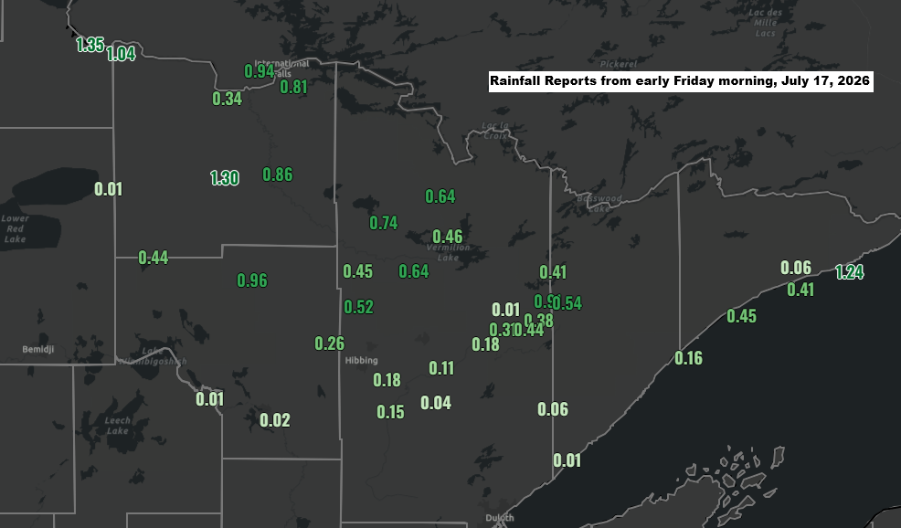
Far Northeast Minnesota Fires See Some Rain — and a Surge of Lightning Strikes
Early Friday morning, showers and thunderstorms brought some much-needed rain to far northern Minnesota. It was a bit of a good news, bad news situation. The rain was much needed, though it’s still unclear if it will help with firefighting efforts. Unfortunately, thunderstorms also rolled through, bringing up to 13,000…
-

Northland weather: Hazardous wildfire smoke, AQI off the charts
Thick wildfire smoke is covering much of northeast Minnesota and northwest Wisconsin once again today, creating hazardous conditions. In some areas near Lake Superior, the smoke has been so dense that visibility has dropped to less than a mile. In Duluth, the AQI has soared to between 700 and over…
-
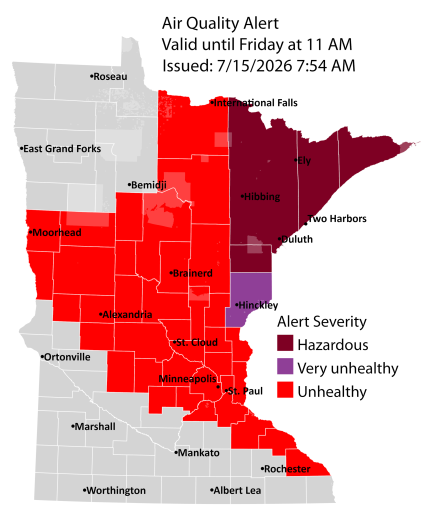
Large Wildfire Complex in Far Northeast Minnesota and Ontario Drives Extended Air Quality Alerts Across the Northland
An air quality alert remains in effect until 11 a.m. Friday for all of northeast Minnesota and until noon Thursday for all of northwest Wisconsin, with the possibility of extensions in both states. Fires are still burning in far northeast Minnesota and northern Ontario, Canada, sending thick, hazardous smoke south…