Category: precip data
-
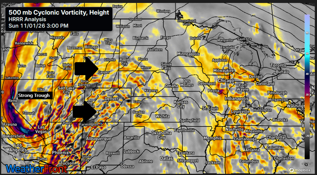
🌧️🌫️Slow-Moving Storm to Bring Multiple Rounds of Rain Through Thursday
A rainy week is shaping up across the Northland as a slow-moving trough gradually pushes east out of the Rockies. This system isn’t expected to move east of the region until sometime Thursday, bringing multiple rounds of rain beginning Monday and continuing through at least part of Thursday. While it…
-
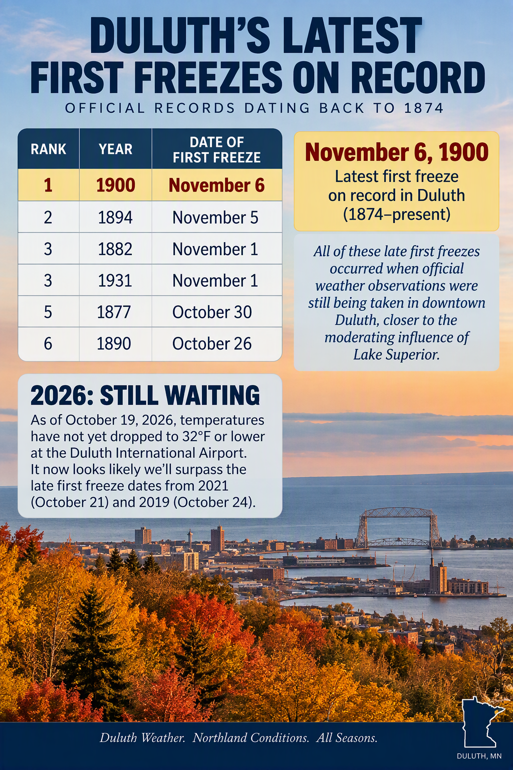
Northland Weather: Tracking Duluth’s Unusually Late First Freeze
Duluth’s first official freeze of the season continues to be delayed, with temperatures still failing to reach 32 degrees or lower at the airport this month. The last time the first freeze occurred this late was in 2021 (October 21), while 2019 holds a more recent late-season mark of October…
-

Rainfall Roulette: Arrowhead Wins Big, Southern Areas Come Up Short
Showers and thunderstorms rolled across the Northland from late Monday afternoon into early Tuesday morning. The heaviest rain from this system fell in far northern Minnesota and the Arrowhead region, with several reports of more than 0.50 inches. Farther south, rainfall was much lighter, generally under 0.1 inches. Radar loop…
-

🌤️🌦️Frost Advisory Tuesday Morning; Light Thursday Showers for Parts of the Northland
A Frost Advisory will be in effect early Tuesday morning for much of northeast Minnesota, excluding the North Shore, and for all of northwest Wisconsin. Forecasted temperatures reaching 34 degrees or lower are expected to produce frost, with the most significant risk occurring in areas inland from Lake Superior. No…
-
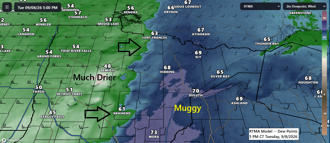
🌬️⛈️Cold Front Exits Tonight, Breezy Wednesday; Next Systems Arrive Friday and Early Next Week
A cold front is moving east across Minnesota this afternoon and is expected to clear the Northland by late tonight. Behind the front, a much drier airmass will return on Wednesday, with dew points dropping from the 60s and low 70s today to the 40s and 50s. Some instability has…
-
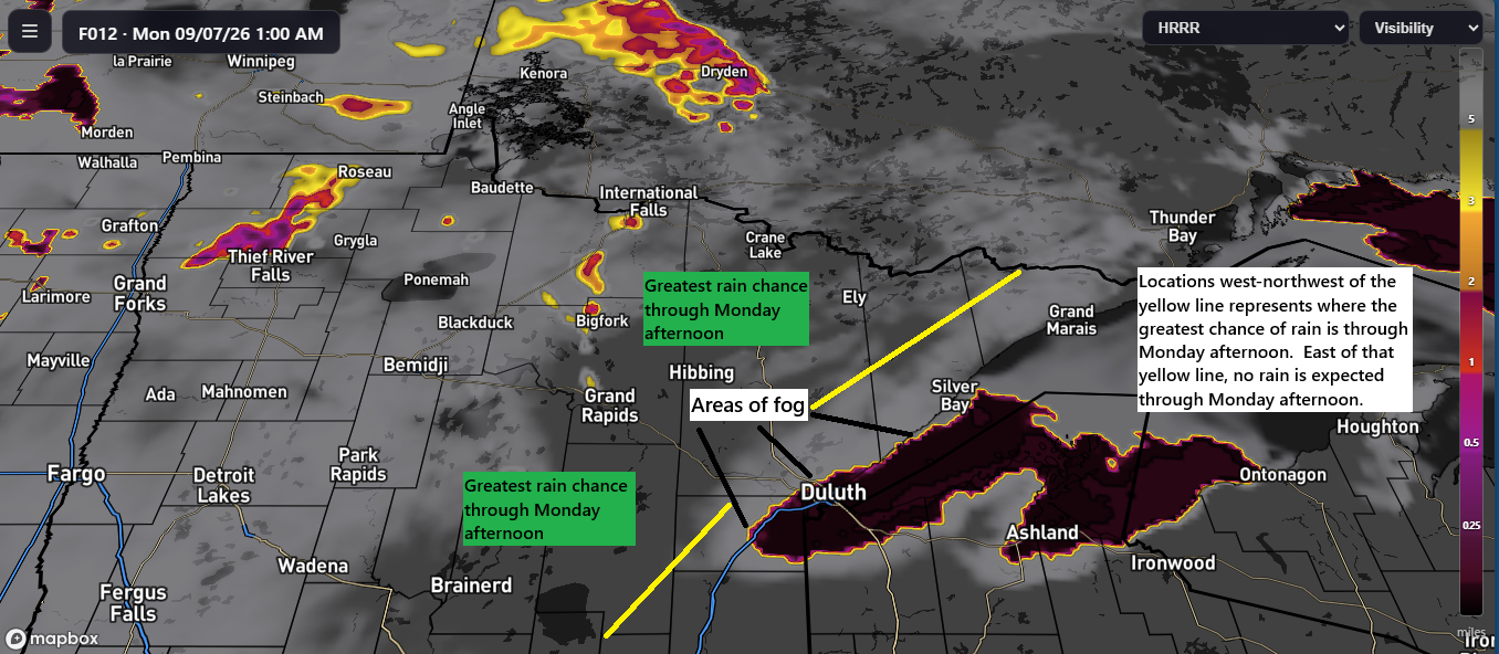
🌧️Rain Stays West Through Monday; Twin Ports Rain Arrives Monday Night
As expected, all off the weekend’s rain stayed west of the Twin Ports, and this pattern should continue through much of Monday. However, the chances for rain will increase Monday night into early Tuesday morning, with a few additional showers possible Tuesday afternoon. The bulk of the rainfall from this…
-
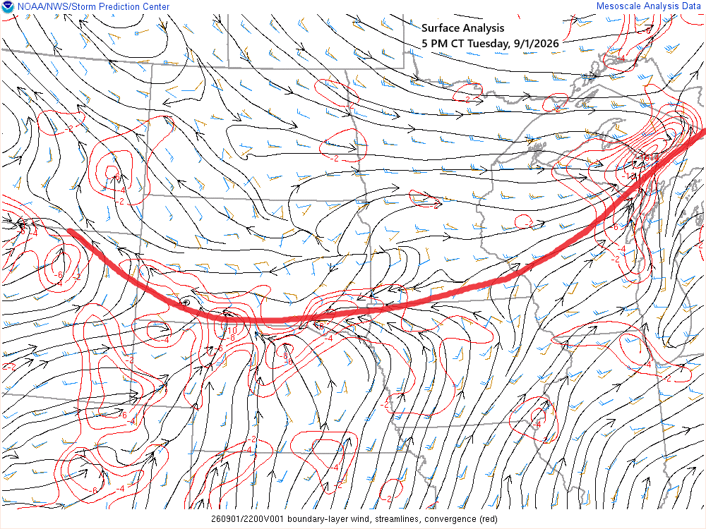
🌧️Stalled Front to Bring Several Rounds of Rain into early next week; A Look at Duluth’s September Averages
A nearly stationary frontal boundary extending from the western High Plains to eastern Upper Michigan will serve as the focus for several rounds of showers and thunderstorms over the next few days. Tonight, most of the rain should remain south of the Northland; however, as the boundary gradually shifts north…