Category: last 80
-
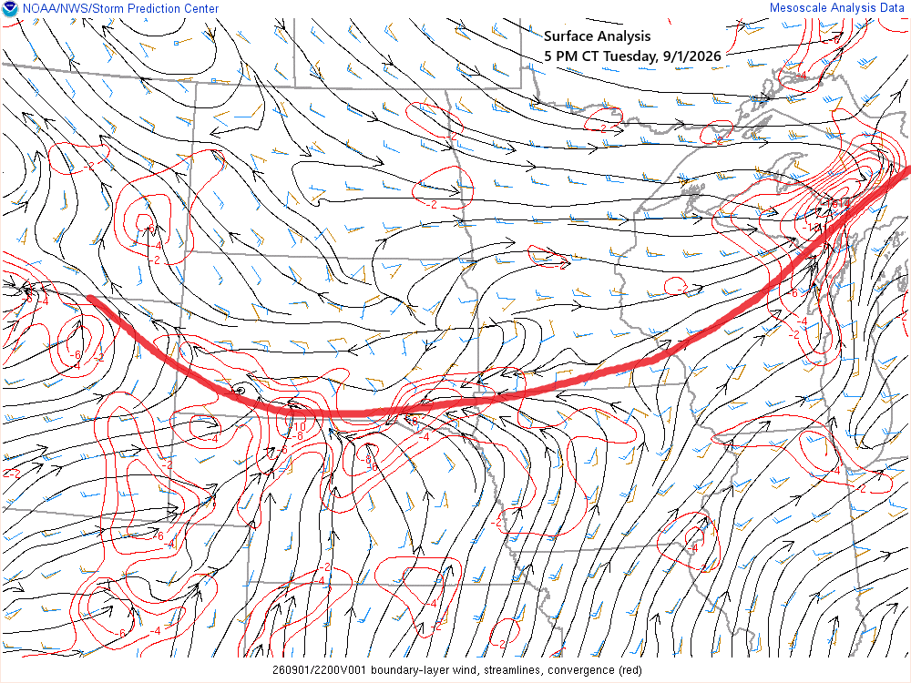
🌧️Stalled Front to Bring Several Rounds of Rain into early next week; A Look at Duluth’s September Averages
A nearly stationary frontal boundary extending from the western High Plains to eastern Upper Michigan will serve as the focus for several rounds of showers and thunderstorms over the next few days. Tonight, most of the rain should remain south of the Northland; however, as the boundary gradually shifts north…
-
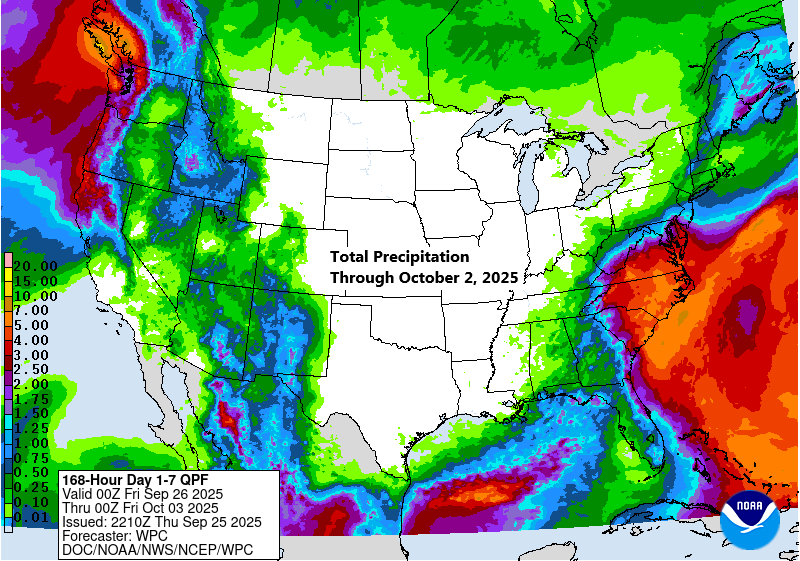
Cool Nights and Mild Days: Weather Update for Northeast MN and Northwest WI
A stretch of dry and pleasant weather is expected to continue across northeast Minnesota and northwest Wisconsin over the next few days, with cool nights and mornings giving way to mild afternoons. Temperatures are expected to reach the 60s and 70s on Friday and Saturday, with highs primarily in the…
-
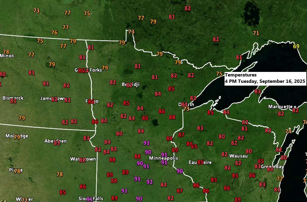
Weather Update: Warm September Day in Northland
It was a warm mid-September day in the Northland, with most areas seeing temperatures in the 80s. However, the southerly winds weren’t strong enough to clear the marine layer lingering near Lake Superior. While the easterly wind was much lighter compared to previous days, temperatures near the lake stayed cooler,…
-
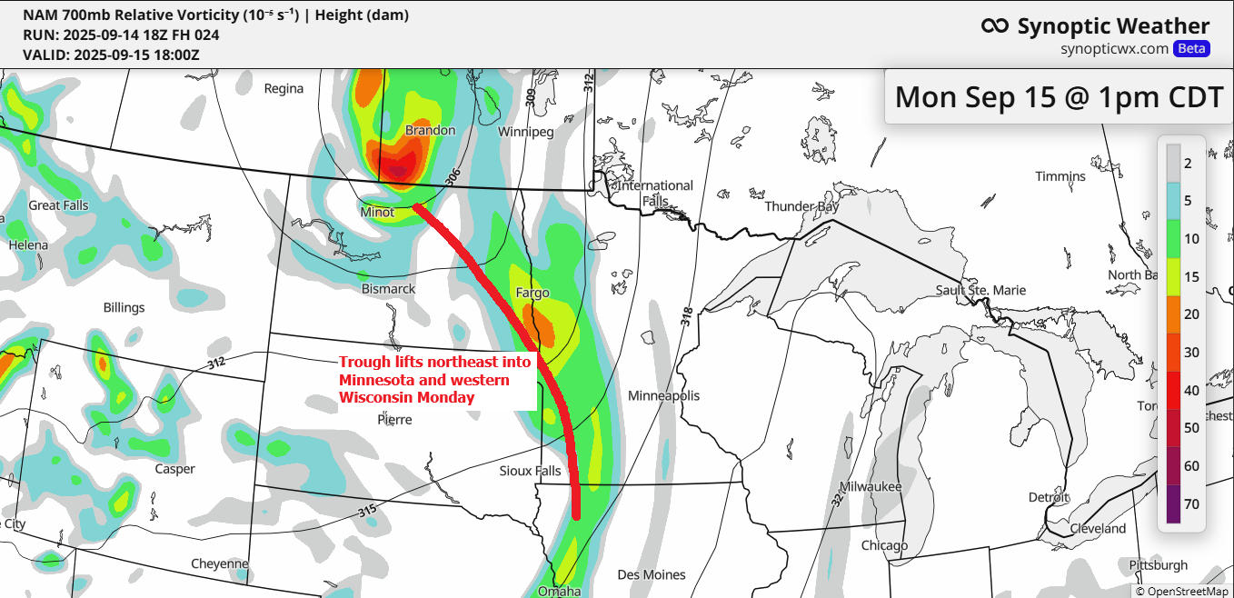
Northland Weather Forecast: Fog, Showers, and Temperature Trends
The trough causing severe weather in the Dakotas today will move northeast into the Northland on Monday, but it will weaken as it encounters a lingering ridge to the east. This, combined with minimal to no height falls from the approaching trough, makes widespread rain unlikely. Instead, there may be…
-
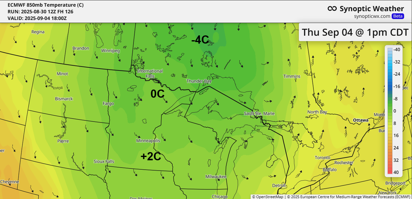
What to Expect After Labor Day: Cooler Temperatures Ahead
Mild temperatures will persist through Labor Day, but cooler weather is expected mid-week and will last for a few days as a mid and upper-level low and trough intensify over the Great Lakes. The GFS model indicates that 500mb heights could drop to between -3 and -5 sigma near the…