A calm fall pattern will persist over the next few days, with cool nights and mild afternoons. Temperatures will climb into the 60s across much of the Northland from Tuesday through Saturday, with some spots possibly reaching 70 degrees. Occasional east winds will keep temperatures cooler near Lake Superior on days when the winds blow from the east.
A few showers might roll in this weekend as a cold front passes through, but widespread rain doesn’t seem very likely right now.
The lack of a freeze in Duluth continues to be a notable weather story. While it looks increasingly likely that we’ll get through at least October 26 without an official freeze, computer models are hinting at several nights next week with temperatures near or below 32 degrees, which could finally end the streak.
Note: In Duluth, October 1st is typically the average date when temperatures first drop to 32 degrees.

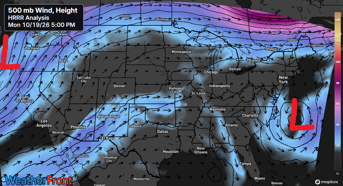
At 500mb, strong upper-level lows remain anchored over the Atlantic and Pacific Oceans today, with generally westerly flow persisting across the Upper Midwest.
A more amplified pattern is expected to take shape late this week through the weekend, characterized by deep troughing over the western and northeastern U.S. and strengthening ridging across the Great Lakes region.
Euro model 500mb forecast valid 7 AM CT Friday, October 23, 2026.

A mild afternoon followed a crisp Monday morning across the Northland, with temperatures this afternoon in the 60s and cooler 50s near Lake Superior as northeast winds picked up.

Leave a Reply