Note: Chances of challenging the latest recorded date for the first 0.1-inch snowfall in Duluth are increasing. That date, November 26, was set in 2004. Whether we reach it remains uncertain, but at least through November 20th, the likelihood of any measurable snow in Duluth appears very low.
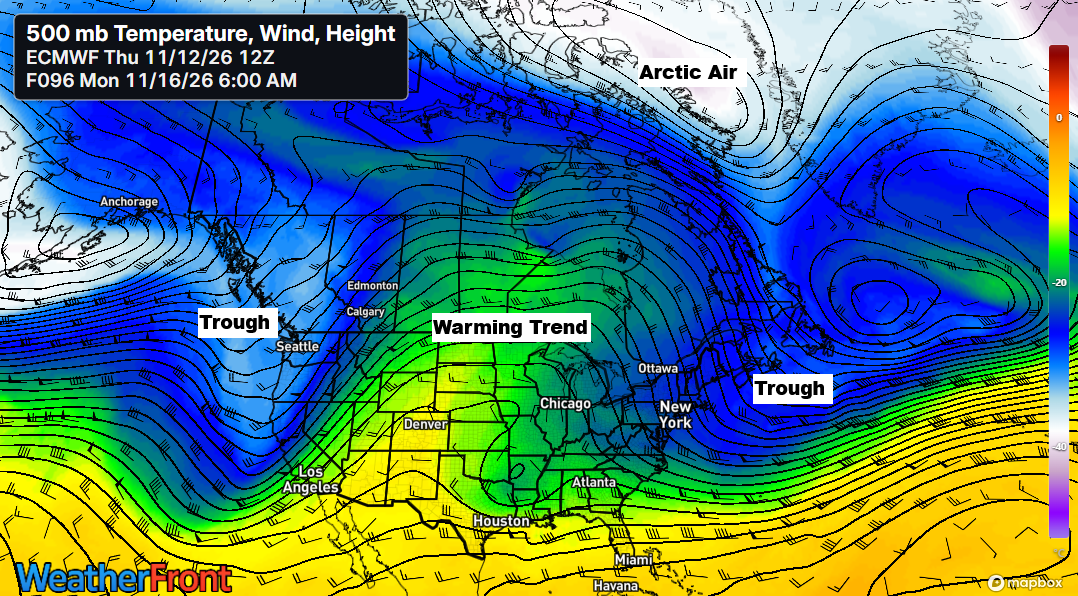
Today, the 500mb pattern features a deep, chilly trough extending from the upper Midwest and Great Lakes to the northeastern U.S., while a broad ridge dominates the western U.S. The trough currently over our area will move east this weekend, making way for the western ridge. By later next week, another trough is likely to develop across the region, potentially bringing some rain chances.
HRRR model 500mb analysis from 5 PM CT Thursday, 11/12/2026

A significantly amplified weather pattern has emerged, bringing in a cooler airmass with a deep trough to the east and a prominent ridge to the west.
Water vapor loop from Thursday, November 12, 2026, ending at 6:05 PM CT.
…Temperature Trends…
The last time Duluth recorded an average temperature below normal was on October 26th, over two weeks ago.
Today was the coldest day of the month so far in the Northland, with temperatures in the 30s—typical mid-November weather.

Note: Highs on Friday will be much like Thursday, with temperatures again reaching the 30s, before moderating over the weekend. This milder pattern is expected to continue into next week, bringing highs in the 40s and 50s across the Northland.
An overview of the high temperatures on Thursday, November 12, 2026, and how they compared to the seasonal average.
International Falls, MN
High: 33
Departure: -3 degrees
Duluth, MN
High: 36
Departure: -3 degrees
Hibbing, MN
High: 36
Departure: 0
Ashland, WI
High: 37
Departure: -5 degrees
Brainerd, MN
High: 39
Departure: -2 degrees
…Lingering Lake Effect Snow…
Lake-effect snow showers will persist tonight and Friday along the South Shore of Lake Superior, from northern Wisconsin to upper Michigan, while the rest of northeast Minnesota and northwest Wisconsin remain mostly dry through Friday.
HRRR model simulated radar forecast through 7 PM Friday.
Forecasts call for roughly an inch or less of snow through Friday afternoon along the South Shore of Lake Superior in northern Wisconsin, east of Ashland, while western Upper Michigan may receive an additional 1–2 inches.

Leave a Reply