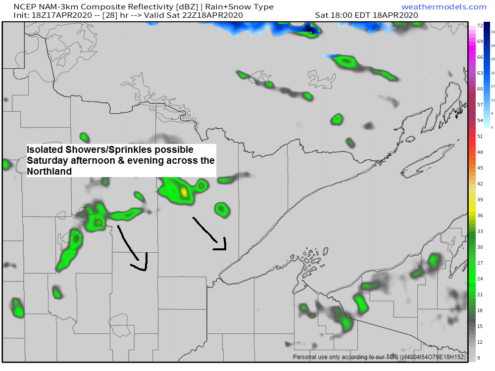
A cold front will move SE through the Northland on Saturday, this front should come through mostly dry, but a few showers or sprinkles could pop up especially in the afternoon and evening.
Simulated radar valid from 1 PM to 11 PM Saturday
Source: 18z NAM-WRF model 4.17.2020; https://weathermodels.com/

A milder air mass is pushing east into the upper Midwest today!
Source: RAP model; https://www.spc.noaa.gov/

A significant late season winter storm hit portions of the Midwest with a swath of several inches of snow from Thursday into Friday.
Source: https://www.pivotalweather.com/

Check out the snow cover today on Goes-16 satellite imagery after last night’s winter storm which hit parts of Nebraska and Iowa. Note: Snow cover shows up in green on the image below.
Source: https://weather.cod.edu/

Severe thunderstorms capable of producing damaging winds, hail and tornadoes are possible from eastern Texas eastward across the Gulf Coast states on Sunday.
Source: SPC; https://www.pivotalweather.com/

…Weather Summary…
After a cold last few days, temperatures are going in the right direction. Highs across the Northland were in the 40s today which is still a little below normal for mid-April, but certainly feels nicer compared to the temperatures we saw earlier in the week.
Our weather this weekend doesn’t look too bad. Will have some clouds around Saturday and Sunday, but also some sun at times. It will be a tad breezy, however, with southwest winds on Saturday becoming northwest in the afternoon, and those northwest winds will carry over into Sunday. Wind gusts to around 20-25 mph are possible both Saturday and Sunday.
Note: Fire season has begun across the Northland as the snow pack has melted or continues to melt while we await the spring green-up around here, so until that happens or until we get some soaking rains, fire danger will be an issue on days that feature gusty winds and mild temperatures, so use common sense if you will be outdoors this weekend.
Low temperatures tonight will be in the 30s with 20s in the tip of the Arrowhead. Highs on Saturday ranging from the upper 40s to lower 60s with the warmest temps in northwest Wisconsin and eastern Minnesota. Will cool off a tad on Sunday with highs in the upper 30s to middle 40s.
Forecast for Duluth and Superior
.Tonight… Partly cloudy. Low 30 to 35. Wind west to southwest 5 to 15 mph.
.Saturday… Breezy and mild. Partly to mostly sunny. Isolated showers possible late in the day. High 53 to 58. Wind southwest 15 to 25 mph becoming northwest in the afternoon.
.Sunday… Cooler. Partly to mostly cloudy. High 40 to 45. Wind northwest 10 to 20 mph.
| Normal temperatures for April 18 High 51 Low 34 Sunrise Saturday 6:15 AM CDT Sunset Saturday 8:02 PM CDT |
Thanks for reading!
Tim
Leave a Reply