A little more moisture in the form of higher dew points will be moving into the Northland over the next few days with dew points in the 40s and 50s, this may eventually lead to some fog/low clouds at times near Lake Superior beginning Wednesday evening, and possibly continuing into the weekend as an easterly breeze looks to continue for several more days.
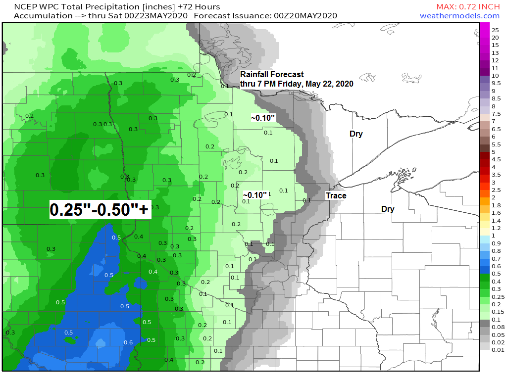
No rain across the Northland through Thursday, but we may see a few showers develop Friday, Saturday and Sunday, but no widespread rains at least through the weekend the way it looks now.
Thunderstorm potential looks low through this weekend, even though we have warmer temps (away from Lake Superior) there doesn’t look to be a great deal of instability, so maybe will get an isolated storm to pop in spots, but that should be about it.
High temps in the 70s to around 80 degrees across northeast Minnesota and northwest Wisconsin for Wednesday with 60s and 70s Thursday and Friday. Note: It will continue to be much cooler near Lake Superior through Friday with highs ranging from around 47 to 55 degrees.
Note: There is a chance the Duluth Airport hits 70 degrees on Wednesday (May 20th) if they do this would be the first official 70 degree temperature this year in Duluth. The average date for first 70 degree temperature in Duluth is April 28th (1875-2019 climate period) Last year’s first 70 was on April 20th, and the latest first 70 on record for Duluth was on June 14th set in 1907.
A highly amplified weather pattern remains in place today with widespread warmth well north into Canada while much cooler temperatures covered the Great Lakes, Midwest and Ohio Valley areas.

Regional view of our temperatures from late Tuesday afternoon.
50s in northern Illinois, 80s in western North Dakota, north into Canada, and southeast into far northwest Minnesota.
Note: International Falls, Minnesota reached 80 degrees today (May 19th, 2020) this marks the 1st 80 degree or warmer temperature this year at International Falls. The average date for the 1st 80 degree temp in International Falls is May 15th, and last year’s 1st 80 was on June 4th.

Higher 500mb heights (warmer temps) found near the ridge or the blue H on the map, while lower 500mb heights (cooler temps) near the upper lows/troughs or the red L on the map – This is an Omega Block weather pattern.

Another day with extreme (red) and very high fire danger (orange) across most of northern and northeastern Minnesota.
Source: https://www.dnr.state.mn.us/

We’ve seen some clouds move from SE to NW out of Wisconsin and into parts of northeast and eastern Minnesota today, these clouds are actually associated with the larger system over the Ohio Valley.

Goes-16 water vapor loop from Tuesday, May 19th, 2020 shows the two strong upper level lows and the ridge in the middle.
Source: https://weather.cod.edu/

One year ago today (May 19th) parts of the Northland saw accumulating snow with the Duluth Airport picking up 2.4 inches of snow.

Forecast for Duluth and Superior
.Tonight… Clear to partly cloudy. Low 43 to 48. Wind east 10 to 20 mph.
.Wednesday… Partly to mostly cloudy. High 66 to 71 but cooler near Lake Superior. Wind east to southeast 10 to 20 mph.
.Thursday… Partly to mostly cloudy. Areas of fog possible near Lake Superior. High 62 to 67 but cooler near Lake Superior. Wind east to southeast 10 to 20 mph.
| Normal temperatures for May 20 High 64 Low 42 Records for May 20 High: 88 degrees set in 2009 Low: 26 degrees set in 1986 Sunrise Wednesday 5:28 AM CDT Sunset Wednesday 8:44 PM CDT |
Thanks for reading!
Tim

Leave a Reply