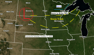
Computer models are starting to come into better agreement with the track of Saturday’s low pressure system, but there still are some differences on where the main band of precipitation sets up, and just how much precipitation will fall across the Northland. A shift of about 50-75 miles north or south with the low could lead to the heaviest band of precip setting up a little farther north or south of where the models are showing it today. Stay tuned.
Breaking down my snowfall forecast for Saturday’s event
3 to 5 inches across portions of north-central into northeast Minnesota including Cass Lake, Grand Rapids, Bigfork, Hibbing, Ely and Isabella.
2 to 3 inches for International Falls, Walker, Hill City, Floodwood, north side of Duluth (higher elevation) and also along the Higher Terrain of the North Shore of Lake Superior.
1 to 2 inches of snow for Aitkin, McGregor and Cloquet.
Less than an inch of snow for Brainerd, Moose Lake, Solon Springs, Ashland, and for locations within about 10 miles of Lake Superior.
Note: Changes to snowfall amounts and snowfall gradients are possible over the next 24 hours.

Snowfall forecast for Saturday zoomed in on the Twin Ports.
Elevation should play a role with Saturday’s snowfall with higher elevated areas on top of the hill in Duluth likely picking up more snow than locations in lower elevation or below the hill in Duluth, this is fairly common with early season snow events.
East winds coming off Lake Superior where water temps are still in the mid to upper 40s as of Thursday afternoon should modify the temperature on land just a bit, or at least enough where precipitation is more rain than snow within 5-10 miles of Lake Superior on Saturday, but even lakeside locations could see a period of snow Saturday morning (prior to Noon) when temperatures will be at their coldest, but I’m not expecting more than a light slushy coating of snow (if that) for locations below the hill in Duluth on Saturday.

Breaking down the timing of Saturday’s snow
Snow is forecast to reach SW portions of the Northland, roughly along and south of a line from Cass Lake to Spooner between 5-7 AM Saturday, then will see the snow move farther north reaching the Iron Range and Twin Ports around 8-10 AM Saturday. Snow is expected to reach the Borderland and Arrowhead by early Saturday afternoon the way it looks now.
A dry slot could shut off precipitation, or cause the snow to change to patchy drizzle especially south of Highway 2 in northeast Minnesota, and across all of northwest Wisconsin by Saturday afternoon, but this will depend on the track of the low, if it goes further south so will the dry slot, but if the low tracks farther north, the dry slot could also shift farther north impacting a larger portion of the Northland Saturday afternoon.
Note: Temperatures aloft continue to look sufficiently cold enough for snow on Saturday with models showing 850mb temps of around -2 to -5C, and 925mb temps of around -1 to -3C. Surface temps on Saturday are forecast to range from around 33 to 35 degrees across northern Minnesota, but it will be a few degrees warmer by Saturday afternoon across east-central Minnesota and northwest Wisconsin where snow should change over to drizzle if precipitation is still falling Saturday afternoon.
Snowfall ratios look to be around 5:1 to 8:1 with Saturday’s event so this should be a wet snowfall. It may take an hour or so from when snow starts to fall to when it starts to accumulate due to the warmer soil and pavement temps, but eventually the snow should start to accumulate, especially across north-central Minnesota and into the Arrowhead.
Source: https://weathermodels.com/

The Duluth Airport saw their first snowflurries of the season early Thursday morning, October 15, 2020 with a trace of snow reported.
A few dates to keep in mind – The mean date for first 0.1″ or greater snowfall in Duluth is October 24th, and date for first 1.0″ or greater snowfall in Duluth is November 4th.
It’s been a crisp fall day across the Northland as Thursday afternoon temperatures were only in the upper 30s across the north to the lower 40s across the south. Normal highs in mid-October are in the low to mid 50s.
Note: Temperatures on Friday will be on the chilly side once again with highs only in the 30s to around 40 degrees.

Not looking at a lot of snow or rain through Friday, but there likely will be a few passing snow or rain showers from time to time, some of this will be caused by lake effect of the larger inland lakes as cold air and a WNW wind blows over the warmer waters of those lakes causing more numerous snow or rain showers into Friday downwind of some of the larger inland lakes across the Northland.
18z NAM 3km radar forecast valid thru 7 PM Friday.
Source: https://weathermodels.com/

A cold air mass has locked into place across the upper Midwest and shows no signs of going anywhere through next week.
There are a couple more systems showing up in model guidance for next week, and depending on their track and temperatures we could see some more snow or rain across parts of the Northland next week.

Thanks for reading!
Tim
Leave a Reply