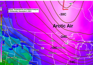
A frigid night ahead with low temps in the single digits and teens below zero across northeast Minnesota and northwest Wisconsin with a few -20s even possible in the traditional cold spots in northern Minnesota.

Still cold on Tuesday, but after that we warm up for the rest of the week.
Highs on Tuesday will mainly be in the teens in the Northland, followed by highs in the 20s on Wednesday, and then even warmer on Thursday with widespread 30s expected. Temperatures will cool slightly Friday and Saturday with highs in the mid 20s to low 30s but will warm right back up again on Sunday with highs forecast to be in the 30s to around 40 in our area.
High temperature forecast valid Tuesday, December 7, 2021, to Sunday, December 12, 2021

Updated snow numbers for Duluth, Minnesota after Sunday’s snow event.
2021-2022 annual snowfall total: 13.7″ (thru Dec. 6)
Departure to date: -6.7″ below normal
We’ve had ~17″ less snow in Duluth this year compared to at this time last year.
31.2″ last year vs. 13.7″ this year (thru Dec. 6).
Another clipper system will move SE out of the Northern Rockies on Tuesday spreading a swath of light fluffy snowfall in its path. This clipper should stay well south of the Northland with the bulk of the snow across southern Minnesota where a dusting to 2″ of snow is possible on Tuesday, but southern portions of the Northland may see a little snow Tuesday afternoon, possibly as far north as Duluth but again the better chances for any accumulating snow will remain farther to the south.
18z NAM 3km model simulated radar forecast valid 6 AM Tuesday to 6 PM Tuesday.

Another winter storm is possible for late this week, but this one appears to be targeting southern Minnesota vs. northern Minnesota with a possibility for 4″ or more of snow (blue outlined area) in the Friday to early Saturday time frame.
The basic setup for late this week features a ridge over the Gulf (blue H) and a trough (red L) digging across the Rockies. The aforementioned trough will move out onto the Plains and then eject quickly NE toward the Great Lakes in the Friday-Saturday time frame.

Probabilities for snowfall of 4″ or more is currently highest across southern Minnesota into central Wisconsin (dark green area on map) for late this week.

Massive upper-level ridge of high pressure is forecast to develop across the central U.S., Great Lakes into the northeast U.S. for much of next week with an upper-level trough focused over the far western U.S.
The Northland looks to be under the ridge next week which means well above normal temperatures are looking quite likely.

Here’s the temperature anomaly forecast for next week — We could have several days next week with highs in the 30s and maybe even the 40s in the Northland.

Tim
Leave a Reply