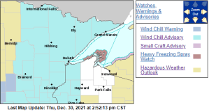
A Wind Chill Advisory is in effect from 6 PM Friday to Noon Saturday for much of the Northland including all of northeast, east-central and north-central Minnesota, and parts of northwest Wisconsin including the cities of International Falls, Bigfork, Grand Rapids, Cass Lake, Walker, Pine River, Brainerd, Hill City, Aitkin, McGregor, Pine City, Hinckley, Moose Lake, Cloquet, Duluth, Hibbing, Ely, Cook, Orr, Crane Lake, Two Harbors, Isabella, Silver Bay, Grand Marias, Superior, Solon Springs, Danbury, Grantsburg, Siren, Minong, Spooner and Shell Lake.
IMPACTS
- Wind chills as low as 40 below zero
- The dangerously cold wind chills could cause frostbite on exposed skin in as little as 10 minutes
Low temperature forecast for northeast Minnesota and northwest Wisconsin valid 12/31/21 – 1/2/22
Friday morning: Around 10 below to 10 above zero.
Saturday and Sunday morning: Teens and 20s below zero with 30s below possible in the typical cold spots.
A regional view of forecasted low temperatures from Friday, December 31, 2021, to Sunday, January 2, 2022

High temperature forecast for northeast Minnesota and northwest Wisconsin valid 12/31/21 – 1/2/22.
Friday: Single digits to around 20 (warmest temps in northwest Wisconsin).
Saturday: Single digits below to single digits above zero.
Sunday: Around zero to the single digits above zero.
Note: A warming trend is expected early next week with highs getting back into the teens and 20s, but another shot of arctic air may impact our area later next week.
A regional view of forecasted high temperatures from Friday, December 31, 2021, to Sunday, January 2, 2022.

DANGEROUSLY COLD WIND CHILLS
Wind chills ranging from around 25 to 45 below zero are expected in northeast, east-central and north-central Minnesota into far northwest Wisconsin from late Friday night into Saturday morning, with another round of dangerously cold wind chills likely for Saturday evening into Sunday morning.
HRRR model wind chill forecast valid 6 PM Friday to Noon Saturday

FRIDAY SNOW CHANCES
We have one more system to contend with this week which may bring a period of snow to parts of the Northland on Friday.
Snow chances on Friday are greatest from eastern Minnesota into northwest Wisconsin, but there are differences in the computer models on where this band of snow will set up on Friday, with the NAM, HRRR and RAP models showing the snow band a little further north (affecting Duluth), while the Euro and GFS models keep this band of snow further south and away from Duluth. The band of snow that does develop on Friday looks pretty narrow, so any slight shift north or south will mean the difference from getting no snow, to possibly getting a few inches of fluffy snow.
Snow is forecast to spread ENE into east-central Minnesota and northwest Wisconsin by mid to late Friday morning (after 8 AM), with snow coming to end from west to east by late Friday afternoon or early Friday evening.
18z NAM 3km model simulated radar forecast valid 6 AM Friday to 7 PM Friday.


Tim
Leave a Reply