5:30 PM Wednesday, January 12, 2022
- Several snow chances ahead, but no major winter storms are expected to hit the Northland through most of next week
- Subzero low temperatures are possible in northern Minnesota Friday morning, and area-wide Saturday morning
- More shots of arctic air possible middle of next week through next weekend
WEAK CLIPPER TONIGHT
Parts of the Northland may see a little snow tonight into early Thursday morning as a fairly weak low-pressure system drops SE across the area. Any snow that does fall tonight should exit the area by around 6 AM Thursday.
Note: Timing for when we may see some snow in Duluth tonight is from around 11 PM to 3 AM. Total snowfall accumulations of an inch or less are possible in Duluth tonight.
18z NAM 3km model simulated radar forecast ending 6 AM Thursday (snow in blue colors)

Snowfall accumulations ranging from a trace to an inch are expected in northeast Minnesota and northwest Wisconsin tonight.

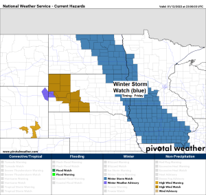
FRIDAY’S CLIPPER
- Low pressure is forecast to be over western North Dakota Friday morning. This low is forecast to move south-southeast reaching western Iowa by Friday evening.
- Accumulating snow with this system is expected to remain west/southwest of the Northland on Friday.
- Snow totals may exceed 6″ in parts of the eastern Dakotas into western-southwest Minnesota into northwest Iowa (pink dashed area on map)

LAKE EFFECT SNOW POTENTIAL ALONG THE NORTH SHORE OF LAKE SUPERIOR FRIDAY
A mostly favorable lake effect setup for the North Shore of Lake Superior will be in place Friday with easterly winds in place as low pressure passes well SW of our area while strong high pressure sets up to our north. The issue in this case is just how much dry air advects southwestward off that high over Ontario. If the dry air wins out, then lake effect snow should remain on the light side with minor accumulations. However, if we get enough moisture from the lake plus an added boost of juice from that clipper system, then we may see this lake effect snow event take off just a bit. Time will tell.

850mb temperatures will be plenty cold enough to support lake effect snow development on Friday with 850mb temps forecast to range from around -15 to -20C over Lake Superior.

Here’s what I’m going with for snowfall amounts for Friday’s lake effect snow event for the North Shore.
Note: At the moment it looks like locations northeast of Duluth may see the greatest amounts of snow (3-6″) based on forecast wind directions per model data.
Gusty east winds are also possible near Lake Superior Friday which may lead to patchy blowing snow.

TEMPERATURE CONTRAST
Temperature of -15F near the shores of Hudson Bay Canada while Rapid City, SD had a temperature close to 60F this afternoon.

Thanks for reading!
Tim
Leave a Reply