5:04 PM Wednesday, July 13, 2022
- A warming trend the next few days but we’re not looking at any extreme heat in our area, with highs Thursday in the mid 70s to low 80s, with highs Friday through Monday mainly in the 80s with a few locations possibly up around 90 Sunday and Monday.
- No signs of any prolonged heat (several days of 90+ temps) impacting the Northland through next week as the core of the heat remains farther west/southwest of the upper Midwest.
- Temperatures will be cooler at times near Lake Superior the next few days.
- It will be turning more humid Friday into early next week with dew point temperatures climbing into the 60s.
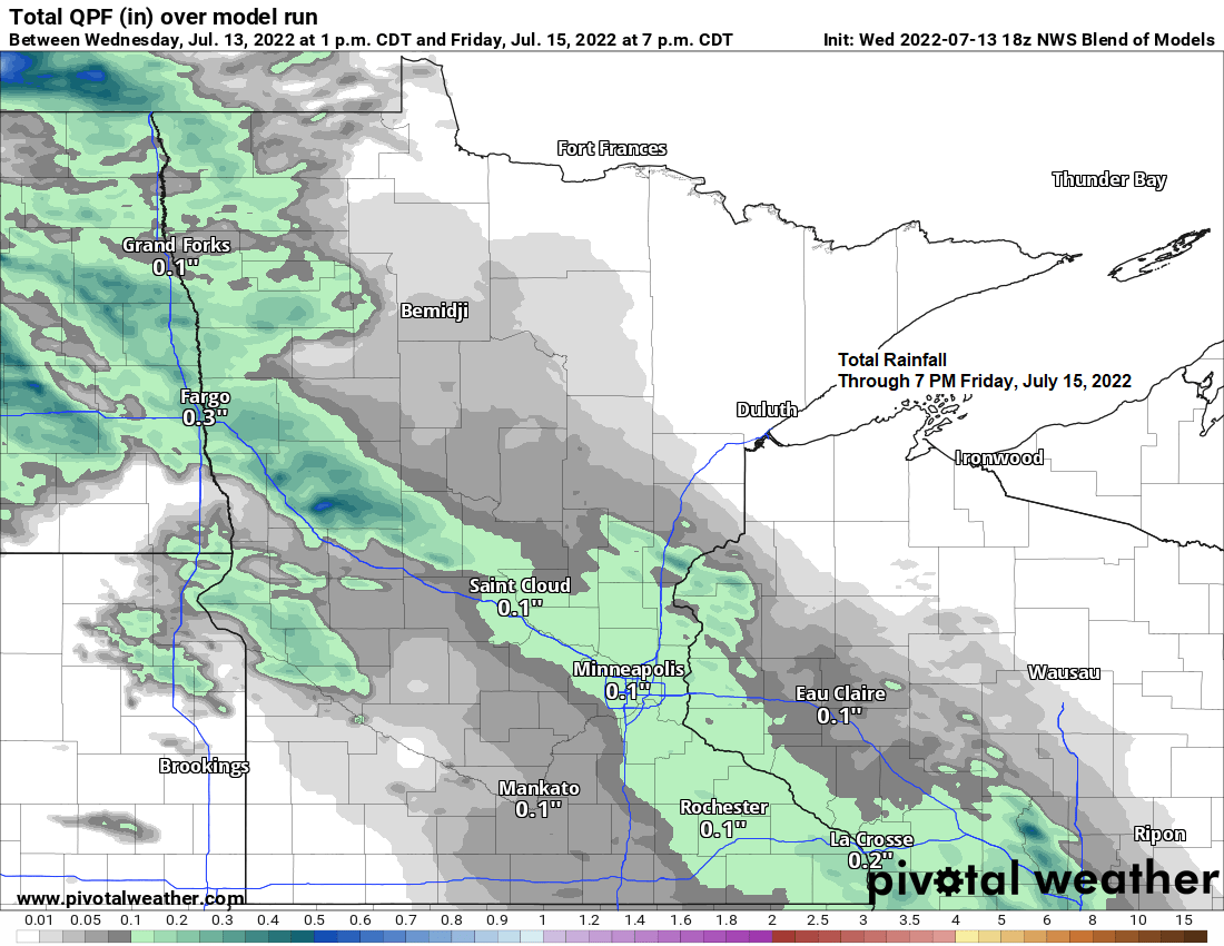
- Not a whole lot of rain expected in the Northland through early next week, but it likely won’t be completely dry either, as there could be some showers and isolated thunderstorms in parts of the Northland late Thursday night/Friday morning, and possibly again on Saturday, but no widespread rains are expected the way it looks now.
It’s going to be a cool mid-July night in the Northland with lows in the 40s, with a few 30s likely in the typical cold spots in our area.
Record Low Temperatures for July 14th
Hibbing, MN: 35 set in 1987
Ashland, WI: 37 set in 1960
Duluth, MN: 37 set in 1987
Brainerd, MN: 38 set in 1930
International Falls, MN: 38 set in 1960

Fair weather cumulus clouds scattered around the region today but note the lack of clouds closer to the Great Lakes as a more stable air mass kept skies mainly sunny this afternoon.
Goes-16 visible satellite loop from Wednesday, July 13, 2022.

There were a few pockets of heavy rainfall in the Northland on Tuesday with 3″ of rain reported at Kabetogama, while rainfall totals of around an inch were reported at Cook and about a mile north of Duluth.

Rainfall Reports for July 12, 2022
Source: NWS Duluth, MN.
Kabetogama, MN: 3.00″
3 E Orr, MN: 1.23″
Cook, MN: 1.04″
1.4 NNW Duluth, MN: 1.03″
0.2 W Culver, MN: 0.76″
12 N Grand Rapids, MN: 0.70″
Embarrass, MN: 0.57″
Hurley, WI: 0.55″
2 S Tower, MN: 0.54″
Two Harbors, MN: 0.52″
Hayward, WI: 0.49″
Duluth, MN: 0.46″
Brimson, MN: 0.36″
1.2 W Solon Springs, WI: 0.31″
International Falls, MN: 0.29″
Cass Lake, MN: 0.29″
Ashland, WI: 0.27″
2 E Celina, MN: 0.25″
Brainerd, MN: 0.24″
Floodwood, MN: 0.23″
Grand Marais, MN: 0.21″
4 W Clam Lake, WI: 0.21″
10 W Gunflint Lake, MN: 0.20″
Butternut, WI: 0.19″
3 E Wright, MN: 0.18″
Hibbing, MN: 0.01″
Monthly rainfall totals for July 2022 (thru the 12th)
Duluth, MN: 2.12″
International Falls, MN: 2.06″
Hibbing, MN: 1.76″
Brainerd, MN: 1.29″
Ashland, WI: 0.63″

Percent of Normal Precipitation for July 2022 (thru the 12th)
Duluth, MN: 123% of normal
International Falls, MN: 114% of normal
Hibbing, MN: 100% of normal
Brainerd, MN: 71% of normal
Ashland, WI: 44% of normal
Red – Below normal rainfall
Green, blue, and purple – Above normal rainfall

There’s been some snow or a mix of rain and snow in far northern Alaska today with temperatures only in the 30s on this mid-July day!

Thanks for reading!
Tim
Leave a Reply