6:00 PM Friday, October 21, 2022
Precipitation totals have decreased quite a bit in model guidance in the Northland for the Sunday-Monday time frame.
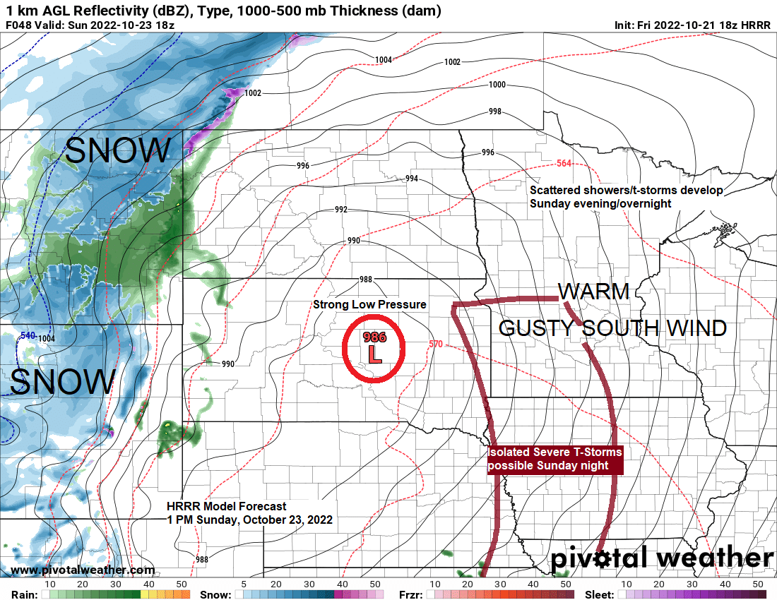
A strong low-pressure system is still expected to develop this weekend while tracking from the northeast Colorado/western Nebraska area to northwest Minnesota between Sunday morning and Monday morning, and as forcing increases we will see scattered showers and thunderstorms develop in northeast Minnesota and northwest Wisconsin Sunday night with locally heavy downpours possible, but a widespread heavy rain event is looking less likely compared to a few days ago, with average rainfall totals now looking like they will be in the 0.10″ to 0.50″ range in our area for the Sunday night/Monday time frame.

There won’t be any snow with this system in the Northland with measurable snow remaining well to the west of our area this weekend.

For those that prefer the colder temperatures like we had earlier in the week, well you won’t be liking this forecast very much as we’re looking at an extended period of warmer than normal temperatures in the Northland which could linger right into early November, now that’s not to say we won’t cool off toward normal a few times over the next week or so, but overall, the pattern ahead is looking pretty mild for the upper Midwest.
The general pattern ahead for about the next 2 weeks will feature below normal temperatures out west, with above normal temperatures farther east including for us here in the Northland.
Note: Highs in the 60s to around 70 are likely in the Northland on Saturday with highs Sunday in the mid 60s to low 70s. Temperatures will be cooler both days closer to Lake Superior due to a breezy ESE wind.


We’ve seen quite a change in temperatures in the Plains this week, going from record cold to near record cold early to mid-week, to record or near record warmth today (Friday)
Locations which set or tied record low temperatures in darker blue circles on the animation below.
Locations which set or tied record high temperatures in orange and red circles on the animation below.
October 15-21, 2022

Widespread 80s and even a few 90s over parts of the Central Plains today, with 60s farther north in much of Minnesota and Wisconsin today.

Temperatures are running +10 to +15 degrees above normal across much of the upper Midwest late this afternoon with an area of +15 to +25 degree temperature anomalies covering the Central Plains late today.

Still seeing a lingering trough over the eastern U.S. today with generally a west to east or zonal flow covering the northern Rockies into the upper Midwest. This weekend’s system which will affect the Northland is currently digging SE into the Pacific northwest this afternoon.

Goes-16 water vapor loop ending 4:40 PM Friday, October 21, 2022.

Thanks for reading!
Tim
Leave a Reply