6:10 PM Wednesday, December 20, 2023
A slow-moving low-pressure system and upper-level trough could bring some precipitation to much of the Northland late this weekend into early next week, but with a mild air mass already in place and showing no signs of going away anytime soon, a lot of the precipitation we might get out of this system will likely fall as rain with only slight chances for snow.
-Southerly winds will advect some moisture northward into the Northland Thursday night and Friday and this will likely cause some drizzle to develop and perhaps some patchy freezing drizzle in spots early Friday morning.
-Looking at quite a bit of cloud cover (limited amounts of sun) in the Northland over the next several days and fog may also become an issue at times as moisture continues to increase.
-Highs in the 30s to around 40 Thursday and Friday and in the upper 30s and 40s this weekend, with a few 50s even possible in northwest Wisconsin on Christmas Eve. Note — Record or near record warmth is possible this weekend.
*1.19″ of precipitation so far this month in Duluth which is +0.20″ above normal to date, and 120% of our normal precipitation through December 20.
*Snowfall, however, is running well below normal in Duluth this month with just 3.3″ of snow through December 20 which is -8.8″ below normal to date and is just 28% of our normal snowfall to date.
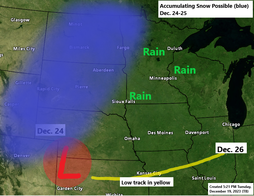
NWS Blend of Models total precipitation through early next week.

The bulk of the snow with the system this weekend looks to fall over parts of the Rockies into the western High Plains and northern Plains.

It’s been a dry December in far northern Minnesota while areas from east central into northeast Minnesota into far northern Wisconsin have seen quite a bit of precipitation so far this month.
Total Precipitation this month (thru December 19)

Black outlined area on the map below represents precipitation totals running 110% to 150% of normal so far this month, while locations in far northern Minnesota have seen 50% or less of their normal precipitation so far this month.
Percent of Normal Precipitation this month (thru December 19)

Winds are in a favorable direction (ENE) to produce some lake effect snow in the Twin Ports and North Shore today, but the overall air mass is just too warm to produce any lake effect precipitation today.

Much of northern Canada and locations around Hudson Bay is covered by an arctic air mass today with temperatures in the teens and 20s below zero this afternoon, but with winds aloft out of the west, this will help keep this arctic air well north of the Northland at least through early next week.

Today’s run from the EPS model has trended quite a bit warmer next week.
Temperature Anomaly valid December 25-30, 2023.
NEW RUN from Today.

And here was the EPS model run from Tuesday for December 25-30, 2023.

Thanks for reading!
Tim
Leave a Reply